lexxnchloe
Member
Now this is a winter storm


Look how much more cleaner the GFS has gotten out west. Good trend here on a OP in the medium range View attachment 145766

Triple phase on the table.
I had that typed in but deleted it…I didn’t want to temp fate.Triple phase on the table.
Yeah. And with those runs a day or two ago with snow into the GA/FL border the 500mb pattern left a lot to be desired but still producedDon’t know if this should be exciting but the GFS has the weakest height suppression out of any model and still produces a winter storm for CAD areas… View attachment 145774


zoinks! the iceCan anyone find I-85 for me????


This system kinda looks to favor midlands of SC. Finally a run where everything don’t stop at the border of NC/SCzoinks! the ice
If we can get a good cold blend between these there's some white gold to be hadDon’t know if this should be exciting but the GFS has the weakest height suppression out of any model and still produces a winter storm for CAD areas… View attachment 145774
Please don’t tell me this is another troll accountYeah, it looks like Georgia misses out again! that sucks
Way too early to write this one off for anyone IMO just as it's too early for anyone to count on a hit IMO. The jury is still out on whether or not an Arctic plunge comes down the lee of the Rockies ahead of the modeled system. Or not.was gonna complain but us here in nwest bama had our snow so i wont..this looks to be a carolina storm...if anything at all
Sorry to disappoint you, but no I am not trolling. I sue to have an account here under Buckfever2. my son love to watch and follow what was going on. I replied and posted somewhat but…I lost him a year ago and stopped following but.. Weather has always been an enjoyment for me. I am nearly as good as it as following and understand it the way most of the people on here are but, every once in a while, I might post something. But no need to worry. I’ll delete my account can’t deal with this type of BS .Please don’t tell me this is another troll account
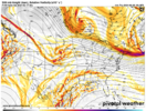
Jet retraction?
Yeah, it extends to Baja, then just starts to collapse and weaken in the E Pac. It's just part of the players, not saying it's going to make everything right in the endJet retraction?
