- Joined
- Jan 23, 2021
- Messages
- 4,601
- Reaction score
- 15,195
- Location
- Lebanon Township, Durham County NC
Ok this one isn’t like a model differing from its ensemble on one individual storm. This is a major overhauling difference in the overall pattern, but we have some folks that are just going to take it as gospel
I initially posted it. Of course, I don't take it as gospel, nor any 7+ day run of any model for that matter.Ok this one isn’t like a model differing from its ensemble on one individual storm. This is a major overhauling difference in the overall pattern, but we have some folks that are just going to take it as gospel
I guess for me, I just don’t spend much time looking at an op run no matter what solution it shows, good or bad, especially when it goes back and forth. Now if you start to see 3 or 4 runs in a row, showing the same or something similar, then yeah I’ll pay it a little bit of attention, but there’s gotta be some consistency firstI initially posted it. Of course, I don't take it as gospel, nor any 7+ day run of any model for that matter.
But, seeing a deterministic model go so far off the rails beginning on day 5 shouldn't be completely ignored. Strangely, the 18Z GFS run was eerily similar to yesterday's 18Z run.
If we can admire a great look on a long-range deterministic run, we can handle seeing a train wreck too.
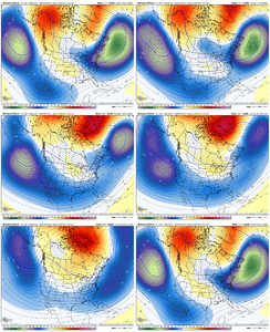
The evolution of the Aleutian low was where the operational completely went off the rails. Which is a feature we’re going to need. GEFS showing it so not sweating itGefs evolution. Can see the 17-20th chance, then the evolution closer to a El Niño February phase 8 MJO look, GOAK low retrograding and heights recovering out the in NW, with the -NAO retrograding to Baffin Bay and the Atlantic getting clogged up. The constant southern stream barrage encourages cyclonic wavebreaking which keeps the -NAO going healthy. the 17-20th time of interest is just the tip of the icebergView attachment 145640
So I like where the 0z ICON ended. The storm that cuts up west of the Apps for Valentines moves off and establishes a 50/50 low while the ridge builds in the west. A 1043 HP drops into Montana while a 1042HP is moving down behind it.
Yep. The ICON looks delicious. Oh, and nothing like the 18Z GFS, lol.So I like where the 0z ICON ended. The storm that cuts up west of the Apps for Valentines moves off and establishes a 50/50 low while the ridge builds in the west. A 1043 HP drops into Montana while a 1042HP is moving down behind it.


It phases the initial dump into the NW US into the pac trough, totally wrecks the patternGFS just has different plans with that low out in the pacific. Wants to crash it into the west coast which totally wrecks the pattern. It’s wrong I think. Maybe..View attachment 145674

06z GFS coming in better but got work to do.Euro nods to the GFS with the lack of cold push during our timeframe of interest. Sucks if we get to where we only have the Canadian, which it feels like we already have. Man we aren’t good at Winter.
The EURO still had the same general pattern as the CMC though so I wouldn’t say it was a nod to the GFS. It more had some timing differences from the CMC which is to be expected at 240Euro nods to the GFS with the lack of cold push during our timeframe of interest. Sucks if we get to where we only have the Canadian, which it feels like we already have. Man we aren’t good at Winter.
Still a little bit of work to do but definitely quite a bit better looking. I would expect the GEFS to follow suit.06z GFS coming in better but got work to do.
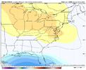
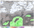
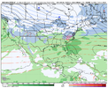
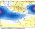
You say that it brings VA into the game which is cool but cold air is an issue with this system. Would be a rain to sloppy snow system if things trended slightly better for us.
