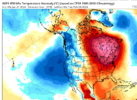
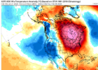
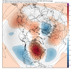
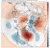
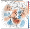
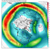
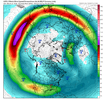
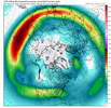
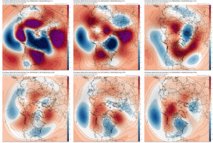
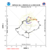
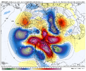
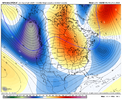
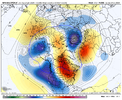
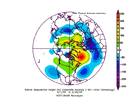
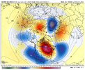
This thread is dogshit. Keep ruining the whamby thread and keep this ---- out of an actual thread
-
Hello, please take a minute to check out our awesome content, contributed by the wonderful members of our community. We hope you'll add your own thoughts and opinions by making a free account!
You are using an out of date browser. It may not display this or other websites correctly.
You should upgrade or use an alternative browser.
You should upgrade or use an alternative browser.
Pattern February 2024
- Thread starter SD
- Start date
rburrel2
Member
This just tells me we’re punting 21 days minimum.Very nice progression from the cfs weekly version on tidbitsView attachment 143016
20 days seems about right so 2/10ishThis just tells me we’re punting 21 days minimum.
Lol sheesh we suck. I’m going back to looking at the 10 day forecast off the weather channel. ?This just tells me we’re punting 21 days minimum.
NBAcentel
Member
TC messing with RMM phase charts use VP chartsIf it’s only another 3 weeks then we are extremely fortunate. It’s what I am hoping for. ?
View attachment 143018
well that's butt ugly. still holding out hope it doesn't bend after the 27thIf it’s only another 3 weeks then we are extremely fortunate. It’s what I am hoping for. ?
View attachment 143018
We always want to blame TC interference when we don’t get the MJO chart we want. If that’s the case then we should get a wild swing in extended modeling.TC messing with RMM phase charts use VP charts
NBAcentel
Member
I meannnnWe always want to blame TC interference when we don’t get the MJO chart we want. If that’s the case then we should get a wild swing in extended modeling.
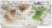
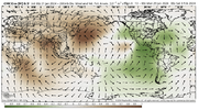
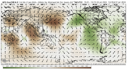
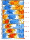
By the time we get that look wrt main rising over the whem, it’s towards the latter half of the respective ens runs, so something at H5 wouldnt verbatim show up yet
You are showing a bunch of ph6-7 and by end of EPS run it’s a muddled ph6/7. I guess we can agree day 10+ is a lot of unknown so that way the cup half full people will feel good.I meannnn View attachment 143027View attachment 143028View attachment 143029View attachment 143030
By the time we get that look wrt main rising over the whem, it’s towards the latter half of the respective ens runs, so something at H5 wouldnt verbatim show up yet
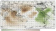
NBAcentel
Member
Yea I guessYou are showing a bunch of ph6-7 and by end of EPS run it’s a muddled ph6/7. I guess we can agree day 10+ is a lot of unknown so that way the cup half full people will feel good.
View attachment 143032
Webberweather53
Meteorologist
Webberweather53
Meteorologist
I'm personally skeptical of the big torch pattern in early Feb for much of the SE US (esp Carolinas).
Sure it looks generally mild overall, but I've seen so many long range warm patterns like this turn into cloudy, chilly CADs. This is a very conspicuous pattern here w/ a trough lurking near Atlantic Canada & the Pacific jet extending and undercutting a progressive block over south-central Canada. That's usually how you get sneaky CADs to show up in the medium range in Nino winters.
Unlike the late January warm pattern, the ridge in early February is not rooted in the subtropics, which means you're prone to undercutting it w/ sneaky southern stream waves. Notice on the GEFS mean the 500mb ridge is nosing up from the Bahamas in late January, whereas in early February, it's squashed into S America.
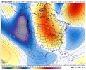
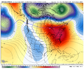


Are you saying CAD with respect to possible getting sneaky winter events or saying CAD in that we won t be highs in the 60-70’s?I'm personally skeptical of the big torch pattern in early Feb for much of the SE US (esp Carolinas).
Sure it looks generally mild overall, but I've seen so many long range warm patterns like this turn into cloudy, chilly CADs. This is a very conspicuous pattern here w/ a trough lurking near Atlantic Canada & the Pacific jet extending and undercutting a progressive block over south-central Canada. That's usually how you get sneaky CADs to show up in the medium range in Nino winters.
Unlike the late January warm pattern, the ridge in early February is not rooted in the subtropics, which means you're prone to undercutting it w/ sneaky southern stream waves. Notice on the GEFS mean the 500mb ridge is nosing up from the Bahamas in late January, whereas in early February, it's squashed into S America.
View attachment 143036
View attachment 143037
NBAcentel
Member
I'm personally skeptical of the big torch pattern in early Feb for much of the SE US (esp Carolinas).
Sure it looks generally mild overall, but I've seen so many long range warm patterns like this turn into cloudy, chilly CADs. This is a very conspicuous pattern here w/ a trough lurking near Atlantic Canada & the Pacific jet extending and undercutting a progressive block over south-central Canada. That's usually how you get sneaky CADs to show up in the medium range in Nino winters.
Unlike the late January warm pattern, the ridge in early February is not rooted in the subtropics, which means you're prone to undercutting it w/ sneaky southern stream waves. Notice on the GEFS mean the 500mb ridge is nosing up from the Bahamas in late January, whereas in early February, it's squashed into S America.
View attachment 143036
View attachment 143037
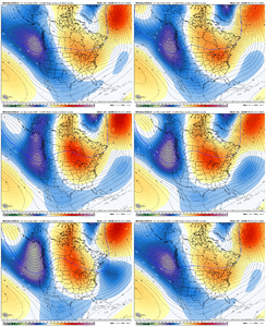
Yeah this is something I’ve taken a notice of as well. This is a look that screams a lot of CAD… now weather we can sneak out some winter weather with that CAD remains to be seen.I'm personally skeptical of the big torch pattern in early Feb for much of the SE US (esp Carolinas).
Sure it looks generally mild overall, but I've seen so many long range warm patterns like this turn into cloudy, chilly CADs. This is a very conspicuous pattern here w/ a trough lurking near Atlantic Canada & the Pacific jet extending and undercutting a progressive block over south-central Canada. That's usually how you get sneaky CADs to show up in the medium range in Nino winters.
Unlike the late January warm pattern, the ridge in early February is not rooted in the subtropics, which means you're prone to undercutting it w/ sneaky southern stream waves. Notice on the GEFS mean the 500mb ridge is nosing up from the Bahamas in late January, whereas in early February, it's squashed into S America.
View attachment 143036
View attachment 143037
Webberweather53
Meteorologist
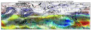
Over the next several weeks (from now til mid-late Feb & early March), we're repeating the same overall pattern progression we had in the latter half of December into early-mid January, except the (anomalously) colder pattern on the backend of this Pacific Jet extension will likely last much longer this time around once we get to it (per usual for Ninos).
The difference I see this time that makes me think we'll end up w/ a more persistent cold pattern later in Feb (& possibly lingering into March) is the collapse of the +IOD, which will favor a slower/stronger bout of Indian Ocean subseasonal forcing (whether that's more MJO-like remains to be seen).
Unlike early-mid winter, Indian Ocean convection in February & March actually favors cold in the east-central US.
In essence: subtropical jet wave train & MJO emergence out of the Maritime Continent >> Pacific Jet extension >> "torch" pattern (centered over the Upper Midwest & Lakes) >> momentum loss (via wave breaking) >> -NAO >> cold pattern w/ legit threats for winter storms.

Flotown
Member
sounds like good newsOver the next several weeks (from now til mid-late Feb & early March), we're repeating the same overall pattern progression we had in the latter half of December into early-mid January, except the (anomalously) colder pattern on the backend of this Pacific Jet extension will likely last much longer this time around once we get to it (per usual for Ninos).
The difference I see this time that makes me think we'll end up w/ a more persistent cold pattern later in Feb (& possibly lingering into March) is the collapse of the +IOD, which will favor a slower/stronger bout of Indian Ocean subseasonal forcing (whether that's more MJO-like remains to be seen).
Unlike early-mid winter, Indian Ocean convection in February & March actually favors cold in the east-central US.
In essence: subtropical jet wave train & MJO emergence out of the Maritime Continent >> Pacific Jet extension >> "torch" pattern (centered over the Upper Midwest & Lakes) >> momentum loss (via wave breaking) >> -NAO >> cold pattern w/ legit threats for winter storms.
View attachment 143042
Appreciate you giving us an update on your thoughts man. We’ve been waiting for your input, I know I have. Hopefully we can have a 2015 style come back this Winter.Over the next several weeks (from now til mid-late Feb & early March), we're repeating the same overall pattern progression we had in the latter half of December into early-mid January, except the (anomalously) colder pattern on the backend of this Pacific Jet extension will likely last much longer this time around once we get to it (per usual for Ninos).
The difference I see this time that makes me think we'll end up w/ a more persistent cold pattern later in Feb (& possibly lingering into March) is the collapse of the +IOD, which will favor a slower/stronger bout of Indian Ocean subseasonal forcing (whether that's more MJO-like remains to be seen).
Unlike early-mid winter, Indian Ocean convection in February & March actually favors cold in the east-central US.
In essence: subtropical jet wave train & MJO emergence out of the Maritime Continent >> Pacific Jet extension >> "torch" pattern (centered over the Upper Midwest & Lakes) >> momentum loss (via wave breaking) >> -NAO >> cold pattern w/ legit threats for winter storms.
View attachment 143042
Webberweather53
Meteorologist
Flotown
Member
if we can get a good pattern going round valentines day ,its cool some of my best snows have came in that time here in nortwest bama..
Webberweather53
Meteorologist
EPS looks like it's getting ready to setup a big -NAO after the end of the run.
View attachment 143045
The very active/negatively tilted & equatorward-displaced storm track in/around N America is a big clue we're about to get a west-based -NAO.
Really amazing how models can mail a 10-15 day heatwave, but can’t get a cold pattern 2 days out
NBAcentel
Member
Dunno seems like the models nailed the last cold shot, in fact they were wrong at one point showing Wall to wall torch then the TPV trended east. But it’s not like how it used to be right. Heat right cold wrongReally amazing how models can mail a 10-15 day heatwave, but can’t get a cold pattern 2 days out
He actually has done well with what he predicted. Just don’t have the snow in our area yet. As far as the pattern he has done well. For those that follow his videos get a lot more info than those that follow a tweet. He does well recognizing patterns and always has said that. A lot of flip and flopping on here to when models don’t show what they want. I appreciate you sharing his info. In November he said cold will relax and come back in Feb. interesting as he looks to be on to something.Can you give me someone who has not flip flopped this winter and has been spot on? I would like to follow Him/Them and see what lies ahead for us... And I will not post anything else from JB, Oh btw his winter forecast doesn't end until March 31st then we can see how much ---- he pushed this winter!! TIA
MichaelJ
Member
JB has always been pretty good on long range outlooks but his short term progs (especially in the South East) is not very good. Still he has his focus on the MA and NE and gets a lot of grief from them too.
- Joined
- Jan 23, 2021
- Messages
- 4,602
- Reaction score
- 15,197
- Location
- Lebanon Township, Durham County NC
I remember you saying back in November when we had the first one, it was a good sign that it would returnThe very active/negatively tilted & equatorward-displaced storm track in/around N America is a big clue we're about to get a west-based -NAO.
Prestige Worldwide
Member
Well, ensembles are pretty clearly showing the AO falling off the cliff after it spikes later this week… at the very least that will prevent the SPV from getting wound up and it should stay fairly week. The models seem to match Webb’s thinking on the NAO as well.ole jb aint backing down..overall hes been pretty accurate in my opinion
Webberweather53
Meteorologist
I remember you saying back in November when we had the first one, it was a good sign that it would return
You can also see the 18z GEFS is quickly evolving into a big -NAO after Feb 5.
All that westerly momentum in the Pacific Jet that’s creating the mild pattern initially gets used up by large southward-shifted cyclonic wave breaks in/around N America. That process will kickstart a -NAO.
Remember that the -NAO actually is associated with an equatorward shifted storm track in/around N America and N Atlantic. We’re doing just that later in week 2 and even more so into week 3
Another thing is the strong signal for low heights in the western Atlantic and a squashed SER.You can also see the 18z GEFS is quickly evolving into a big -NAO after Feb 5.
All that westerly momentum in the Pacific Jet that’s creating the mild pattern initially gets used up by large southward-shifted cyclonic wave breaks in/around N America. That process will kickstart a -NAO.
Remember that the -NAO actually is associated with an equatorward shifted storm track in/around N America and N Atlantic. We’re doing just that later in week 2 and even more so into week 3
Cad Wedge NC
Member
Just wish we would not have wasted prime climo with this up-coming warm-up.
iGRXY
Member
I was too watching the ensembles thinking the way the ridge was being oriented that we would be pushing to a pretty big -NAO. SER and EC ridges tend to get pushed into Greenland blocking as they progress. It’s just you have to get through 7-10 days of ridging on the EC before you get to that point.
If you recall, that very thing happened in mid January 2010 and late January/early February 2015… both times it set up some good patternsI was too watching the ensembles thinking the way the ridge was being oriented that we would be pushing to a pretty big -NAO. SER and EC ridges tend to get pushed into Greenland blocking as they progress. It’s just you have to get through 7-10 days of ridging on the EC before you get to that point.

