That big D7 phase on the euro is interesting. Probably not enough cold yanked in behind it for the 15th/16th to get us started early
-
Hello, please take a minute to check out our awesome content, contributed by the wonderful members of our community. We hope you'll add your own thoughts and opinions by making a free account!
You are using an out of date browser. It may not display this or other websites correctly.
You should upgrade or use an alternative browser.
You should upgrade or use an alternative browser.
Pattern February 2024
- Thread starter SD
- Start date
That big D7 phase on the euro is interesting. Probably not enough cold yanked in behind it for the 15th/16th to get us started early
That blocking though….

Ridge axis from the WC up through he NWT is one of the better precursors to E of the apps cold that I've found. Withthis at D10 no need to really over analyze it but those E of a montgomery to atlanta to knoxville line would want the cinnabon north of MN farther east. You guys would look good in this setup.
.png")
Which looks like exactly where said cinnabon looks to be headed by day 11.Ridge axis from the WC up through he NWT is one of the better precursors to E of the apps cold that I've found. Withthis at D10 no need to really over analyze it but those E of a montgomery to atlanta to knoxville line would want the cinnabon north of MN farther east. You guys would look good in this setup. View attachment 145244

NBAcentel
Member
euro op Vs ens 

iGRXY
Member


Been busy for the last couple hours and just saw this… that’s a January/February 2003, February 2010 like block.
Euro Weeklies into mid-March want to rot the cold trough right on top of us. I hope you don't coach Little League Baseball

packfan98
Moderator
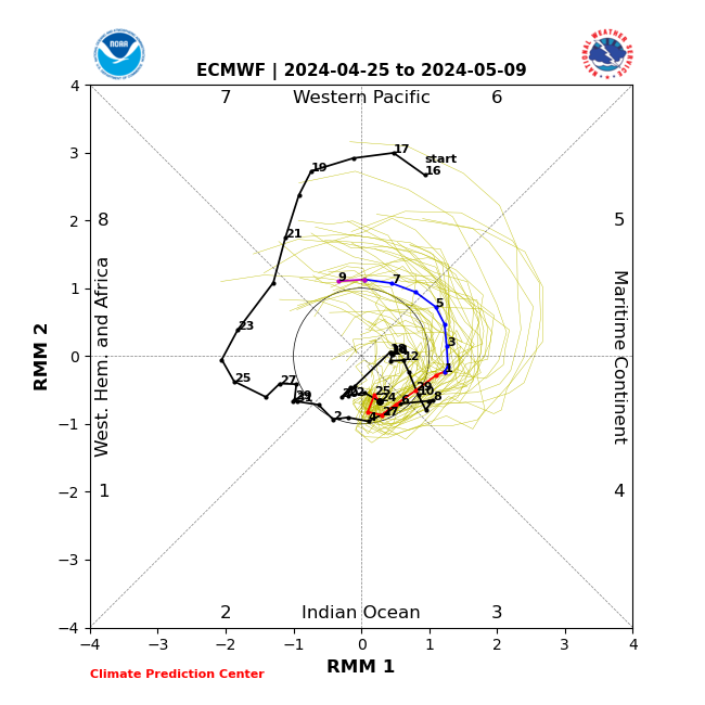
Looks like the MJO still wants to make the loop, but now it appears to loop between phases 8 and 7 instead of phases 7 and 6.
However, outdoor fireside chats will be the bomb-diggity well into March. ?️ ? ?Euro Weeklies into mid-March want to rot the cold trough right on top of us. I hope you don't coach Little League Baseball
View attachment 145256
From NOAA CPC's Weekly MJO Update:Looks like the MJO still wants to make the loop, but now it appears to loop between phases 8 and 7 instead of phases 7 and 6.


Are we losing the west ridge in that first graph as it gets towards the 20th?This is what I want to see. PV tucking beautifully under the Greenland block, window would be wide open after this for a southern slider.
View attachment 145263
Late in the run, hints of something appearing.
packfan98
Moderator
Are we losing the west ridge in that first graph as it gets towards the 20th?

NBAcentel
Member
Now that’s mega blocking. 
I mentioned this earlier, you kinda want that +PNA to fluctuate some and not stay strongly positive. Often times it’s those periods it heads towards neutral that the southeast scores a good storm
NBAcentel
Member
Would love the get that deep TPV lobe to move northeast slowly in Tandem with rising heights right behind the TPV itself around the lakes with some southern stream moving east, some CMCE members did that, that would get us a classic deep cold wedge setup. -NAO this go around looks oriented more NE to SW which is more favorable to keep the TPV or a TPV extension around the 50/50 area, and hang around at that.Possibly (it's so far out we're losing a lot of things to smoothed out means), but we're also gaining undercutting energy moving in at a favorable latitude with a locked-in PV in prime position. The time period just after the 20th that I believe @griteater has also been mentioning looks to be our time if we can keep the trends going.
View attachment 145267
Ridge axis from the WC up through he NWT is one of the better precursors to E of the apps cold that I've found. Withthis at D10 no need to really over analyze it but those E of a montgomery to atlanta to knoxville line would want the cinnabon north of MN farther east. You guys would look good in this setup. View attachment 145244
I would definitely be happy with that progression if it is showing four or so days out
Which looks like exactly where said cinnabon looks to be headed by day 11. View attachment 145245
I love seeing that 558dm benchmark digging into north AL.
dsaur
Member
That was a stout cad yesterday. Had 4 trees in a clump blow down from ne to sw. Up by the roots in well soaked ground. Get a cad like that when It's cold enough, and we've got something.
I've mentioned a lot of time periods, so there's no way I can miss hahaha. No really, everything is falling in place, and like mentioned last night, it's just going to come down to the smaller details going forward I think.Possibly (it's so far out we're losing a lot of things to smoothed out means), but we're also gaining undercutting energy moving in at a favorable latitude with a locked-in PV in prime position. The time period just after the 20th that I believe @griteater has also been mentioning looks to be our time if we can keep the trends going.
Here is a 500mb comparison for days 10-15 on the GEFS / EPS / CMCE.
The GEFS is injecting the most momentum into the Pac Jet and has this Super El Nino look to it with the more intense and farther east Aleutian Low anomalies. That breaks down some of the western N America ridge strength; and on the Atlantic side, the -NAO isn't quite as robust
The CMCE is the weakest of the 3 with the Pac Jet and has the strongest W N Amer ridge and -NAO signature.
As mentioned before, I think the EPS is the one to ride with in this El Nino / Split / HL Blocking setup. Given that it lies in between the other 2 gives it even more credence.

Accordingly, here is the temperature comparison where the CMCE is the coldest by far. The CMCE is the place where I'd personally like to see us in the end. I'd like to see the GEFS and EPS trend colder...and if there ever is a scenario where models trend colder, it's with heavy -NAO blocking signatures like this.

If this were to not work out on the front side of the nice pattern, I don't think that's going to be the end of it. The Euro Weeklies here make a beautiful move in dropping the Greenland blocking anomalies to the west <and> south, while the Pac Jet backs off some and western ridging isn't getting impinged

Last edited:
CNCsnwfan1210
Member
Great in-depth post as always Grit!I've mentioned a lot of time periods, so there's no way I can miss hahaha. No really, everything is falling in place, and like mentioned last night, it's just going to come down to the smaller details going forward I think.
Here is a 500mb comparison for days 10-15 on the GEFS / EPS / CMCE.
The GEFS is injecting the most momentum into the Pac Jet and has this Super El Nino look to it with the more intense and farther east Aleutian Low anomalies. That breaks down some of the western N America ridge strength; and on the Atlantic side, the -NAO isn't quite as robust
The CMCE is the weakest of the 3 with the Pac Jet and has the strongest W N Amer ridge and -NAO signature.
As mentioned before, I think the EPS is the one to ride with this El Nino / Split / HL Blocking setup. Given that it lies in between the other 2 gives it even more credence.
View attachment 145268
Accordingly, here is the temperature comparison where the CMCE is the coldest by far. The CMCE is the place where I'd personally like to see us in the end. I'd like to see the GEFS and EPS trend colder...and if there ever is a scenario where models trend colder, it's with heavy -NAO blocking signatures like this.
View attachment 145269
If this were to not work out on the front side of the nice pattern, I don't think that's going to be the end of it. The Euro Weeklies here make a beautiful move in dropping the Greenland blocking anomalies to the west south, while the Pac Jet backs off some and western ridging isn't getting impinged
View attachment 145270
Sent from my SM-A136U1 using Tapatalk
Here is a Pac Jet comparison at day 15 where the GEFS has the stronger jet running into Baja compared to the EPS...and you can see the stronger wave / trough signature in the Gulf of Alaska

Last edited:
Ron Burgundy
Member
What’s the significance of that? Asking for a friendI love seeing that 558dm benchmark digging into north AL.
NBAcentel
Member
Would be cool if the day 8 storm could do something like this. Anything helps 
Euro showed something similar yesterday but now it cuts it more north.Would be cool if the day 8 storm could do something like this. Anything helps View attachment 145272
LukeBarrette
im north of 90% of people on here so yeah
Meteorology Student
Member
2024 Supporter
2017-2023 Supporter
Would take in a heartbeat, would be nice to score with a pattern flipperWould be cool if the day 8 storm could do something like this. Anything helps View attachment 145272
NBAcentel
Member
Not only does it lay a little snowpack to the north, but it also becomes a big bombing low in the Atlantic, which is key in this upcoming patternWould take in a heartbeat, would be nice to score with a pattern flipper


NBAcentel
Member
Probably the best run I’ve seen pattern wise for just after day 10 


Step it down one time. We’d like a good snowpack at least over PA to anchor our ? highWould be cool if the day 8 storm could do something like this. Anything helps View attachment 145272
NBAcentel
Member
Sfc pattern is ?
What’s the significance of that? Asking for a friend
I don’t know about the Carolinas, but from the past snows storms in AL you want to be close to that line. Now ofcourse, situations vary, but when I see that 558dm line preferably the 552dm line dig deep my ears definitely perk up.
NBAcentel
Member
Difference between yesterdays/todays setup, and just after D10, is the general longwave pattern is shifted west, which allows a much better injected cold source 


NBAcentel
Member
This pattern is now under day 10. Still 384 hours though right 

We just ain’t gonna talk about this? 50/50 low ain’t budging…honk honk
NBAcentel
Member
Just hope it isn’t to suppressive by sticking around, but normally they trend quicker closer to go time. Give me a Miller B mixed bag with front end snow to mix, that’s the only way to win seemingly the last decade. but that’s a good lookWe just ain’t gonna talk about this? 50/50 low ain’t budging…honk honkView attachment 145286
We just ain’t gonna talk about this? 50/50 low ain’t budging…honk honkView attachment 145286
That my friend is beautiful. Would love to see something akin to February 2010 to track.
rburrel2
Member
The problem with that system on the GFS is there seems to be zero support for a storm then on the EPS/CMCE.
But I'm thinking that's why they're looking better than the GFS/GEFS for a threat down the road a few days.
Probably has something to do with them showing a better/stronger 50/50 being established in that day 10-12 range.
But I'm thinking that's why they're looking better than the GFS/GEFS for a threat down the road a few days.
Probably has something to do with them showing a better/stronger 50/50 being established in that day 10-12 range.
I would also say, from what I have seen so far on a limited amount, this might be the last good shot we have for snow/ice in and south of the I-20 corridor at this point.