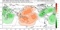
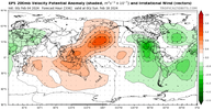
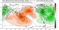
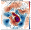
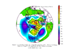
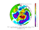
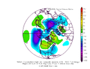
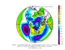
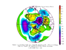
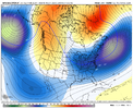
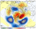
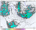
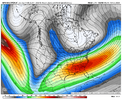
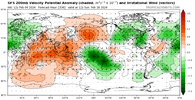
Check, please! Yes, if we can reel this look in, I’m all-in.I think 1300m will approve of the PV location on the 06z GEFS.
February 20th'ish seems like it might be the day for a winter storm; if we get a winter storm.
View attachment 145066
-
Hello, please take a minute to check out our awesome content, contributed by the wonderful members of our community. We hope you'll add your own thoughts and opinions by making a free account!
You are using an out of date browser. It may not display this or other websites correctly.
You should upgrade or use an alternative browser.
You should upgrade or use an alternative browser.
Pattern February 2024
- Thread starter SD
- Start date
packfan98
Moderator
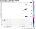
Is that the MJO in 8 and 1? I’m trying to get better reading these maps.
The 06z GEFS is one of the best looks we've seen so far leading up to this pattern.
rburrel2
Member
Yea, it really joined the party with what the EPS/CMCE are showing.The 06z GEFS is one of the best looks we've seen so far leading up to this pattern.
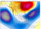
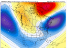
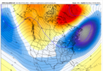
Strong signal for greenland blocking that retrogrades west over time, in addition to a stout west coast ridge and undercutting jet with a 50/50 low in place. Basically; the perfect setup.
- Joined
- Jan 23, 2021
- Messages
- 4,602
- Reaction score
- 15,197
- Location
- Lebanon Township, Durham County NC
Looking at the teleconnections the last couple days and the hints in the modeling, I really think that the 2/18-2/22 timeframe is one to watch.
AO-going sharply negative by the end of the week
NAO-going slightly negative later this week and looks to stay there for a while. Generally the lag time for the -NAO effects to show is 8-10 days.
PNA-staying positive this week but maybe touching neutral for a day next weekend. Then it really spikes after that.
MJO- enters phase 8 this week and might be amped up a bit.
Edit: this timeframe is also one that Grit has been talking about and he’s been doing a very good job with eyeing the pattern progression.
AJ1013
Member
Blizzard conditions 9,000ft above my head tomorrow. Rates will overcome?


Cold air and 50/50 low trapped underneath GL Blocking with a low latitude southern stream. That's high-end potential stuff, but then it comes down to getting the details right.
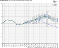
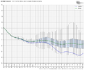
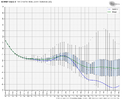
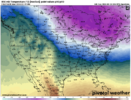
Here is the 850 temp median with 10th percentile and 90th percentile point values at the end of the EPS run. The 0 deg run line runs from NE North Carolina to NE Kansas. What I would like to see is that line running from Charleston to Dallas.
How do we get there? Will the modeling trend colder? Will the GL block work farther southwest? Will the 50/50 be more expansive and farther south? Will those changes force the height pattern to drop farther south? Will the W Canada ridge be more potent and tap more cold air from the pole?
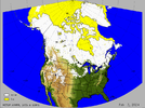
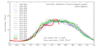
I'm not as big into snow cover as some others maybe, but these images don't help
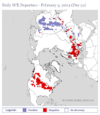

Here is the 850 temp median with 10th percentile and 90th percentile point values at the end of the EPS run. The 0 deg run line runs from NE North Carolina to NE Kansas. What I would like to see is that line running from Charleston to Dallas.
How do we get there? Will the modeling trend colder? Will the GL block work farther southwest? Will the 50/50 be more expansive and farther south? Will those changes force the height pattern to drop farther south? Will the W Canada ridge be more potent and tap more cold air from the pole?

I'm not as big into snow cover as some others maybe, but these images don't help


Those 850s are still at fairly good spot for an ensemble mean at 15 days out. Also with the snow cover, one region that hasn’t been losing it has been southeast Canada and even northern interior New England… that’s important IMO because that’s the region we tap into for CAD.Cold air and 50/50 low trapped underneath GL Blocking with a low latitude southern stream. That's high-end potential stuff, but then it comes down to getting the details right.
View attachment 145087
Here is the 850 temp median with 10th percentile and 90th percentile point values at the end of the EPS run. The 0 deg run line runs from NE North Carolina to NE Kansas. What I would like to see is that line running from Charleston to Dallas.
How do we get there? Will the modeling trend colder? Will the GL block work farther southwest? Will the 50/50 be more expansive and farther south? Will those changes force the height pattern to drop farther south? Will the W Canada ridge be more potent and tap more cold air from the pole?
View attachment 145088
I'm not as big into snow cover as some others maybe, but these images don't help
View attachment 145089
View attachment 145090
View attachment 145092
I hear ya, but you and I both would rather be in a ‘great’ spot rather than a ‘fairly good’ one. Let’s see how things trendThose 850s are still at fairly good spot for an ensemble mean at 15 days out. Also with the snow cover, one region that hasn’t been losing it has been southeast Canada and even northern interior New England… that’s important IMO because that’s the region we tap into for CAD.
The way that the gefs rolled that pattern forward with the retrograding NAO, the pv pulling east, and the +height anom north of barrow it has to be checking boxes for higher end events across parts of the region.I think 1300m will approve of the PV location on the 06z GEFS.
February 20th'ish seems like it might be the day for a winter storm; if we get a winter storm.
View attachment 145066
This is the 24 hour snow ending at 384, granted its D15/16 but haven't seen one this high this far out on the ens in a while
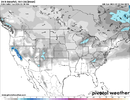
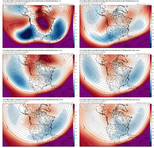
Extending the Euro Op run past day 10 with the control run shows the colder pathway with intense block and 50/50 low couplet (and initial sharp western ridge)


When looking at the teleconnections, if I were to imagine what a 500mb and 850mb progression would look like, this is it.Extending the Euro Op run past day 10 with the control run shows the colder pathway with intense block and 50/50 low couplet (and initial sharp western ridge)


The snowpack in the Midwest/Plains should start rebuilding this week.Cold air and 50/50 low trapped underneath GL Blocking with a low latitude southern stream. That's high-end potential stuff, but then it comes down to getting the details right.
View attachment 145087
Here is the 850 temp median with 10th percentile and 90th percentile point values at the end of the EPS run. The 0 deg run line runs from NE North Carolina to NE Kansas. What I would like to see is that line running from Charleston to Dallas.
How do we get there? Will the modeling trend colder? Will the GL block work farther southwest? Will the 50/50 be more expansive and farther south? Will those changes force the height pattern to drop farther south? Will the W Canada ridge be more potent and tap more cold air from the pole?
View attachment 145088
I'm not as big into snow cover as some others maybe, but these images don't help
View attachment 145089
View attachment 145090
View attachment 145092
AJ1013
Member
Not everyday you see this down here
- Joined
- Jan 23, 2021
- Messages
- 4,602
- Reaction score
- 15,197
- Location
- Lebanon Township, Durham County NC
It’s cute and all to gaze at the day 12+ ensembles but eventually we going to need some op runs with the magic.
This ain’t it.
View attachment 144943
let's try this one again....pattern change is cute and all until the OP's start spewing snow where we want it. Last time I ran my mouth on this the GFS heard me.
I still agree with you in principle. I’m tired of seeing pretty ensemble means. I want to see a promising pattern with the key features in place inside D5 on the deterministics.let's try this one again....pattern change is cute and all until the OP's start spewing snow where we want it. Last time I ran my mouth on this the GFS heard me.
Yeah, even with these heights over Alaska, they’re modeled a big warm up next weekend… Fairbanks for example is modeled to have highs in the 20s by the end of next weekend. Typically when you see a warm up like that in the interior of Alaska this time of the year, the cold is headed southeastGetting difficult for me to poo poo the upcoming pattern change...the EPS has brought this to day 11-12 now and looks legit. Displaced Aleutian low. One thing I want to see is lipstick red over AK.
Past 4 EPS runs centered on 2/16
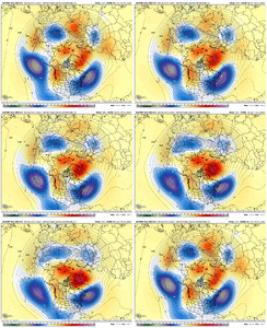
View attachment 145097
BHS1975
Member
Yeah, even with these heights over Alaska, they’re modeled a big warm up next weekend… Fairbanks for example is modeled to have highs in the 20s by the end of next weekend. Typically when you see a warm up like that in the interior of Alaska this time of the year, the cold is headed southeast
Like a 50 degree warm up.
Sent from my iPhone using Tapatalk
I don't want to overthink/analyze day 10+ GFS op runs but they diverge so much from it's ensembles. The op day 10+ stretches/splits the PV and sends a piece to Quebec/Newfoundland and sends the other part to British Columbia. That would be awful.I still agree with you in principle. I’m tired of seeing pretty ensemble means. I want to see a promising pattern with the key features in place inside D5 on the deterministics.
But it's the OP, it doesn't show what we want so we toss...
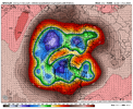
What do you mean? It goes positive mid next week and stays positive for the rest of the month into March.Should we be concerned with such a short window of +PNA? Looks narrow
He’s probably referencing that GFS Op runWhat do you mean? It goes positive mid next week and stays positive for the rest of the month into March.
Oh. I thought he was referring to the ENS. I’m not too concerned about the GFS OP run considering it changes every run. I’d be more concerned if the ENS start consistently showing it honestly.He’s probably referencing that GFS Op run
Regardless of what it shows, I think a heavy lean on the EPS Mean is the way to go for now. That's usually a good play anytime, but especially so with El Nino / Split Flow / High Latitude Blocking. Also, I feel like the Euro suite has had the hot hand this winter when models have diverged.I don't want to overthink/analyze day 10+ GFS op runs but they diverge so much from it's ensembles. The op day 10+ stretches/splits the PV and sends a piece to Quebec/Newfoundland and sends the other part to British Columbia. That would be awful.
But it's the OP, it doesn't show what we want so we toss...
View attachment 145106
Can we not clutch the GEPS...I like this one. I can only imagine the snow mean.Regardless of what it shows, I think a heavy lean on the EPS Mean is the way to go for now. That's usually a good play anytime, but especially so with El Nino / Split Flow / High Latitude Blocking. Also, I feel like the Euro suite has had the hot hand this winter when models have diverged.
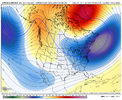
NBAcentel
Member
This baja wave really has a southern slider look to it on all ensemble means....if if there is enough cold airCan we not clutch the GEPS...I like this one. I can only imagine the snow mean.
View attachment 145108
NBAcentel
Member
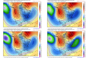
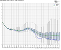
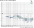
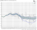
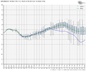
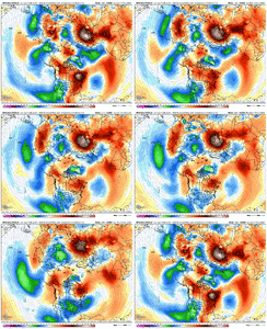
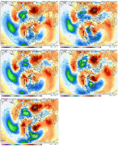
5 run temperature trend on the GEFS for Feb 16thTemps are always a concern but if this ain't cold enough...View attachment 145111
dsaur
Member
Cad wind at near 12, gusting to 24. Raining and 42. This is the kind of weather I used to get near Thanksgiving, and be thinking come Feb this would surely be over running, and dropping frozen, lol.

