iGRXY
Member
I’m not trying to be rude, but this is basically a repeat of how we’ve failed the past 4 years. The PV is too far west and it will not work for us without supreme luck IMO. That’s a western southeast and Mid-Atlantic north winter look IMO. PV must be anchored further east for us to score (but then not too far east or we fail that way too).

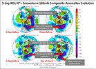
Just to back this up, this is the evolution of single-day 6"+ events at RDU from 5 days out to the day of the storm. The PV is anchored over New England / southeastern Canada and rotates there, sending additional vortices southward as a southern wave approaches from the west.I’m not trying to be rude, but this is basically a repeat of how we’ve failed the past 4 years. The PV is too far west and it will not work for us without supreme luck IMO. That’s a western southeast and Mid-Atlantic north winter look IMO. PV must be anchored further east for us to score (but then not too far east or we fail that way too).


Lol you're trying too hard at this point.
Yea I mean it's pretty hard to get a 15-day mean to show the center of tpv completely shifted South and East where we need it. Since the tendency as you go out in time will be to pull tpv to the pole where it's suppose to be located. I focus more on the anomalies to give an indication of where things appear to be setting up for that reason.
I will say that the TPV is moving from NW Greenland and dropping down to the Hudson Bay.
Bro you know what you're doing. The first 10-12 days of February are a torch and skewing the mean. You know it so why post it? If it doesn't get cold or snow, then okay but trying to post skewed data that you know is skewed as of today is ridiculous.Try what? I’m just simply posting these long range ensembles we are defending as gospel.
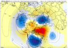
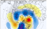
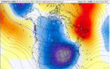
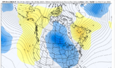
Bro you know what you're doing. The first 10-12 days of February are a torch and skewing the mean. You know it so why post it? If it doesn't get cold or snow, then okay but trying to post skewed data that you know is skewed as of today is ridiculous.
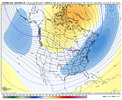
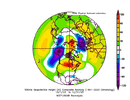
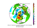
There were some really positive things about the 0z means and some massive red flags. I get concerned about pushing the pac ridge poleward too fast which would want to excite the SER and potentially phase west. I think that the means may be washing the -nao a little too much, more -nao would help off set more undercutting. Looking at the plumes there are some 30 degree spreads for highs on the eps as you go later that's concerning since it's on the back of a cold shot. As a whole you cant complain about where the means are at D10-16 if you want snowCould you draw it up any better than this? Picture frame worthy
View attachment 144949View attachment 144950
Correct me if I'm wrong but that sounds more transient than a perpetual reinforcing cold pattern like advertised earlier. TBH while I see the cold I had a harder time in believing a more locked in pattern to begin withThere were some really positive things about the 0z means and some massive red flags. I get concerned about pushing the pac ridge poleward too fast which would want to excite the SER and potentially phase west. I think that the means may be washing the -nao a little too much, more -nao would help off set more undercutting. Looking at the plumes there are some 30 degree spreads for highs on the eps as you go later that's concerning since it's on the back of a cold shot. As a whole you cant complain about where the means are at D10-16 if you want snow
Wait until next weekendNice out today. Spring is in the air.
It depends what happens in the high latitudes. The 12z gfs dissolves any WC ridging but it's plenty cold with the -epo/ao/naoCorrect me if I'm wrong but that sounds more transient than a perpetual reinforcing cold pattern like advertised earlier. TBH while I see the cold I had a harder time in believing a more locked in pattern to begin with
EPO set to flip bigly according to the ensembles. Along with the AO and NAO. This is what we want.View attachment 145006
I’m not as sharp as most of you on here and I’m learning, but Alaska has some extremely unusual cold air this year colder than normal. At some point this cold air will have to move.
Yeah this why I’m never disappointed to see cold air building up in Alaska and the NW territories. It gives a source of cold air to tap into without having to depend on a cross polar flow that can squash all the southern stream energy to CubaEPO set to flip bigly according to the ensembles. Along with the AO and NAO. This is what we want.
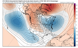


Hopefully that SER bubble will not allow southern waves to get squashed by the northern stream.This just looks like a better and colder version of this upcoming weeks look, a more correct longwave pattern with ridge further west, SE can vortex actually nearby, and southern stream undercutting a west ridge instead of a central US ridgeView attachment 145017View attachment 145018View attachment 145019
There has definitely been somewhat of a different look evolving on ensembles over the last few model suites.This just looks like a better and colder version of this upcoming weeks look, a more correct longwave pattern with ridge further west, SE can vortex actually nearby, and southern stream undercutting a west ridge instead of a central US ridgeView attachment 145017View attachment 145018View attachment 145019

Better to have more a TPV extension into a 50/50 low vs vise versa having a dominant TPV near Hudson Bay, otherwise we run into JanuaryThere has definitely been somewhat of a different look evolving on ensembles over the last few model suites.
There was a few CMCE members with some cad winter storms and southern waves rolling through the STJCFS looks pretty good as does the end of the EPS and GEPS. THE GFS/GEFS isn't as pretty but it seems to be the outlier right now. The wait is going to be painful but everything seems on track.
View attachment 145060View attachment 145061View attachment 145062
View attachment 145058View attachment 145059
Is this a skewed mean as well in that we are more warmer in the first couple of the 7-day than the last couple?
Bump and I just deleted a bunch of post. C'mon guys, each of you have knowledge and bring something to the discussion worthwhile but the cold hot, calling each other out (passive-aggressively) diminishes that.How about stop calling each other out, block/ignore, PM one another but leave it out of here please
