WolfpackHomer91
Member
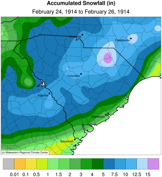
March 2009 , Maybe @BullCityWx or someone remembers that one it was a deform band that came thru I believe after Raining all day. It was a Sunday Night I was forecasted 6-8" in Concord and got like 4", but drove up to my then GF house in China Grove they had about 6". The next Saturday it was 72 degrees and over for that yearMarch will be too late except for some anomalous (dripping snow). Saw a decent one once when I was in Greenville, NC back in '83. Late Feb's a little better but last good one was Feb 2015(?) which happened on 23rd-25th--That's doable but getting rough late in the year.
https://products.climate.ncsu.edu/weather/winter/event/?e=466


")


.png")