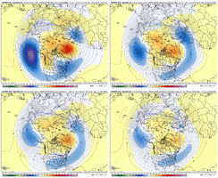
FYI, SD opened up a new thread on the southern stream bowling ball threat: https://southernwx.com/community/threads/feb-3-6-2024-system.1262/
-
Hello, please take a minute to check out our awesome content, contributed by the wonderful members of our community. We hope you'll add your own thoughts and opinions by making a free account!
You are using an out of date browser. It may not display this or other websites correctly.
You should upgrade or use an alternative browser.
You should upgrade or use an alternative browser.
Pattern February 2024
- Thread starter SD
- Start date
I understand. I really do think this change has legs though, but what sucks is this is likely our last shot. If we screw mid to late Feb up, we will be betting on an anomaly in March (yes, I know there has been monsters in March). This pattern change showing up has a ton of pressure to perform or this Winter is a wrap.True...and I agree we probably see BN temps the last 10 days of Feb but that gives us 10 days, give or take, to score for folks east of 77/85 corridor.
But until ensembles are inside day 12 it's hard to trust day 15-16. We had been eyeing the 10th as a change but that can has been kicked to the 15th....does it get kicked to the 20th.
exactlyIts great we are smacking each other on the ass about how great the back half of Feb looks…let’s not forget how first half of Jan looked. ?
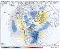
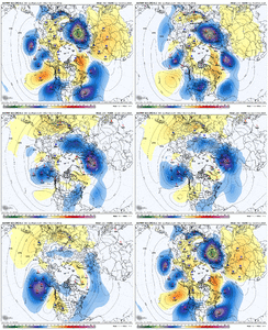
View attachment 144372
Lol if we hook the pv south and go cold and dry the level of hatred for this winter would be immeasurable
Yeh that's a mean shot of cross polar flow right there.Lol if we hook the pv south and go cold and dry the level of hatred for this winter would be immeasurable
Being skeptical is part of our DNA in the SE and rightly so. A strong nino in February with MJO 7-8-1 and models consistently spitting out some cold and split flow is all we can ask for though from a long range standpoint. Let the chips fall12z EPS saw my cynical smacking ass comment and now is rubbing my face in positive changes...
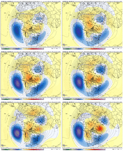
View attachment 144376
The good thing is you need that in mid Feb to mid March since just cold enough stops working the bad thing is suppression is still suppressionYeh that's a mean shot of cross polar flow right there.
iGRXY
Member
I'll be honest, if we miss on weeks 2-4 in February it's almost certainly over. Usually mid march is the cutoff but considering we can't snow during peak climo, there's zero reason to think we can during the transition period into Spring. Now with that said, this is as promising of a 2 week period as we've had in a while around here. I think we get one solid storm at least but if we don't I think it's onto winter 24-25.I understand. I really do think this change has legs though, but what sucks is this is likely our last shot. If we screw mid to late Feb up, we will be betting on an anomaly in March (yes, I know there has been monsters in March). This pattern change showing up has a ton of pressure to perform or this Winter is a wrap.
SnowNiner
Member
-Nao is great and all, but let's not block the PV in Hudson Bay this month. Let's kick it to the 50/50.
CLTStrong69
Member
Signal for 50/50 looks pretty good on that map Grit posted. ?-Nao is great and all, but let's not block the PV in Hudson Bay this month. Let's kick it to the 50/50.
SnowNiner
Member
Signal for 50/50 looks pretty good on that map Grit posted. ?
Yeah I was thinking the lobe of the pv itself, not the trough lower heights. January it got trapped in Central Canada and everything got caught out west.
rburrel2
Member
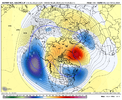
At the risk of being ridiculed for posting the 384hr GFS... but this is exactly what you'd expect to get with the pattern being shown on all the ensemble/long range modeling. Cross polar flow, mega high pressure pressing down, monster blocked 50/50 low, Active southern stream beginning to interact with the northern stream. This run was going to be an absolute massive winter storm for the South encompassing a large area, IMO.
But it just shows what we hopefully have to look forward to at some point Feb 15-20th.
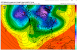
But it just shows what we hopefully have to look forward to at some point Feb 15-20th.

I do also think that we were affected by a poor phase of the MJO that did promote the SER to poke its way up east of the mountains. That shouldn’t be much of an issue in phases 7.8,1 and a strong STJYeah I was thinking the lobe of the pv itself, not the trough lower heights. January it got trapped in Central Canada and everything got caught out west.
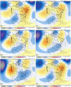
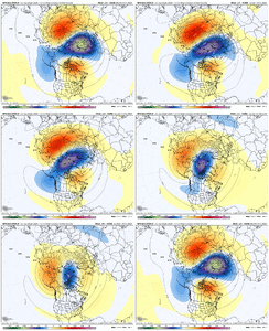
Just curious, would this look be clipper city for me? With disturbances coming off the +PNA ridge?Last one. Here are the last 11 runs back to Jan 20 of the Euro Weeklies for Feb 13-20 as the better pattern kicks in. No can kickage
View attachment 144388
Get ready for it!Lol if we hook the pv south and go cold and dry the level of hatred for this winter would be immeasurable
Good storm chance for you may be as the colder pattern is kicking off in Feb 11-13 timeframe. After that I suppose it would be some cold dry, with some storm chances mixed in as things oscillate. Just some thoughts thereJust curious, would this look be clipper city for me? With disturbances coming off the +PNA ridge?
Flotown
Member
u know ole jb says mid feb beyond is like 21 except a little east...say what u want about him hes been pretty good this year ....if we get 21 a little east...we gonna be poppin!!
The big thing we’ll have going for us east of the Apps when compared to a couple weeks ago is a more favorable MJO in phases 7,8,1. The MJO amped up into phases 3,4,5 two weeks and that promoted the SER that made it harder for the cold to move east. We’re in phase 7 and lower amp now and you tell this week the response has been for less SER.Is this great pattern mid feb gonna be more of the same cold out west and not making it past the apps?
Most likely a good pattern for Seattle and PortlandIs this great pattern mid feb gonna be more of the same cold out west and not making it past the apps?
Or Dallas, Little Rock, Memphis, Nashville & Montana (Northern Alabama)Most likely a good pattern for Seattle and Portland
Myrtle beachOr Dallas, Little Rock, Memphis, Nashville & Montana (Northern Alabama)
Or CubaOr Dallas, Little Rock, Memphis, Nashville & Montana (Northern Alabama)
People discount the MJO but I personally put a lot of weight in it.The big thing we’ll have going for us east of the Apps when compared to a couple weeks ago is a more favorable MJO in phases 7,8,1. The MJO amped up into phases 3,4,5 two weeks and that promoted the SER that made it harder for the cold to move east. We’re in phase 7 and lower amp now and you tell this week the response has been for less SER.
It shouldn’t be discounted, however it should not be given more weight that the other indicies. I’ve spent some time looking into winter storms in my area and what the MJO was at the time and yes there’s been a number of big storms in what we would consider bad phases… the common thing on them though is that the MJO was low amped in those phases.People discount the MJO but I personally put a lot of weight in it.
Last edited:
Twister
Member
Hard to snow in 50s and 60s. Gonna have 2 weeks to score last 2 weeks of Feb and that is going to be Hard pressed. This winter is done.

Sent from my SM-S911U using Tapatalk

Sent from my SM-S911U using Tapatalk
Drizzle Snizzle
Member
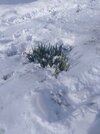
Would be cool to see snow covering up the daffodils.Hard to snow in 50s and 60s. Gonna have 2 weeks to score last 2 weeks of Feb and that is going to be Hard pressed. This winter is done.
Sent from my SM-S911U using Tapatalk
Seems a bit emotionally impulsive but enjoy your summer! We'll catch you back in here next winterHard to snow in 50s and 60s. Gonna have 2 weeks to score last 2 weeks of Feb and that is going to be Hard pressed. This winter is done.
Flotown
Member
i like what i see with models come feb 11thish
Heelyes
Member
They we’re in full bloom in 93 and buried under 18” of snow.
Twister
Member
I will definitely enjoy Spring and Summer! I love to Fish, Golf, And just Being outdoors enjoying life. Kinda of hard to do those things when there's snow on the ground and Freezing Cold! I've never really understood people in the South Loving Cold and Snow?? It really makes no sense, that's what the North is made for. I think most in here forgets where they areSeems a bit emotionally impulsive but enjoy your summer! We'll catch you back in here next winter
Sent from my SM-S911U using Tapatalk

