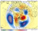
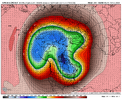
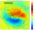
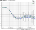
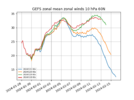
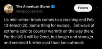
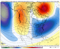
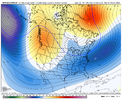
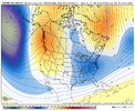
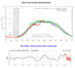
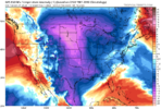
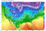
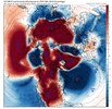
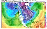
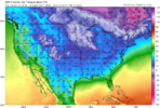
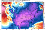
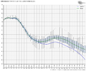
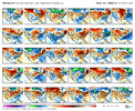
I’m worn out from posting them, but the good model runs keep coming. 18z GEFS, GEFS Extended, and GEFS Extended Control which has what looks like an SSW with a big -NAO
-
Hello, please take a minute to check out our awesome content, contributed by the wonderful members of our community. We hope you'll add your own thoughts and opinions by making a free account!
You are using an out of date browser. It may not display this or other websites correctly.
You should upgrade or use an alternative browser.
You should upgrade or use an alternative browser.
Pattern February 2024
- Thread starter SD
- Start date
SWVAwxfan
Member
I hate those NWS temp maps. Those things change daily.Okay God, tell us what the Powerball numbers are next?
Twister
Member
Tell us when the next "CAD" Setup is ? Since you haven't been right about one yetOkay God, tell us what the Powerball numbers are next?
Sent from my SM-S911U using Tapatalk
iGRXY
Member
Considering we've gotten CAD's all winter you're 0/2. Go back to the drawing board and try again.Tell us when the next "CAD" Setup is ? Since you haven't been right about one yet
Sent from my SM-S911U using Tapatalk
I hear you. I’m a golf nut myself but don’t play much in the winter. I hate the wet and mucky ground moreso than the cold. A lot of us I think just get bitten by the winter storm bug at an early age and never get it out of our system. I’m a North Carolina guy thru and thru and highly unlikely to move and live elsewhere for snow. It’s just a hobby thing to follow in winterI will definitely enjoy Spring and Summer! I love to Fish, Golf, And just Being outdoors enjoying life. Kinda of hard to do those things when there's snow on the ground and Freezing Cold! I've never really understood people in the South Loving Cold and Snow?? It really makes no sense, that's what the North is made for. I think most in here forgets where they are
Sent from my SM-S911U using Tapatalk
Near Charlotte and looking for someone else to play golf with while my partner is out with surgery. If you're interested this spring, I would love to play a round with you. Just dont laugh at my 100+ scoreI hear you. I’m a golf nut myself but don’t play much in the winter. I hate the wet and mucky ground moreso than the cold. A lot of us I think just get bitten by the winter storm bug at an early age and never get it out of our system. I’m a North Carolina guy thru and thru and highly unlikely to move and live elsewhere for snow. It’s just a hobby thing to follow in winter
Twister
Member
I will play in winter as long as it's above 50° But definitely here lately it's been very soggy! And I get it people likes winter storms but a lot of here forgets about realization and just how hard it is to get snow around here. Things are Changing and folks can't accept the Fact.I hear you. I’m a golf nut myself but don’t play much in the winter. I hate the wet and mucky ground moreso than the cold. A lot of us I think just get bitten by the winter storm bug at an early age and never get it out of our system. I’m a North Carolina guy thru and thru and highly unlikely to move and live elsewhere for snow. It’s just a hobby thing to follow in winter
Sent from my SM-S911U using Tapatalk
They close the course here in October and re open them in May! I’m gonna omay more this year! Anytime Grit, Rain_Cold , And Jimmy Hypocrisy need a 4th, y’all let me know! I shoot low 90s and am a little rough on etiquette!
John Daly is my idol
John Daly is my idol
I've started playing edgewater down in Lancaster, fun little course. Easier than Eagle Chase here outside of Marshville.I will play in winter as long as it's above 50° But definitely here lately it's been very soggy! And I get it people likes winter storms but a lot of here forgets about realization and just how hard it is to get snow around here. Things are Changing and folks can't accept the Fact.
Sent from my SM-S911U using Tapatalk
AO responding00z GFS got down to 3 m/s here at end of its run, down from 34 m/s earlier in the run. -1 is SSW. Things are progressing nicely
View attachment 144491
- Joined
- Jan 23, 2021
- Messages
- 4,602
- Reaction score
- 15,197
- Location
- Lebanon Township, Durham County NC
One word of caution regarding the advertised mid-month pattern change. While the upper-air pattern screams vodka cold complete with cross-polar flow, Eurasia and the NW territories are not exceptionally cold, and much of the N. American snow cover has been decimated by this recent thaw. So, the surface response, while cold, doesn't look nearly as cold as the pattern would leave one to assume. At least initially.


One word of caution regarding the advertised mid-month pattern change. While the upper-air pattern screams vodka cold complete with cross-polar flow, Eurasia and the NW territories are not exceptionally cold, and much of the N. American snow cover has been decimated by this recent thaw. So, the surface response, while cold, doesn't look nearly as cold as the pattern would leave one to assume. At least initially.


Yep...and it will be late Feb at best before we could see that improve. I think we all know how this ends.
tick tock
rburrel2
Member
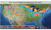
respectfully disagree. The coldest high temperature recorded in Clemson, SC in the last 20 years occurred on February 20, 2015 with a high of 28 and a low of 6 degrees in full sun... and this was the snowcover that day.One word of caution regarding the advertised mid-month pattern change. While the upper-air pattern screams vodka cold complete with cross-polar flow, Eurasia and the NW territories are not exceptionally cold, and much of the N. American snow cover has been decimated by this recent thaw. So, the surface response, while cold, doesn't look nearly as cold as the pattern would leave one to assume. At least initially.


Last edited:
Windergawx
Member
has anyone really been right?Tell us when the next "CAD" Setup is ? Since you haven't been right about one yet
Sent from my SM-S911U using Tapatalk
besides the ones saying warm and rain which is right 90% of the time?
It runs in cycles and will always be changing. I'm an avid Golfer and Like Grit love the winter wx /snow chase. I prefer playing in mid 50's*mid 60's, full sun, no breeze, no bugs, no humidity. Played down at coast alot this past summer, early fall. Just get soaked in sweat etc, not pleasantI will play in winter as long as it's above 50° But definitely here lately it's been very soggy! And I get it people likes winter storms but a lot of here forgets about realization and just how hard it is to get snow around here. Things are Changing and folks can't accept the Fact.
Sent from my SM-S911U using Tapatalk
Hopefully, by the last ten days or so of February, we'll get a similar response.respectfully disagree. The coldest high temperature recorded in Clemson, SC in the last 20 years occurred on February 2020, 2015 with a high of 28 and a low of 6 degrees in full sun... and this was the snowcover that day.
View attachment 144522
I'm just saying that as sexy as the upper pattern looks by mid-month, getting much below temps may take longer than one would think based on the upper-air pattern. And why.
Not to mention that as we get into late February and early March, slightly below no longer works very well for winter weather.
Drizzle Snizzle
Member
I have a hard time believing the next cold wave will be stronger than the one earlier this month. It’s a lot harder to get that kind of cold in Late February than it is in Mid January.Everyone is Annieing up! Bets are in as the last shot at winter approaches! 40 days of Glory just around the corner. Better not here no delayed but not denied, midwest snowpack excuses. Time for actual weather to show its hand.
View attachment 144529
NBAcentel
Member
It can be stronger/ colder in the fact of actual departures from normal which should be plenty for wintery precipitation. We don't need 9 degrees to support snow in February so I really don't get your point other than you are nit picking (and with an avatar of Kelce, that nauseated me).I have a hard time believing the next cold wave will be stronger than the one earlier this month. It’s a lot harder to get that kind of cold in Late February than it is in Mid January.
Sent from my SM-S918U using Tapatalk
When you compare it to seasonal norm, it will be easier. Average highs are going up and so the deviation is greater. Thats what hes referencingI have a hard time believing the next cold wave will be stronger than the one earlier this month. It’s a lot harder to get that kind of cold in Late February than it is in Mid January.
lexxnchloe
Member
Mid winter break? We havent had winter yet.Everyone is Annieing up! Bets are in as the last shot at winter approaches! 40 days of Glory just around the corner. Better not here no delayed but not denied, midwest snowpack excuses. Time for actual weather to show its hand.
View attachment 144529
For Raleigh Dec was 4.6 degrees above normal and Jan is 3.4 degrees above normal with a total of 0.0 of snow.
Jan88
Member
If that verifies looks like party time
I’m ready to throw all my chips in on this pattern ahead yet there are skeptics. Let’s see what today’s data provides
That's all we got man. There really isn't any other way to go. You either go all in on the second half of February or just take the premature L & say Winter is over on January 31st but still find yourself commenting on weather forums.I’m ready to throw all my chips in on this pattern ahead yet there are skeptics. Let’s see what today’s data provides
accu35
Member
accu35
Member
Man mid month gonna be epic
The gfs is kind of addition by subtraction yes we miss next week's storm but the phase to our east clogs up the Atlantic and the following waves get directed progressively farther S as we get a little help out west
Last edited:
The GFS drops the hammer at the end. Snowing in almost Brownsville.
Hour 384 is blizzard conditions to Monterrey MexicoThe GFS drops the hammer at the end. Snowing in almost Brownsville.
accu35
Member
accu35
Member
Hour 384 is blizzard conditions to Monterrey Mexico
