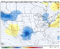
-
Hello, please take a minute to check out our awesome content, contributed by the wonderful members of our community. We hope you'll add your own thoughts and opinions by making a free account!
You are using an out of date browser. It may not display this or other websites correctly.
You should upgrade or use an alternative browser.
You should upgrade or use an alternative browser.
Pattern February 2024
- Thread starter SD
- Start date
do you feel it’s inevitable that this will trend NW atleast some in the coming days?
coldfront22
Member
That’s my question Webb. NW trend? Your thoughts.
Chills
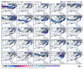
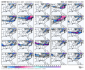
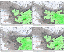
Several hits on the EPS for various parts of the SE. Anything is in play View attachment 143892View attachment 143891
Looks like for NC outside the mountains it's either nothing or big dogs. I count 8 good size hits and the rest have pretty much nothing outside the mountains.
Webberweather53
Meteorologist
@Webberweather53 I know we are looking at snowfall but what’s the probability of ice accumulation?
Webberweather53
Meteorologist
Wrt to the NW trend w/ a system like this, need to let the synoptic pattern settle in first over the coming days. Odds are there may be some, but it's too early to be sure if we end up NW of where the models are now because of how the pieces may get moved around.
Webberweather53
Meteorologist
@Webberweather53 I know we are looking at snowfall but what’s the probability of ice accumulation?
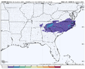
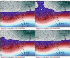
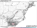
Here's the 24-hour ice accumulation off the EPS mean fwiw.
Wouldn't read much into this yet obviously, but just to give you an idea.
NBAcentel
Member
Generally does.That’s my question Webb. NW trend? Your thoughts.
BHS1975
Member
Generally does.
The more phasing you get the more NW it will get tugged.
Sent from my iPhone using Tapatalk
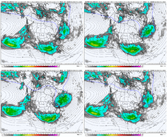
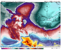
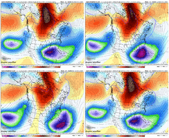
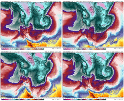
Looking past our storm chance, pretty nice sequence here on the Weeklies from Feb 11 to Feb 23. Enlarging low latitude Aleutian Low anomalies lead to southern stream running underneath amplifying Western North America ridging. Would like to see more low pressure off the NE coast, but pretty nice overall. Coldest anomalies in the N Hemisphere located in the eastern 1/2 of the U.S. Feb 14-21 (2nd image)
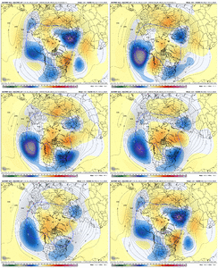
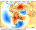


Yes, but it depends on where the phasing occurs too as the phasing can inject much needed cold air into the storm in this setupThe more phasing you get the more NW it will get tugged.
A little bit sooner wouldn’t hurt, but even still the EURO has a 996mb low just off SAV that deepens to 992 just off CHS six hours later and moves NE from there. Precip never gets north of HWY 9 in SC or west of HWY 17 in NC, and I simply don’t buy that. A deepening low taking that track should have a precip field at least back to the NC Foothills and SC upstateYeah I’ll take my chances w this View attachment 143907
When it really blows up off the Carolina coast it yanks that cold air down the east side of the mountains. I’d venture to say we’d want to get this thing ramped up and going a bit sooner than the euro showed this afternoon?View attachment 143908
I thought the Euro was known for underdoing how far the precip expands in these kind of setups.A little bit sooner wouldn’t hurt, but even still the EURO has a 996mb low just off SAV that deepens to 992 just off CHS six hours later and moves NE from there. Precip never gets north of HWY 9 in SC or west of HWY 17 in NC, and I simply don’t buy that. A deepening low taking that track should have a precip field at least back to the NC Foothills and SC upstate
Just off memory it’s definitely done that at least a few times I can remember. In the 1/3/2018 storm, it never brought moisture back west of I-95 until within 12 hours of the storm. Then the 1/21-22/2022 storm it was the last model to bring snow back into the Piedmont and FoothillsI thought the Euro was known for underdoing how far the precip expands in these kind of setups.
packfan98
Moderator
Interesting tweet from DT. I definitely don’t think the mid-Atlantic is out, but I’m not sure this is going to have a Tennessee valley low.
 WORKING HYPOTHESIS so if we accept the idea that the northern Jet Stream is overdone then the southern LOW is not along the Gulf Coast on FEB 4-5 . It will be back in the Tennessee Valley and the big snowstorm threat is still alive.
Flotown
Member
still say this has big POSSIBILITIES for a lot..but carolinas look the best to me
I agree. Also I would say that the last thing anyone in the Carolinas needs to be worried about right is it being too suppressed. That’s a very strong and active STJ and I would fully expect that even with a stronger push from the northern stream, there will certainly be some NW trends in the last several days.Precip fields and amounts are a bit much at this range. Models still trying to tie down the track. We have a storm though so that's good.
Here’s the thing… if he’s correct then this will be a much different looking storm that could still work for the western/central NC and SC upstate. It would be a Miller B storm with a transfer to off the SC coast because I do think that strong CAD is going to be there.Interesting tweet from DT. I definitely don’t think the mid-Atlantic is out, but I’m not sure this is going to have a Tennessee valley low.
WORKING HYPOTHESIS so if we accept the idea that the northern Jet Stream is overdone then the southern LOW is not along the Gulf Coast on FEB 4-5 . It will be back in the Tennessee Valley and the big snowstorm threat is still alive.

Ilovesnow28
Member
So is this possible storm only for the Carolina's in the southeast or are there areas else where that needs to pay attention to this as well?
NorthGaWinter4
Member
Everyone needs to pay attention.So is this possible storm only for the Carolina's in the southeast or are there areas else where that needs to pay attention to this as well?
It was reallly close to being amazing though haha.12z Spire shows the factor that we need to get right more than anything else IMO...that is, cold air that doesn't move south quick enough. The amplifying central Canada ridge and 50/50 low dropping south need do their thing and get the cold air in early
View attachment 143913
Flotown
Member
i agree,i think everyone should definately pay attention...so many possibilities...atleast a couple days before we even close to knowing who is most likely to getting in on this...JMOEveryone needs to pay attention.
JLL1973
Member
In my opinion this was never a threat for our area. You are correct if anything at all occurs it will be our Carolina friends. Good luck to themstill say this has big POSSIBILITIES for a lot..but carolinas look the best to me
LukeBarrette
im north of 90% of people on here so yeah
Meteorology Student
Member
2024 Supporter
2017-2023 Supporter
NBAcentel
Member
LukeBarrette
im north of 90% of people on here so yeah
Meteorology Student
Member
2024 Supporter
2017-2023 Supporter
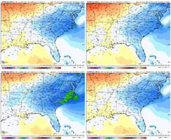
Also seems like slightly less CADMore amped this run View attachment 143919View attachment 143920
18z might be one of those weenie runs been waiting for, c'mon good 'ol GFS don't let me down lol
packfan98
Moderator
Low still in the gulf


Or not ?18z might be one of those weenie runs been waiting for, c'mon good 'ol GFS don't let me down lol
packfan98
Moderator
Well, it didn't go to Cuba. Headed straight east.Or not ?
Yeah it's kinda a messWell, it didn't go to Cuba. Headed straight east.
LukeBarrette
im north of 90% of people on here so yeah
Meteorology Student
Member
2024 Supporter
2017-2023 Supporter
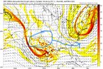
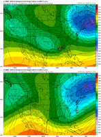
Essentially what you want for this system to work is for the center of the energy to somewhere in that blue circle. Right now it’s just too far south for anything to happen. The track of the system should move somewhat SE because of the Canadian Ridge overtop and suppressive NE energy not allowing it to move North. Keep that energy in the NE in that same spot.
Flotown
Member
starting to think this one is over...i know i know too early...but it looks horibly supressed
It's nothing to do with it being suppressed at this point. It's actually a good thingstarting to think this one is over...i know i know too early...but it looks horibly supressed

