-
Hello, please take a minute to check out our awesome content, contributed by the wonderful members of our community. We hope you'll add your own thoughts and opinions by making a free account!
You are using an out of date browser. It may not display this or other websites correctly.
You should upgrade or use an alternative browser.
You should upgrade or use an alternative browser.
Pattern February 2024
- Thread starter SD
- Start date
Webberweather53
Meteorologist
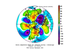
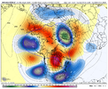
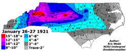
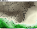
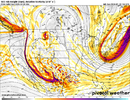
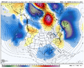
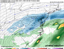
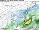
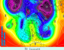
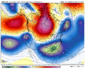
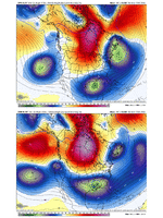
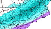
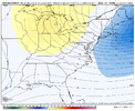
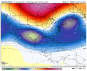
This would be quite satisfactory.This oldie from the early 20s almost gets the hemispheric pattern to a T.
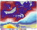
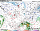
View attachment 143810View attachment 143813
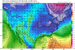
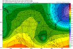
View attachment 143811
NBAcentel
Member
It’s worth noting that the part that can wrong the most (the dumping energy on the eastern side of the omega block) is only 4-5 days out
rburrel2
Member
and the 12z GFS looks great in that department at hr126.It’s worth noting that the part that can wrong the most (the dumping energy on the eastern side of the omega block) is only 4-5 days out
NBAcentel
Member
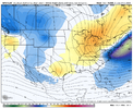
To my untrained eye it appears the cold is a little faster coming south, wouldn't that lead to more suppression?Wonder if this helps out the suppression, we’re about to find out View attachment 143815
rburrel2
Member
Helps with supression and CAD I'd think. This is the safest way we score assuming it drops down hard and heavy in the first place.Wonder if this helps out the suppression, we’re about to find out View attachment 143815
NBAcentel
Member
The vortex itself is a little bit east should at least result in a stronger southern stream waveTo my untrained eye it appears the cold is a little faster coming south, wouldn't that lead to more suppression?
NBAcentel
Member
That makes sense, thanks.The vortex itself is a little bit east should at least result in a stronger southern stream wave
NBAcentel
Member
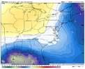
It’s Amp up too earlier for me. Nw Trend should have waited until about day 3-4.Mercy..I don’t even want it to do it yet. Give it at least a few more days View attachment 143820View attachment 143821
Look at the tilt. Not badIt’s Amp up too earlier for me. Nw Trend should have waited until about day 3-4.
Flotown
Member
meaning u think we gonna trend nw even more,correct?It’s Amp up too earlier for me. Nw Trend should have waited until about day 3-4.
NBAcentel
Member
rburrel2
Member
Cmc is phasing in the northern stream so close to an total bombCMC finally shows something, it’s sloppy but anything is better then it’s previous solutions View attachment 143823View attachment 143824
Sent from my SM-A236U using Tapatalk
NBAcentel
Member
With a TPV extension like that looks like a classic Miller B mix bag setup per that H5 lookThe 12z Ukmet is pretty far east with tpv lobe. Looks like it's winding up tight though. Good or bad?
I think it definitely wouldn't be suppressed and CAD/ high location should be really good location.View attachment 143827
Flotown
Member
boy ole boy at the range of possibilities with this thing...
CMC doing that hard headed thing where it slowly moves towards the center of other guidance. Wouldn’t surprise me if it met even more southward tonight and posterized the Carolinas with an epic weenie roast of a run
NBAcentel
Member
I’m the reason this showed up by the way
another screen shot for my what could have been archiveAin’t no way fam. Bro we just having fun at this point. View attachment 143830
I just ain’t seeing the run of the mill Miller B ingredients here but that’s just maybe because I’m an amateur map reader at best. Usually we get some sort of ridging moving in off the Atlantic in those setups.With a TPV extension like that looks like a classic Miller B mix bag setup per that H5 look
Webberweather53
Meteorologist
Starting to see the classic double-barrel jet look on the GFS & CMC as this thing reaches the SE US Coast
The CMC found another way to make it snow in the SE. It actually drops another short wave pinched off from the northern stream behind the initial system lol.Ain’t no way fam. Bro we just having fun at this point. View attachment 143830

NBAcentel
Member
Double barrel jet = bomb. One of the things you see in severe wx season and you know the setup is gonna be big if there isn’t a bunch of junkStarting to see the classic double-barrel jet look on the GFS & CMC as this thing reaches the SE US Coast
Stay positive. We have to will this into reality.another screen shot for my what could have been archive
NBAcentel
Member
Trying to temper the interest but hard to deny the models are starting to sound the alarms.Starting to see the classic double-barrel jet look on the GFS & CMC as this thing reaches the SE US Coast
NBAcentel
Member
NBAcentel
Member
rburrel2
Member
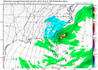
Just as you'd expect the 12z GEFS is more icy with the eastward shift of tpv and the slightly slower southern wave.
Doesn't hurt my feelings one bit though because I think those trends lead to more wintery hits in general. I'll take sleet and freezing rain
There's no doubt that trend is bad for anyone in the mid-south that doesn't get in on CAD though.
Doesn't hurt my feelings one bit though because I think those trends lead to more wintery hits in general. I'll take sleet and freezing rain
There's no doubt that trend is bad for anyone in the mid-south that doesn't get in on CAD though.

