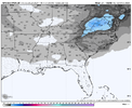
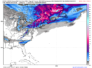
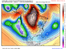
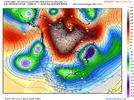
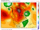
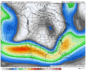
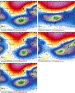
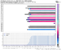
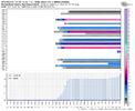
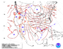
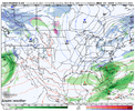
It sure does feel like something is brewing.View attachment 143749
This could be big for lot of people on this board. I’m hyped up
-
Hello, please take a minute to check out our awesome content, contributed by the wonderful members of our community. We hope you'll add your own thoughts and opinions by making a free account!
You are using an out of date browser. It may not display this or other websites correctly.
You should upgrade or use an alternative browser.
You should upgrade or use an alternative browser.
Pattern February 2024
- Thread starter SD
- Start date
The tricky part is keeping that a thing for the next 4-5 days ?. I wouldn't mind losing it entirely tomorrow into Monday/TuesdayThing I like to see this gefs run Vs the last is a more suppressive nature, the gefs run last run had some big members, but also some mid Atlantic members, I’d prefer the spread to be from hits around here to suppression
NBAcentel
Member
accu35
Member
It wouldn’t take but a couple degrees shaves off and Boom!!
CNCsnwfan1210
Member
Is ice included with this mean? I saw a few members with ice in them.
Sent from my SM-A136U1 using Tapatalk
JLL1973
Member
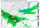
This is not a ms/al storm. No cold air source. Temps are marginal at bestView attachment 143741
This has big potential for MS/AL
accu35
Member
This could easily be a Al/MS storm it’s not that far off with temps plus gefs is showing more members for out area vrs 18z. Its way to soon to say to sayThis is not a ms/al storm. No cold air source. Temps are marginal at best
accu35
Member
You’re looking at an operational run that’s a week away. Temps could easily come in our favorThis is not a ms/al storm. No cold air source. Temps are marginal at best
accu35
Member
accu35
Member
0z Euro has the storm but temps were too warm. No snow for anyone
Forevertothee
Member
Euro has 987mb off SC coast but is the cold air lacking?
NBAcentel
Member
NBAcentel
Member
Webberweather53
Meteorologist
Ensembles look fine atm, esp for it being day 8 ish. Would love to see this phase with the trough over New England in the nick of time to drop a big dog event for the Carolinas and/or VA.
Last edited:
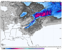
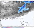
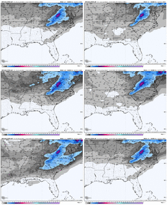
Big shift south in the snow mean in response to the continued trend towards more northern stream press.Excellent way to start the day offView attachment 143765
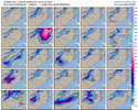
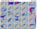
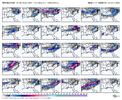
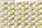
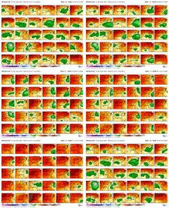
Is it possible to see the 500mb vort progression for individual members? Would be interested to see why there were so many big dog solutions on the ensemble run. If we could phase into that trough in the NE somebody's gonna get a huge stormSome big dog members in the 06z GEFS.
View attachment 143769
Sent from my SM-A236U using Tapatalk
I’m sure the bigger members had more interaction. Both the op and ensemble are trending that way.Is it possible to see the 500mb vort progression for individual members? Would be interested to see why there were so many big dog solutions on the ensemble run. If we could phase into that trough in the NE somebody's gonna get a huge storm
Sent from my SM-A236U using Tapatalk
Last edited:
Cad Wedge NC
Member
Just looking at the individual members, I'll take a blend of members 3, 12, 14, and 16. That should about do it.
rburrel2
Member
I haven't had a 3 inch mean on a GEFS run since at least 2018. Combine that with the fact that this threat is still 8 days away, and... wow!?!
Throw in the fact that most of the members showing no snow, have an ice storm instead. Crazy!
All I care about today is keeping our cold source in tact and pressing south fast. My biggest concern is a lobe of tpv not dropping down in time which is what the 00z Euro showed.
Throw in the fact that most of the members showing no snow, have an ice storm instead. Crazy!
All I care about today is keeping our cold source in tact and pressing south fast. My biggest concern is a lobe of tpv not dropping down in time which is what the 00z Euro showed.
Webberweather53
Meteorologist
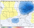
Different set up but kinda similar to February 2014. You see that initial wave riding along the cold front as it’s dropping south and bringing in the cold push from the NNE(great direction for it to come from for everyone east of the Apps). Then you can see the main storm taking show in the Gulf… it will be interesting to see if any of the other models have a solution like this in the coming days.View attachment 143763Wake up fam, another day of fantastic trends on the way.
I
TrIt sure was, strong SW with CAD pressing down hard. If you start seeing icon showing a cooler surface you better pay attention.
What’s does it look like for snowfall and ice?Spire trying
And I would be far more worried if we weren’t seeing suppressed solutions.
View attachment 143772
- Joined
- Jan 2, 2017
- Messages
- 1,566
- Reaction score
- 4,279
That's a helluva mean and hopefully not the high end peak. I mean if this was 2 days out I'd be super pumped. So mentally prepping for bad trends in the next day or so. But I like what I see today!
iGRXY
Member
Honestly, I’d be more worried about suppression being the end result as to why we don’t get a storm vs what the Euro is showing. This storm has me very interested. I’ve tried not to comment because my luck has been awful tracking what appeared to be good potentials that go poor in the 11th hour. But this a much different setup. Legit blocking with a bombing 50/50 low crawling the progression to a hault. And kicking a SW out of the west with troughing all across the subtropical regions and the south. Right now I want this thing in Cuba because this is the type of setup we usually see the NW trend.I haven't had a 3 inch mean on a GEFS run since at least 2018. Combine that with the fact that this threat is still 8 days away, and... wow!?!
Throw in the fact that most of the members showing no snow, have an ice storm instead. Crazy!
All I care about today is keeping our cold source in tact and pressing south fast. My biggest concern is a lobe of tpv not dropping down in time which is what the 00z Euro showed.
This is why I like seeing the suppression we’re seeing on the models right now. With this strong a STJ, you know that this is going to move further north even with a strong press from the northern stream. Yeah it’s been said a lot, but this definitely where we want at this timeThe potential ceiling here is extremely high if you can get everything to line up just right.
Not often you see the subtropical jet this absurdly strong.
View attachment 143771
Tarheelwx
Member
So it’s much like when I go golfing - I know the left hook is coming on my tee shot. So I aim for the trees to the right and feel pretty good when it is headed in that direction. Still, I need the hook to show up at just the right time- too early and I still end up in the trees to the left. About 2/3 of the time I end up in the fairway. Too late and I clip the tres on the right. Yep, that about sums it up.
iGRXY
Member
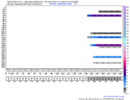
Dang. There's even a 30+ inch member in there!
rburrel2
Member
Blue_Ridge_Escarpment
Member
Does @NCHighCountryWX approve of this message?
You happen to have one for my neck of the woods? Those are sweet.

