-
Hello, please take a minute to check out our awesome content, contributed by the wonderful members of our community. We hope you'll add your own thoughts and opinions by making a free account!
You are using an out of date browser. It may not display this or other websites correctly.
You should upgrade or use an alternative browser.
You should upgrade or use an alternative browser.
Pattern February 2024
- Thread starter SD
- Start date
Thanks for posting KFQD!
Sent from my iPhone using Tapatalk
NEGaweather
Member

Gainesville, Ga for anyone in North Georgia
Sent from my iPhone using Tapatalk
NEGaweather
Member

Anderson, SC
Sent from my iPhone using Tapatalk
njbarrineau
Member

Anderson, SC
Sent from my iPhone using Tapatalk
Got one for northern Greenville County/Travelers Rest?
Sent from my iPhone using Tapatalk
Tarheelwx
Member
Can you grab GSO for the triad area?
TW
TW
NEGaweather
Member

Sent from my iPhone using Tapatalk
KCAE if possible. Thanks in advance.
Sent from my iPhone using Tapatalk
NEGaweather
Member
Can you grab GSO for the triad area?
TW

Sent from my iPhone using Tapatalk
NEGaweather
Member
KCAE if possible. Thanks in advance.

Sent from my iPhone using Tapatalk
Flotown
Member
any noise for muscle shoals??View attachment 143778
Holy cow at that 06z GEFS! Please be onto something
Tsappfrog20
Member

Sent from my iPhone using Tapatalk
Would you share RDU please
Sent from my iPhone using Tapatalk
carolinachaos
Member
How about Florence, SC
Sent from my iPhone using Tapatalk
Sent from my iPhone using Tapatalk
I want to iron this thing out to the point where all we’re worried about come 12z Thursday is moisture robbing convection.
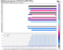
Guys. Please don't go crazy with the imby long range ensemble individual graphics.
The ensemble mean maps are sufficient right now.
The ensemble mean maps are sufficient right now.
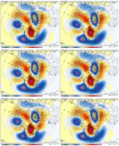
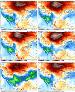
Some big dog members in the 06z GEFS.
View attachment 143769
Shoot that is by far the strongest look here of the year. Wow.
Webberweather53
Meteorologist
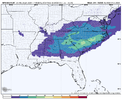
Kinda insane to see a snow mean above 2 inches here. Even more insane is the amount of members w/ big hits, more than I thought it would be.
NEGaweather
Member
How about the McDonald’s on 378 in Lexington, SC?
No McDonald’s but how about the Burger King
Sent from my iPhone using Tapatalk
That’s a rare sight for Columbia SC and south. Reel it in @Mitch West
ForsythSnow
Moderator
30 and 40%'s showing up at 8 days out has to be some signal for someone. I'm assuming other suites are not this enthusiastic currently but I'd be curious what 12Z brings on all of them.
I am trying hard to not get my hopes up. I’m screaming inside though, who am I kidding.That’s a rare sight for Columbia SC and south. Reel it in @Mitch West
The last strong signal I saw like, far south, was 2010. The storm was sent to Cuba on the operationals before eventually nailing i-20 north
With that said, models have improved so let's wait it out another 5 days
With that said, models have improved so let's wait it out another 5 days
JLL1973
Member
There is a couple members with decent hitsany noise for muscle shoals??
The whole pattern going forward would benefit from our winter storm chance next weekend maturing and blowing up off the SE coastGood to see a global ens start trying to build a trough in the east...still looks like maybe 15-20th period we could transition to trough in the east and a nice NPac low. Would give us, outside of elevation, 2-3 weeks to work with.
View attachment 143786
After that crappy Euro Op run last night, that GEFS run was pretty awesome to see. 06z EPS looked a little improved too
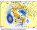
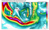
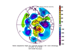
Latest WPC 500mb forecast for next Sunday
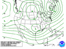
The thing that intrigues me most is that there’s no “pig” ridge trying to blow this thing up and track it over our heads. However, we run the risk of total wave suppression without it but it’s one less thing to worry about here. For this reason I think we’ll have the general storm idea ironed out sooner rather than later at least for someone.
Well we could still hook it into a miller b mess with a westward phase. Suppression is my biggest concern here for my areaThe thing that intrigues me most is that there’s no “pig” ridge trying to blow this thing up and track it over our heads. However, we run the risk of total wave suppression without it but it’s one less thing to worry about here. For this reason I think we’ll have the general storm idea ironed out sooner rather than later at least for someone.
NBAcentel
Member
wow
Member
Ok this is the setup I've been waiting for since El Nino returned. It's been too long.
NBAcentel
Member
icon is a little to amped/far north with the wave, but damn it May have gone for some sort of phase
Kinda look like 0z Euro frm last night. Something to monitor.icon is a little to amped/far north with the wave, but damn it May have gone for some sort of phase
More interaction with the northern stream this run. Looks like it's about to pop a coastal off of SC. I'm not sure I like this look for Ga. though.


