-
Hello, please take a minute to check out our awesome content, contributed by the wonderful members of our community. We hope you'll add your own thoughts and opinions by making a free account!
You are using an out of date browser. It may not display this or other websites correctly.
You should upgrade or use an alternative browser.
You should upgrade or use an alternative browser.
Pattern February 2024
- Thread starter SD
- Start date
NBAcentel
Member
NBAcentel
Member
If you are into the stratosphere stuff, Judah Cohen had a good post yesterday. Excerpt below.
Source: https://www.aer.com/science-research/climate-weather/arctic-oscillation/ (See "Impacts" section)
"...As I discussed back in November, Canadian warmings overwhelmingly transition to just two other PV phases - one is a larger sudden stratospheric warming but most commonly to a stretched PV. A Canadian warming can transition to other PV states (in the strong PV category) but it is significantly less likely. I don’t see another SSW anytime soon but the threshold for a stretched PV is much lower. I think in the time frame of the second week of February and even possibly mid-February a stretched PV is becoming more likely. This should help end the very mild pattern in place across North America. The intensity and duration of cold weather associated with the stretched PV is yet to be determined.
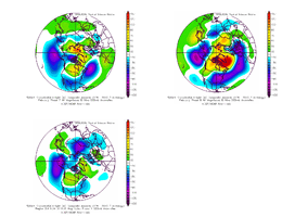
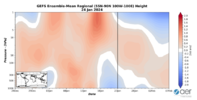
I want to end with one wild card. As usual I show the latest polar cap geopotential height anomalies (PCHs) plot in Figure 11, but occasionally I have also included the North Atlantic regional version of the plot, with the most recent in Figure iv. In Figure 11 one cannot observe the typical “drip” of warm/positive PCHs from the stratosphere to the troposphere often on a timescale of two weeks. Instead, the warm/positive PCHs in the stratosphere associated with last week’s major warming come to an abrupt end and independently warm/positive PCHs appear or emerge in the troposphere in early February. But looking at the North Atlantic regional PCHs (below) a different understanding is suggested. Warm/positive PCHs in the mid to upper stratosphere associated with last week’s major warming first “drip” or descend into the mid to lower stratosphere this week. This first leg down can be seen in Figure 13b with the polar stratospheric warming centered over Greenland. Then “drip” further into the troposphere in early February. Since this is only the North Atlantic regional plot, it is strongly suggestive of the return of Greenland blocking, though for now I don’t see much evidence of this in the weather model forecasts."

NBAcentel
Member
Still the CMC is rather mid because it brings energy right back to the GLs afterwards 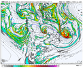
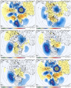
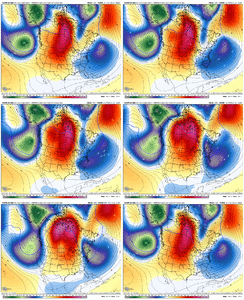
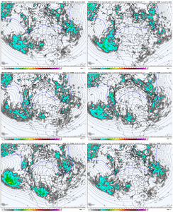
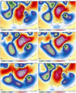
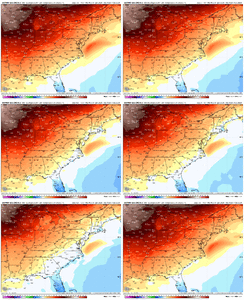
Here’s the 4 run trend from the GFS… there is no trend, we either settle with a pacific origin wave that cuts off ots and we get WAA back in quicker and a ridge more rooted to the subtropics, or we inject a TPV ext into it, bring the can ridge more poleward and undercut quicker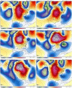

Here’s the 4 run trend from the GFS… there is no trend, we either settle with a pacific origin wave that cuts off ots and we get WAA back in quicker and a ridge more rooted to the subtropics, or we inject a TPV ext into it, bring the can ridge more poleward and undercut quicker

rburrel2
Member
Yea, the verdict is still out on this timeframe. Seems like every piece is on a knife's edge from going one way or the other.
The 12z Icon looked great and hopefully the Euro has a similar look.
It's looking increasing likely we will get the mega wedge with a high pressure possibly rooted all the way in Northern Canada and knifing it's way through our area. I've seen those type CAD events overperform before on a few occasions. Problem is it won't matter if there no cold available. A piece of the TPV has to drop down and provide some cold dry air to tap in to for us to get wintery.
tonysc
Member
Me too Mitch, I'm over here in Greenwood and I would love to see something like that.View attachment 143287
Ohhh lawwwd hep me
NBAcentel
Member
NBAcentel
Member
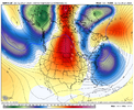
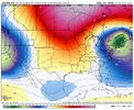
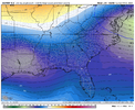
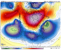
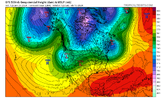
You can see at 500mb the ridge going up through AK and the Aleutian Low establishing itself. The SW trough is in the process of pinching off and will allow the core of the cold to drop in farther east:
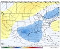
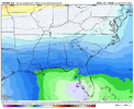
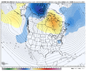
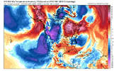
The 850s showing up in western Canada are cold. This is probably underdone, given the height of the ridge going up.
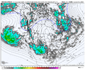
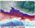
You can see at 250 mb the howling jet across the south and the split flow out in the Pacific....kind of an Omega block look:
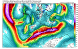
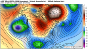
It shows up really well on the 2 PVU pressure map too:
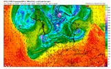
Add in the strat warm and it's impact on the NAO that the models aren't even picking up on yet, and by Valentine's day, we're going to be rocking. I'm thinking a major winter storm for the SE around 2/18. Let's go!!

The 850s showing up in western Canada are cold. This is probably underdone, given the height of the ridge going up.

You can see at 250 mb the howling jet across the south and the split flow out in the Pacific....kind of an Omega block look:

It shows up really well on the 2 PVU pressure map too:

Add in the strat warm and it's impact on the NAO that the models aren't even picking up on yet, and by Valentine's day, we're going to be rocking. I'm thinking a major winter storm for the SE around 2/18. Let's go!!
D
Deleted member 609
Guest
If he’s in I’m in. Let’s do this.You can see at 500mb the ridge going up through AK and the Aleutian Low establishing itself. The SW trough is in the process of pinching off and will allow the core of the cold to drop in farther east:
View attachment 143321
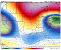
The 850s showing up in western Canada are cold. This is probably underdone, given the height of the ridge going up.
View attachment 143322
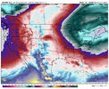
You can see at 250 mb the howling jet across the south and the split flow out in the Pacific....kind of an Omega block look:
View attachment 143323
It shows up really well on the 2 PVU pressure map too:
View attachment 143324
Add in the strat warm and it's impact on the NAO that the models aren't even picking up on yet, and by Valentine's day, we're going to be rocking. I'm thinking a major winter storm for the SE around 2/18. Let's go!!
This is the most impressive analysis of 384 hr output I've ever seen. I can't think of even a single thing that could derail thisYou can see at 500mb the ridge going up through AK and the Aleutian Low establishing itself. The SW trough is in the process of pinching off and will allow the core of the cold to drop in farther east:
View attachment 143321
The 850s showing up in western Canada are cold. This is probably underdone, given the height of the ridge going up.
View attachment 143322
You can see at 250 mb the howling jet across the south and the split flow out in the Pacific....kind of an Omega block look:
View attachment 143323
It shows up really well on the 2 PVU pressure map too:
View attachment 143324
Add in the strat warm and it's impact on the NAO that the models aren't even picking up on yet, and by Valentine's day, we're going to be rocking. I'm thinking a major winter storm for the SE around 2/18. Let's go!!
- Joined
- Jan 23, 2021
- Messages
- 4,602
- Reaction score
- 15,197
- Location
- Lebanon Township, Durham County NC
The 850 0 degree moved from *checks notes* New York City to just between 40 and the border in NC on the GEFS around day ten.
Last edited:
It's over man just ask a few here that make sure we know they think it isThe 850 0 degree moved from *checks notes* New York City to just between 40 and the border in NC on the GEFS. around day ten.
NBAcentel
Member
NBAcentel
Member
You got a little something down there over Mex. Seems like it would probably get squashed, but who knows.Euro unloads a TPV into the NE US at day 7 ? just need a southern stream wave to eject from out west View attachment 143327
Has wedgie written all over it.Here comes a wave entering the western US View attachment 143328View attachment 143331
backdoor front?Euro unloads a TPV into the NE US at day 7 ? just need a southern stream wave to eject from out west View attachment 143327
NBAcentel
Member
- Joined
- Jan 23, 2021
- Messages
- 4,602
- Reaction score
- 15,197
- Location
- Lebanon Township, Durham County NC
I hate to make this comparison, but it's almost the exact same wave orientation. Just pull the low into SE Canada and let the wave develop.
View attachment 143336
View attachment 143338

Ok I’m glad someone said before me, but I couldn’t help but notice this.I hate to make this comparison, but it's almost the exact same wave orientation. Just pull the low into SE Canada and let the wave develop.
View attachment 143336
View attachment 143338
NBAcentel
Member
Absolutely beautiful progression right there. Interested to see if the EPS continues or picks up more in the signal. Had some hits last night for this periodGreenland / Davis Strait ridges are nice, but nothing can block up and slow down the flow across the CONUS like a slow-moving low over the Northeast / off the NE Coast.
View attachment 143343
The one big difference I see is the big block over Greenland in 2004, with the weaker one in Central Canada. It allows for a slower lift-out of the 50/50 off the NE coast and the trajectories out of Canada are more favorable. I would guess that the air to the north would be chillier too, but without the maps, it would just be a guess. Anyway, it's remarkably similar, other than that. Here's a map of that event, from the NWS in Raleigh:I hate to make this comparison, but it's almost the exact same wave orientation. Just pull the low into SE Canada and let the wave develop.
View attachment 143336
View attachment 143338
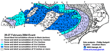
Looking at Grit's animation above, there appears to be just enough ridging north of the low to hold it in place longer. Big, big positive factor, if true.
NBAcentel
Member
- Joined
- Jan 23, 2021
- Messages
- 4,602
- Reaction score
- 15,197
- Location
- Lebanon Township, Durham County NC
Control run pulls the ol' weathermachine(deep deep cut) move and crush, kills and destroys the storm to the south.
SnowwxAtl
Member
Prolly suppose to be whamby, but this take me down everytime! ?????
NBAcentel
Member
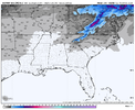
Still a weak signal on the EPS like last run, but making strides at H5, digging the Atlantic Canada trough more, raising heights over the Great Lakes and Canada and loosing the subtropical ridge influence, and the shortwave looking much improved. Plenty of time here to turn this into something or trend worse. Normally in my experience CAD winter storms like to show up between day 7-10, this is barely entering day 10 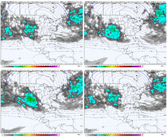


NBAcentel
Member
Blue_Ridge_Escarpment
Member
Earlier Feb looks the most promising to me with a mega CAD event most likelyHopefully by the 15-20th the cold can finally push east. It’s getting there. Should give us a solid 10 day window to see snow. ?
View attachment 143354
That's a southern slider set-up isn't it?Looking at Grit's animation above, there appears to be just enough ridging north of the low to hold it in place longer. Big, big positive factor, if true.
It would be if we can keep the 50/50 in place.That's a southern slider set-up isn't it?
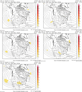
Hopefully we have multiple chances between early Feb to mid-Mar, but who knows. 1 chance would be a start for us east of the Apps. But yeah, the weeklies try to move things into a better pattern by kicking that SW trough east while building an AK ridge. We actually need some renewed momentum in the Pac Jet to do that because the initial big jet extension coming in a few days dies out.Hopefully by the 15-20th the cold can finally push east. It’s getting there. Should give us a solid 10 day window to see snow. ?
View attachment 143354
Just looking at the surface anomaly charts here on the weeklies from Feb 3 to 23, it is showing low pressure in EAsia being replaced with high pressure (+EAMT), and shortly thereafter, the Pac Jet extends and the Aleutian Low swells and moves east...then the southern stream across the CONUS becomes active again. Long way out of course, but that Feb 17-23 timeframe has the best look at the moment IMO.
