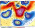
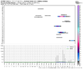
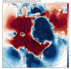
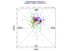
If we hit mid feb and see that winter is over. I don’t think we will though.Agree. If we hit Mid February and we see that map it is concerning.
-
Hello, please take a minute to check out our awesome content, contributed by the wonderful members of our community. We hope you'll add your own thoughts and opinions by making a free account!
You are using an out of date browser. It may not display this or other websites correctly.
You should upgrade or use an alternative browser.
You should upgrade or use an alternative browser.
Pattern February 2024
- Thread starter SD
- Start date
JHS
Member
The 2nd week is probably gone too if the 18z GFS is right. It shows warm weather all the way to northern Minnesota and the snowpack vanishes for the most part east of the Rockies. We have a big southeast ridge this run, with a trough in the west and the storm track west of the Great Lakes with highs near 60 all the way to near Chicago.Why do we keep beating a dead horse: We already know the first week of Feb is a wash.
NBAcentel
Member
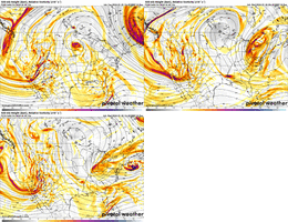
18z GFS has a more poleward shifted pacific jet as it enters the US, something that’s not really supported atm. Poleward is bad, equatorial shifted = possibly warm, but also the risk of undercutting and stuff dropping on the east side of the omega block. Still with a eq shifted pac jet, there’s a warm risk, but an increased chance of lower heights below the ridge. Think what gets my interest the most is ENS towards the end starting to get those looks the EC weeklies/GEFS ext show with blocking everything up top especially getting the western Canada/Alaska ridge going and lowering the height field below
coldfront22
Member
Let’s hope the ensembles are on to a pattern change. And the 18z is not the start of 3 weeks or longer of average to above average highs.
NBAcentel
Member
It’s a southeast weather forumWhat gets my interest is how often the phrase “towards the end of the run” is used around here.
Prefer how the euro suite is handling the pacific coast up to AK around D10 and after vs the gfs suite.
But for real, is there a logical explanation for why the good eye candy and patterns are always at the end of the runs? It’s like the models want it to snow here and think it can but then it never happens. Just once can we get a good fantasy storm and then have it trend better and better all the way up till go time.It’s a southeast weather forum
NBAcentel
Member
They revert to what the subseasonal pattern (MJO/ENSO) should produce the farther you get out but they smooth out the little eff upsBut for real, is there a logical explanation for why the good eye candy and patterns are always at the end of the runs? It’s like the models want it to snow here and think it can but then it never happens. Just once can we get a good fantasy storm and then have it trend better and better all the way up till go time.
There hasn't been a ton of eye candy the last couple of years even in the d7+ range. The reality of it is to me when we see manageable patterns around d7+ you know there's at least some potential to trend better but as you get around and inside of D5 you can get a pretty good feeling of yes or noBut for real, is there a logical explanation for why the good eye candy and patterns are always at the end of the runs? It’s like the models want it to snow here and think it can but then it never happens. Just once can we get a good fantasy storm and then have it trend better and better all the way up till go time.
NBAcentel
Member
Yep. Even at times during legendary jan 2022 it looked mid, and the cold source on models looked lackluster with them locking up the cold in Canada or overextendingThere hasn't been a ton of eye candy the last couple of years even in the d7+ range. The roof of it is to be when we see manageable patterns around d7+ you know there's at least some potential to trend better but as you get around and inside of D5 you can get a pretty good feeling of yes or no
- Joined
- Jan 5, 2017
- Messages
- 3,773
- Reaction score
- 5,983
You're in Anderson, SC? You'll know long before mid-February if winter is really over (it is).If we hit mid feb and see that winter is over. I don’t think we will though.
Webberweather53
Meteorologist
I still can’t quite figure out where the end of this colder/stormier look is in the very long term (& ultimately “true” the beginning of spring).
Even out into early and even mid March, we still look to be stuck in this -NAO/eastern trough-type look.
The fact that we’ve seen a collapse of the +IOD, are approaching the time of the year where the MJO tends to be amplified/moves more slowly, & Indian Ocean phases (2-3) are actually conducive to eastern troughing, makes me think we’re really in it for the long haul once we get past this Pacific Jet extension.
He means winter storm potential.By colder/stormier I’m assuming you don’t mean winter storm potential. Just annoying 40-50 degree days and rain.
NBAcentel
Member
NBAcentel
Member
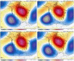
Wake up family, the morning GFS is throwing haymakers.
NBAcentel
Member
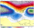
?Perhaps we are starting to cook ? this is similar to the euro View attachment 143286
Cad Wedge NC
Member
Cad Wedge NC
Member
Looks like the GFS is finally seeing the pattern change.
3 storms with in a week with strong CAD and there’s support on the EPS 500mb charts for it. I haven’t had a chance to look at the GEFS yetLooks like the GFS is finally seeing the pattern change.
- Joined
- Jan 2, 2017
- Messages
- 1,566
- Reaction score
- 4,279
Indeed it is!Wake up family, the morning GFS is throwing haymakers.
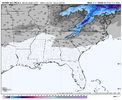
I thought it was against the rules to post P/Type maps past 240 hours? ? ?
Webberweather53
Meteorologist
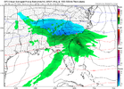
screen shot!View attachment 143287
Ohhh lawwwd hep me
I wouldn’t get caught up in the details of the maps because these storms may or may not happen or they could have much different timing. The important thing that run showed is why you can’t discount anything coming together when there’s a pattern that promotes strong CAD… especially when you have plenty of snow pack in southeast Canada and the interior northeastI thought it was against the rules to post P/Type maps past 240 hours? ? ?
I posted in obs thread. Overnight low of 61 has to be a big time record for jan25, if not January all together. Feels like May/early June out this morning. Just Awful!!!
Does anyone know what records are?
Does anyone know what records are?
rburrel2
Member
Seems like the overnight trend was to pinch off and push a piece of the west coast trough underneath our ridge in the 228-240hr timeframe. Which is exactly what we need to have any chance of a winter storm in the day 10-12 timeframe.
The other piece of the puzzle is we need a strong enough wave to dive down from New England/SE Canada to deliver cold air and reinforce a strong CAD high.
Yesterday the models trended horribly with both these features, and then like magic they've brought them both back from the dead over night. The euro is especially nice with both pieces at hr 240. All we really need is for the maybe for the southern wave to be a tad farther north and a tad quicker as depicted, but it may have worked out as-is.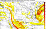

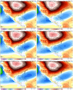
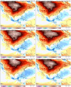
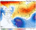
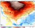
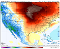
This is exactly what you have been saying for the last week and why I commented yesterday that you can pretty much throw these surface temp maps in the garbage after early next week. Even this look here doesn’t line up with the 500mb maps for the same time periodEven more skeptical of this early Feb torch pattern here than I was a few days ago. May not even be much above average at all at this rate
View attachment 143288
View attachment 143289
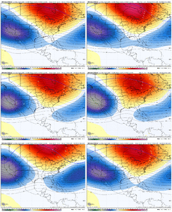
One thing that I’ve noticed since the middle of December is how well the snowpack has held on and grown in southeastern Canada… even while the rest of the continent was losing it quickly around Christmas. So it’s no surprise that is where some of the coldest temperatures have been setting up and it’s where our source region is for CAD.Seems like the overnight trend was to pinch off and push a piece of the west coast trough underneath our ridge in the 228-240hr timeframe. Which is exactly what we need to have any chance of a winter storm in the day 10-12 timeframe.
The other piece of the puzzle is we need a strong enough wave to dive down from New England/SE Canada to deliver cold air and reinforce a strong CAD high.
Yesterday the models trended horribly with both these features, and then like magic they've brought them both back from the dead over night. The euro is especially nice with both pieces at hr 240. All we really need is for the maybe for the southern wave to be a tad farther north and a tad quicker as depicted, but it may have worked out as-is.View attachment 143290
rburrel2
Member
The cool thing about the day 10-12 threat is it has mega big dog potential. If we get the undercutting wave and the the stalled atlantic low things are going to slow to a crawl and we could be looking at a prolonged wintry CAD event.
Odds are low everything works out, but at least the potential is there.
Odds are low everything works out, but at least the potential is there.
- Joined
- Jan 23, 2021
- Messages
- 4,602
- Reaction score
- 15,197
- Location
- Lebanon Township, Durham County NC
Webb, you have done fantastic so far this Winter. We need you to finish strong in February though. No pressure at all.. lolEven more skeptical of this early Feb torch pattern here than I was a few days ago. May not even be much above average at all at this rate
View attachment 143288
View attachment 143289
coldfront22
Member
No pressure Webb... Seriously as West mentions excellent job of breaking down the pattern heading into February.
iGRXY
Member

Why oh why could this run not go a little further. By the end of it DP's were dropping like a rock and were almost into single digits already along the NC/VA border. We were on our way to a legit weenie run.
Why does this remind me of the horror that was March 2010….

