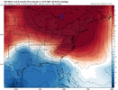
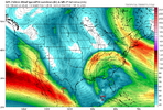
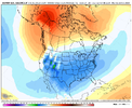
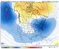
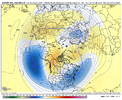
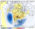
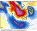
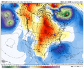
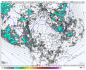
Alaska ridge/ torch, is what you always wanna see!
-
Hello, please take a minute to check out our awesome content, contributed by the wonderful members of our community. We hope you'll add your own thoughts and opinions by making a free account!
You are using an out of date browser. It may not display this or other websites correctly.
You should upgrade or use an alternative browser.
You should upgrade or use an alternative browser.
Pattern February 2024
- Thread starter SD
- Start date
Poor Ice Road Truckers. Gonna reek havoc on the Dalton Haul Road!Alaska ridge/ torch, is what you always wanna see!
Last edited:
I don't do feelings to much cause they are just rooted from my own desires, but I do think we get a classic big ole CAD storm in February.
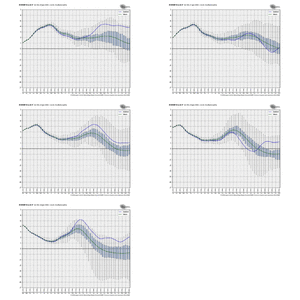
And just like that the eps mean temps cooled 3-4 degrees and havoc was created with some fairly monster spreads
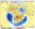
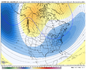
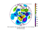
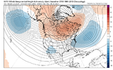
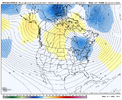
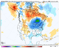
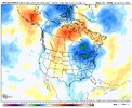
More of this please. Increasing ridging over AK or pulling the CAN ridge back west allows for more cold energy to be directed down the eastern side of the ridge into the eastern US. This in turn should set up a pretty nice wave train at least across SE can into the natl which could help be the catalyst for flexing the NAO -. You can see that action on this r2r change plot. After looking pretty bad for days it's good to see some instability in the eps. That monster omega block with the ridge axis over the eastern US wouldn't have been the death of winter but it would have put it in the hospital
This might be a stupid question and this is something I seldom worry about at this range, but is that the type of set up that can squash all of the energy too far south in the GOM?
This might be a stupid question and this is something I seldom worry about at this range, but is that the type of set up that can squash all of the energy too far south in the GOM?
It's very possible at least for a time. This setup is going to be fun to watch from a weather nerd perspective but those wanting to see purples and model snow its going to struggle to watch. That ridge axis location, how waves break down the eastern side, any CAD influence, the pac jet momentum and eastward extent are all going to combine for a huge spectrum of outcomes from potential snow, to cold and dry, to mundane and normal, to warm and wet, to near record highs.
Last edited:
NBAcentel
Member
It’s beneficial as well that wavelengths start shortening over the next couple of weeks which allows room for a more amplified pattern in general. Last late spring/summer was a good example of the omega block in Canada being good for - departures across the east, and the reason why Memorial Day I was nearly suicidalMore of this please. Increasing ridging over AK or pulling the CAN ridge back west allows for more cold energy to be directed down the eastern side of the ridge into the eastern US. This in turn should set up a pretty nice wave train at least across SE can into the natl which could help be the catalyst for flexing the NAO -. You can see that action on this r2r change plot. After looking pretty bad for days it's good to see some instability in the eps. That monster omega block with the ridge axis over the eastern US wouldn't have been the death of winter but it would have put it in the hospital
Memorial Day weekend last year for us in the Carolinas was absolutely miserable. We deserve the payoff after that for the similar set up in February to give us a huge dump of snow.It’s beneficial as well that wavelengths start shortening over the next couple of weeks which allows room for a more amplified pattern in general. Last late spring/summer was a good example of the omega block in Canada being good for - departures across the east, and the reason why Memorial Day I was nearly suicidal
NBAcentel
Member
That weekend was so awful. We were like 30 degrees below normal that weekend. Absolutely awful. I hope this upcoming one is in the upper 90s. That’s another form of revenge. May cutoffs suckMemorial Day weekend last year for us in the Carolinas was absolutely miserable. We deserve the payoff after that for the similar set up in February to give us a huge dump of snow.
NBAcentel
Member
We were wedged and in the lower 60s with lows making it in the mid 50s. Charlotte is not in Georgia @SoutheastRidgeUpper 70s in Atlanta that weekend. I can’t imagine Charlotte being that much colder.
We were completely wedged in that weekend in the CLT area. Temperatures fell into the 50s overnight on Friday and stayed there with on/off light rain and drizzle through Sunday night. Just a miserable weekend. The sun finally broke through on Memorial Day itself in time to get us up close to 70.Upper 70s in Atlanta that weekend. I can’t imagine Charlotte being that much colder.
NBAcentel
Member
That mslp pattern is a pants explosion @Jimmy Hypocracy 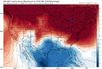

NBAcentel
Member
Looks like the wave is getting held back so probably not big in the winter department, but point stands, looks wedgy with the ridge axis in Canada/the Great Lakes
Well of course the wave gets held back. What else is new. This will be another decent pattern with nada to show for it.Looks like the wave is getting held back so probably not big in the winter department, but point stands, looks wedgy with the ridge axis in Canada/the Great Lakes
Flotown
Member
pretty impressive this far out...looks like overunning potential for lots of people...correct?
Webberweather53
Meteorologist
I'm still not really convinced of the "big torch" pattern in early Feb that's been discussed on social media, esp over the SE US and coastal mid-Atlantic. Mild maybe, but unseasonably so? I doubt it outside the Great Lakes, south-central Canada & Midwest.
Pacific jet is extending yes, but it's also shifting equatorward, which opens the door for troughs to cut underneath, esp in El Niño years like this.
Active southern stream w/ a Canadian blocking ridge over the top & a sneaky trough lurking off the East Coast & Atlantic Canada is usually how you get cold air damming.
Webberweather53
Meteorologist
I’m sorry…this has a chance to be a better version of 87
View attachment 143209
View attachment 143208
Biggest thing we have to fix is the trough off Atlantic Canada (50/50 low). We'll have to see if we get a favorable trend there in the medium range.
- Joined
- Jan 23, 2021
- Messages
- 4,602
- Reaction score
- 15,197
- Location
- Lebanon Township, Durham County NC
I think it's mostly caused by the "EXT" after "GFS".View attachment 143214Really curious if this look is caused by the ridge blocking the PV south
- Joined
- Jan 23, 2021
- Messages
- 4,602
- Reaction score
- 15,197
- Location
- Lebanon Township, Durham County NC
Okay coolI think it's mostly caused by the "EXT" after "GFS".
This jet ext is more of a hit-and-run and doesn't look as bad as the one in late Dec. Low pressure moves west to east across Asia in the Jan 27-Feb 2 timeframe which helps with the pullback downstream


I mean, I like the pretty image, but we've seen similar images more than a few times this winter, along with commentary about how we used to laugh people off of boards for posting 384 GFS maps in the main threads. I do hope it's right.Okay cool
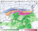
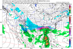
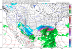
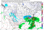
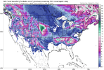
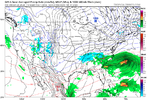
Classic ice storm in midlands the way it used to be.The 00z GFS has some insane CAD.
View attachment 143225
View attachment 143224
View attachment 143226
NBAcentel
Member
NBAcentel
Member
Really the trend we want to see the next couple of days since there’s plenty of time (and if you want to score in this type of pattern consisting of the Canadian ridge/omega block, Is a shortening of wavelengths, and most importantly in this setup is getting some pieces of northern stream/a TPV extension to dig down and phase with the energy in the Atlantic, preferably around and S/SW of Atlantic Canada, tilt the ridge axis slightly more positive in order to suppress the height field further, and a stronger ATL trough in general to suppress any subtropical ridge influence. Biggest thing I wanna see right now is to continue backing up those lower heights in the Atlantic and deepening it around Atlantic Canada, and getting a better N/S fetch to inject a valid cold source into the Atlantic trough and would be trailing high. Ens still look warm in general, but the 00z EPS and especially 06z GEFS made some strides for the better. A lot of these damming setups often show up in the medium range anyways 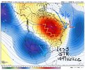

rburrel2
Member
There's been very little support for wintry on the GEFS members, but that's roughly like 8 of the last 10 GFS runs that has showed a CAD winter storm 300+ hours out, (06z run didn't). Prior to this stretch the GFS has been very stingy with fantasy storms showing basically none at all most of the winter.
Seems like a solid signal that something might be brewing, I just hope the ensembles catch on to the threat soon.
Either way I've got a feeling if we miss out on this one, the following week should be rife with opportunities as well.
Seems like a solid signal that something might be brewing, I just hope the ensembles catch on to the threat soon.
Either way I've got a feeling if we miss out on this one, the following week should be rife with opportunities as well.
This is a solid notice. I've mentioned a couple times that since I would say last Winter, the GFS has really got a hold of itself with dishing out fantasy runs left & right. I think as you said, we MIGHT be able to respect noise 300+ hours out on the GFS a little more IF something does play out in that timeframe of interest showing up.There's been very little support for wintry on the GEFS members, but that's roughly like 8 of the last 10 GFS runs that has showed a CAD winter storm 300+ hours out, (06z run didn't). Prior to this stretch the GFS has been very stingy with fantasy storms showing basically none at all most of the winter.
Seems like a solid signal that something might be brewing, I just hope the ensembles catch on to the threat soon.
Either way I've got a feeling if we miss out on this one, the following week should be rife with opportunities as well.
Stormlover
Member
Are you just going to say that every time something positive is posted in the extended time? Why? We get it, you don't believe any of them. Ok.I mean, I like the pretty image, but we've seen similar images more than a few times this winter, along with commentary about how we used to laugh people off of boards for posting 384 GFS maps in the main threads. I do hope it's right.
Order #: 111-3877115-9554608
Cold Rain, I must agree with you. I have watched for years and have commented several times that a lot of folks are wishing our lives away with a 10 day forecast that never makes it 10 days. Yes I am in the same row boat as many I hope that it comes THRU !
Cold Rain, I must agree with you. I have watched for years and have commented several times that a lot of folks are wishing our lives away with a 10 day forecast that never makes it 10 days. Yes I am in the same row boat as many I hope that it comes THRU !
He,Are you just going to say that every time something positive is posted in the extended time? Why? We get it, you don't believe any of them. Ok.
We East of the Apps have a right to be skeptical at this point.
He's not saying it won't or can't happen.
Just take everything with skepticism until we close in on 72 hours then you can really start to buy in...
Maybe us East of the Apps ppl want to see actual frozen precip falling & sticking before we completely buy in...
Being skeptical is a Self defense mechanism at some point.

