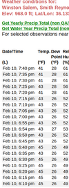
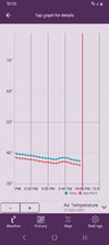
You setting good. Enjoy the storm!Temperature here In Wytheville is 35 degrees at 7:30 with a dewpoint of 15 so looking good up this way.
-
Hello, please take a minute to check out our awesome content, contributed by the wonderful members of our community. We hope you'll add your own thoughts and opinions by making a free account!
You are using an out of date browser. It may not display this or other websites correctly.
You should upgrade or use an alternative browser.
You should upgrade or use an alternative browser.
Pattern February 11-13 2025
- Thread starter SD
- Start date
you will make it down to freezing easy, problem is we going to miss out on the front end precip that's where it's at...I'm at 35 right now. If we can get down to freezing, there could be some heavy frost -- as long as we keep clear skies.
Right, I'm at 33 and airport already reporting 32. Temps not issue, precip bigger problem.... oh wellyou will make it down to freezing easy, problem is we going to miss out on the front end precip that's where it's at...
Always seems to be something that's missing at every chance we get.Right, I'm at 33 and airport already reporting 32. Temps not issue, precip bigger problem.... oh well
WolfpackHomer91
Member
I’m at 39…. Already overcast …. Million dollars we only hit 34 tonight lol
Sent from my iPhone using Tapatalk
jtgus2005
Member
Guilford county/Greensboro, NC have declared tomorrow a remote learning day due to the WAA issued. I thought all the winter weather is supposed to be above the state line.
Seems a bit ridiculous to go remote over a glaze of ZR after how warm it’s been.Guilford county/Greensboro, NC have declared tomorrow a remote learning day due to the WAA issued. I thought all the winter weather above the state line.
packfan98
Moderator
I think the biggest influence is the NWS putting the county under a WWA.Seems a bit ridiculous to go remote over a glaze of ZR after how warm it’s been.
Tsappfrog20
Member
Seems a bit ridiculous to go remote over a glaze of ZR after how warm it’s been.
Don’t be surprised if that band keeps coming south wcpps doesn’t call at least a 2 hour delay if not remote learning
Sent from my iPhone using Tapatalk
Wake doesn't do remote learning for weather. Delay would not surprise me though especially if Durham pulls first.Don’t be surprised if that band keeps coming south wcpps doesn’t call at least a 2 hour delay if not remote learning
Sent from my iPhone using Tapatalk
Tsappfrog20
Member
Wake doesn't do remote learning for weather. Delay would not surprise me though especially if Durham pulls first.
So your right but they could if they choose to.
Sent from my iPhone using Tapatalk
My wife is a teacher and I'm sure she wouldn't mind sleeping in a little bit.Don’t be surprised if that band keeps coming south wcpps doesn’t call at least a 2 hour delay if not remote learning
Sent from my iPhone using Tapatalk
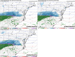
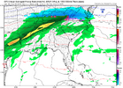
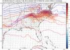
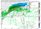
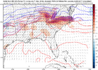
Not going to lie that I’ve been thinking the same thing, then wonder if I just suck at reading these maps and am missing something.Grasping I'm sure but I feel this precip shield should look better, further south, with that 850 fgen....
View attachment 168256
View attachment 168257
LukeBarrette
im north of 90% of people on here so yeah
Meteorology Student
Member
2024 Supporter
2017-2023 Supporter
Well well well
LukeBarrette
im north of 90% of people on here so yeah
Meteorology Student
Member
2024 Supporter
2017-2023 Supporter
I’ve said it a million times aswell, HRRR closer to what will happen with banding.Grasping I'm sure but I feel this precip shield should look better, further south, with that 850 fgen....
View attachment 168256
View attachment 168257
Yeah I'm sure I'm missing something, the 750mb fgen is further north on the NAM but Rah NWS keeps mentioning the 850mb fgen as their basis for for precip further south. That looks solid on the NAM to me. Here is part of their discussionNot going to lie that I’ve been thinking the same thing, then wonder if I just suck at reading these maps and am missing something.
"Additionally, an area of strong frontogenesis centered around 850 mb
is forecast in the guidance to develop over portions along and north
of Interstate 85 to over the northern Coastal Plain. This is likely
to support an area of banded precipitation along and north of
Interstate 85 to over the northern Coastal Plain."
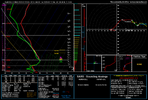
Sounding sure looks as if there would be precip when the model is showing none and as @LukeBarrette has been harping on, the NAM struggled with this last month. Will be interesting to see just how this pans out
Tarheelwx
Member
31.8 here in Colfax, about 4 miles west of GSO.
TW
TW
Well well well
Yep it appears the NAM has folded defintely a clear south trend there.
I am at 29 degrees in Wytheville now so we good just need the moisture. Dewpoint is 17
WolfpackHomer91
Member
Somehow im down to 34 but only over 32 so were done here
And onset sleet, not frzng rn. Sleet will dust a road up quicker than snowI think the biggest influence is the NWS putting the county under a WWA.
Nice ring around moon tonight. 32/32 at 9pm all reporting Davidson Randolph Chatham. Clear skies should start frosting up soon. 50 mile shift on frontgen about 630 am is only piece of puzzle that will be missing.
Id never trust Nam with its footprint,as Luke pointed out, well documented its always to far north. Now thermals is another topic. Border counties will get a onset kiss of flakes tomorow. Book it.
Id never trust Nam with its footprint,as Luke pointed out, well documented its always to far north. Now thermals is another topic. Border counties will get a onset kiss of flakes tomorow. Book it.
Still sitting at 38/29 really surprised at how slow temp has fallen here. Most everyone I see posted is 4-6° colder than me.
Sent from my iPad using Tapatalk
Sent from my iPad using Tapatalk
28.6 dropping like a rock and nice frost on the vehicles already. If can get precip in here a smidge earlier and a few miles south
Be just like you and I to get a rain cold. Lol
Sent from my iPad using Tapatalk
Sent from my iPad using Tapatalk
Wow, can't believe you are 10 degrees colder than me!28.6 dropping like a rock and nice frost on the vehicles already. If can get precip in here a smidge earlier and a few miles south
lcpdk
Member
33 degrees 29 dew point about 10 miles east of Winston-Salem
Yeah clear skies and radiational cooling in full effect, don't know what y'alls problem is out there. Lol elevation, you're closer to the warm noseWow, can't believe you are 10 degrees colder than me!
CNCsnwfan1210
Member
Probably doesn’t mean a hill of beans, but it’s 32/31 here in SW Wilson county
Sent from my iPhone using Tapatalk
Sent from my iPhone using Tapatalk
Tarheelwx
Member
30.9 now in Colfax.
TW
TW
WolfpackHomer91
Member
How accurate do y'all think the weather underground stations are ? Some guy down the road has 33/32 but over in China Grove there's already a 30 and a 31 popping up? But on NWS it has Mooresville at like 36Yeah clear skies and radiational cooling in full effect, don't know what y'alls problem is out there. Lol elevation, you're closer to the warm nose
WFFaithful
Member
I'm at 32. Forecast low is 34.
Icon with some -40’s near the Canadian/US border at the end of the run. Every model showing some anomalous air. How far south and East can it push next week? Stay tuned
NBAcentel
Member
Getting all sleet here
In Concord? What part?Getting all sleet here

