sleety.
precip came earlier, but so did transition. damn
precip came earlier, but so did transition. damn
Lol. Everybody from Loudoun County west to Winchester is reporting light snow in the Mid-Atlantic thread over there. There's also a blind spot in the radar from IAD to the southwest due to Bull Run Mountain blocking the low level moisture.
Please sweet baby Jesus…. Let this stay put for the next 16hrs … I’d get so much Joy from it.
Sent from my iPhone using Tapatalk


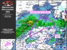
So @Ross any idea what is going on here?
Those folks up on burnt and Oglethorpe mountains can score a lot. So many houses above 3000.Reports of ice on the trees in Pickens County Georgia. Appears to be above 3000 feet. They reporting no problems with the roadways for now.
View attachment 168373
More chances not too distant future.36 with rain. Joint killer
It’s just amazing what a broad push of stale cold air this was. A real kick in the nuts
That's a great storm right there in my books... Congrats!30.9 here in Wytheville with moderate rain. I ended up with 4.3" snow accumulation. Ice hanging from powerlines outside my house. We changed over from snow to sleet to freezing rain a few hours ago.
Well, I'm at 32.9 degrees. Just .9 degrees away from freezing. But, this might as well be 9 whole degrees from freezing. It would amaze me if I fell anymore tonight.
I just noticed your location. Probably one of the best spots in NC outside the mtns.Yeah, I’ve been stuck at 32.2° for a few hours now that’s probably gonna be my low.
Sent from my iPhone using Tapatalk
Don’t think so, either. DCA is at 32 right now with a lot of snow and RIC is also 32, so it’s not as if this NE wind is dragging in a lot of frigid air to counteract latent heat release if we did actually get below freezing. Might be one of those times we drop down to 32.1 and stay.Well, I'm at 32.9 degrees. Just .9 degrees away from freezing. But, this might as well be 9 whole degrees from freezing. It would amaze me if I fell anymore tonight.
This is a little interesting (they are NE of us):Don’t think so, either. DCA is at 32 right now with a lot of snow and RIC is also 32, so it’s not as if this NE wind is dragging in a lot of frigid air to counteract latent heat release if we did actually get below freezing. Might be one of those times we drop down to 32.1 and stay.

I was just noticing this too. Heck the Halifax airport reporting 32 (5 miles east of me)
There are so many folks/stations sitting at 32.1+. It would take just a little bit of cooling to see some light icing. Right now, that little bit of cooling is near Henerson.I was just noticing this too. Heck the Halifax airport reporting 32 (5 miles east of me)
Those folks up on burnt and Oglethorpe mountains can score a lot. So many houses above 3000.
Yeah, I'm 32.5 just gotta love it, not!Sitting at 32.3 degrees. Got lower than I thought (which only dropped .6 degrees). Lots of 32-degree readings through northern NC this morning. Problem is, just about everyone is 32.1+ putting them a tick above freezing. There are some reporting exceptions:
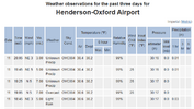
Henderson is 30 degrees with "Unknown Precip"
Roxboro is 32 degrees with "Unknown Precip"
Sanford is 34 degrees with Snow **This one seems a little off...
Otherwise, I think there could be some light icing up in the trees for some of us this morning.
