True though I will say the storm I mentioned did have snow sticking to the roads after about an hour, but obviously it melted as soon as the rates droppedYes, you can have frost on the grass at night with high soil temps. You can have snow on the grass after a few minutes of heavy rates. However, roads and bare ground is a different story. These areas will be the last to cave.
-
Hello, please take a minute to check out our awesome content, contributed by the wonderful members of our community. We hope you'll add your own thoughts and opinions by making a free account!
You are using an out of date browser. It may not display this or other websites correctly.
You should upgrade or use an alternative browser.
You should upgrade or use an alternative browser.
Pattern February 11-13 2025
- Thread starter SD
- Start date
Look I personally watched 2.5” pile up in 2 hours on 4/2/2019 during the day. This was with an early April sun angle and following a couple weeks of temperatures in the 60s and 70s. Yes soil temperatures do mean something but heavy rates do overcome that.
As you stated heavy rates can overcome this so rates are very important. 0.5” QPF in two hours is going to net you a lot more accumulation than 0.5” over 6 hours in these situations. Also, I bet the roads if they got covered melted quickly with that one.
Can’t always go by stations for accurate ground temperatures. Have to check yourself for accuracy with temp probeNo way that would happen. Soil and ground temperatures are around 58 this afternoon in your area. Check the Econet stations. You are in good shape.
It'll be well into Va. tomorrow!
NBAcentel
Member
NBAcentel
Member
Globals and NAMs trended colder. Starting to leak some ZR south of 40
NBAcentel
Member
J1C1111
Member
Pretty wild we are still getting these trends further south this close to game time. I just wonder how much further south they could keep trending. Would love to start out with some sleet on the front end just to say we got something out of this thing.
I can’t afford a flooded basement again. We just finished fixing things from Helene.This won’t happen but man
View attachment 168147
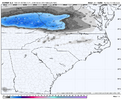
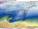
Cherry picking a model right now, but here's the 0z HRW-WRT-NSSL for the last frame(hour 48):
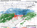
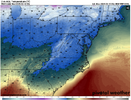
Freezing rain up to hour 48:
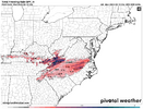
This would go along with what RAH mentioned, whereas this is the low possibility option:
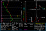
Confidence is increasing that a brief initial `burst` of sleet Tues
morning will quickly transition to an all liquid forecast as the
warm nose rapidly strengthens and surface wetbulb temperatures
delineating the southern/eastern extent of freezing rain. Confidence
remains medium-low on where this will set up, but gradual warming
and lifting northward of the freezing surface wetbulb is expected
through the afternoon into southern VA. Continuing to advertise the
I-85 corridor as its initial starting point with the early morning
update. Some guidance suggest with nocturnal cooling and continued
northerly surface flow that the wetbulb freezing line may ooze back
south towards the I-85 corridor Tues night into Wed morning and
result in additional ice accrual, but confidence is low in this
scenario. Tues night into Wed morning will need to be watched
closely as model guidance is suggesting a slow moving band of
precipitation developing as low-level FGEN sags back into our area
and may result in higher ice accumulation than currently advertised.
Alternatively, central NC counties may remain just above freezing
Tues night into Wed and result in nothing more than a cold rain.


Freezing rain up to hour 48:

This would go along with what RAH mentioned, whereas this is the low possibility option:
Confidence is increasing that a brief initial `burst` of sleet Tues
morning will quickly transition to an all liquid forecast as the
warm nose rapidly strengthens and surface wetbulb temperatures
delineating the southern/eastern extent of freezing rain. Confidence
remains medium-low on where this will set up, but gradual warming
and lifting northward of the freezing surface wetbulb is expected
through the afternoon into southern VA. Continuing to advertise the
I-85 corridor as its initial starting point with the early morning
update. Some guidance suggest with nocturnal cooling and continued
northerly surface flow that the wetbulb freezing line may ooze back
south towards the I-85 corridor Tues night into Wed morning and
result in additional ice accrual, but confidence is low in this
scenario. Tues night into Wed morning will need to be watched
closely as model guidance is suggesting a slow moving band of
precipitation developing as low-level FGEN sags back into our area
and may result in higher ice accumulation than currently advertised.
Alternatively, central NC counties may remain just above freezing
Tues night into Wed and result in nothing more than a cold rain.
LukeBarrette
im north of 90% of people on here so yeah
Meteorology Student
Member
2024 Supporter
2017-2023 Supporter
Same here. I feel like I'm just getting back some semblance of normalcy at the house post-Helene. Can't take 5-7" of rain here though. The storm really wrecked typical drainage patterns.I can’t afford a flooded basement again. We just finished fixing things from Helene.
Looks like a guaranteed COLD rain for Big Frosty!View attachment 168161
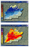
NWS Blacksburg newest update:
More confident on widespread icing, more confident on Blacksburg getting a solid thump and less confident about Roanoke getting that same thump (shocker).
Yep looking like the coldest of rains for most of us. Maybe one or two IPs to start with and then pure miseryLooks like a guaranteed COLD rain for Big Frosty!
WolfpackHomer91
Member
Hey, I mean as long as Lynchburg and Richmond score again thats all that matters we know how starved central VA and up has been ....(Rolls eyes)Yep looking like the coldest of rains for most of us. Maybe one or two IPs to start with and then pure misery
Pilotwx
Member
Looks like a guaranteed COLD rain for Big Fro
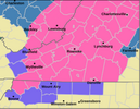
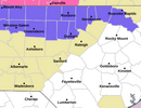
Oh look now we have a winter weather advisoryLooks like a guaranteed COLD rain for Big Frosty!
happy to be in the game again but it would be cool if we could break past the 4 inch barrier. don't feel great about this... feels sleetyHey, I mean as long as Lynchburg and Richmond score again thats all that matters we know how starved central VA and up has been ....(Rolls eyes)
Turner Team
Member
Hopefully here in Roanoke, we will get more sleet than freezing rain after the changeover. That's what usually happens here during these kind of setups.
Nomanslandva
Member
If we do get cold enough for ZR, I am worried about the duration of the wedge. They can be stubborn to break down here in the valley and some models show it holding into early Thursday. I'd like to see that fronto band a little farther south just like everyone else on hereView attachment 168161
NWS Blacksburg newest update:
More confident on widespread icing, more confident on Blacksburg getting a solid thump and less confident about Roanoke getting that same thump (shocker).
LukeBarrette
im north of 90% of people on here so yeah
Meteorology Student
Member
2024 Supporter
2017-2023 Supporter
LukeBarrette
im north of 90% of people on here so yeah
Meteorology Student
Member
2024 Supporter
2017-2023 Supporter
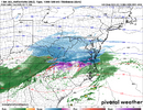
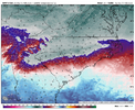
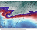
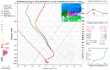
Alright so heres my thoughts on this event, especially with early on in the system with ptypes and where the snow shield sets up. I draw a lot of comparisons to the 1/5 system to this one. The 1/5 system was a much stronger wave overall and CAD was a bit stronger with that one. Still similar processes involved here. Something a lot of people maybe remember is how the NAM tried to depict the snow shield in that last system and how far north developed it leaving southern and SW VA with a little snow but mostly getting missed out on the precipitation. While the times here are not exactly the same you can see how wrong it was.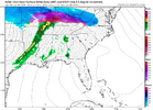
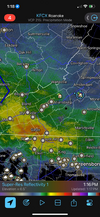
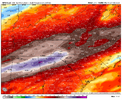
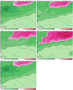
While the NAM is great at sensing warm noses, its overestimation of WAA sends the precip too far north in most setups. I'm not doubting that the DC area is going to get a good snowstorm but the 10+ totals are laughable in my opinion because it sends the precip too far north for too long. Now that I have got this explanation out of the way I can talk about this system. Most modeling is not like the NAM as simple as that, and sets up the snow shield and solid banding starting south of Roanoke area.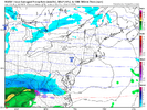
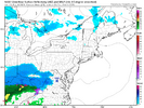
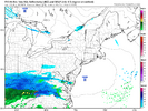
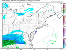
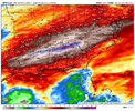
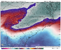
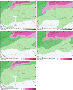
(I will note the HRRR is too far south here which is typical as it normally runs cold) Overall you can see the NAM is out to lunch with this and for the reasons I stated above it will be wrong again on where this inital front end thump sets up. I think the oddest thing about the NAMs depiction is how the 850 mb frontogensis is setup in a way that would make you think the snow shield would be further south but its not. Compared to the RGEM which in my opinion does really well at figuring out banding, (been my go to for years now in this case) its similar to the RGEM so why are they not the same???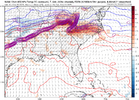
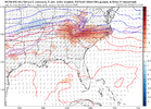
Anyways thats all I got for my analysis of this event, NAM will overestimate WAA and push the best banding north and will be wrong just like it was in the 1/5 system. Look I'm ready to eat my words here because meteorology is an extremely complicated science, but I'm confident my thoughts here will be close to what happens. I'm thinking a solid 3-5 inches in the Blacksburg and Roanoke area before a switch to sleet/frz rain. Edit here: not sure why the images are messed with the typing, my edit screen shows it in the correct way


While the NAM is great at sensing warm noses, its overestimation of WAA sends the precip too far north in most setups. I'm not doubting that the DC area is going to get a good snowstorm but the 10+ totals are laughable in my opinion because it sends the precip too far north for too long. Now that I have got this explanation out of the way I can talk about this system. Most modeling is not like the NAM as simple as that, and sets up the snow shield and solid banding starting south of Roanoke area.


(I will note the HRRR is too far south here which is typical as it normally runs cold) Overall you can see the NAM is out to lunch with this and for the reasons I stated above it will be wrong again on where this inital front end thump sets up. I think the oddest thing about the NAMs depiction is how the 850 mb frontogensis is setup in a way that would make you think the snow shield would be further south but its not. Compared to the RGEM which in my opinion does really well at figuring out banding, (been my go to for years now in this case) its similar to the RGEM so why are they not the same???


Anyways thats all I got for my analysis of this event, NAM will overestimate WAA and push the best banding north and will be wrong just like it was in the 1/5 system. Look I'm ready to eat my words here because meteorology is an extremely complicated science, but I'm confident my thoughts here will be close to what happens. I'm thinking a solid 3-5 inches in the Blacksburg and Roanoke area before a switch to sleet/frz rain. Edit here: not sure why the images are messed with the typing, my edit screen shows it in the correct way
JP152
Member
not to just piggyback on this diligently researched post but this is pretty much what i think, although i think i'm a little more concerned with the warm nose than you areAlright so heres my thoughts on this event, especially with early on in the system with ptypes and where the snow shield sets up. I draw a lot of comparisons to the 1/5 system to this one. The 1/5 system was a much stronger wave overall and CAD was a bit stronger with that one. Still similar processes involved here. Something a lot of people maybe remember is how the NAM tried to depict the snow shield in that last system and how far north developed it leaving southern and SW VA with a little snow but mostly getting missed out on the precipitation. While the times here are not exactly the same you can see how wrong it was.View attachment 168165View attachment 168166
While the NAM is great at sensing warm noses, its overestimation of WAA sends the precip too far north in most setups. I'm not doubting that the DC area is going to get a good snowstorm but the 10+ totals are laughable in my opinion because it sends the precip too far north for too long. Now that I have got this explanation out of the way I can talk about this system. Most modeling is not like the NAM as simple as that, and sets up the snow shield and solid banding starting south of Roanoke area.View attachment 168167View attachment 168168
View attachment 168169
View attachment 168171
(I will note the HRRR is too far south here which is typical as it normally runs cold) Overall you can see the NAM is out to lunch with this and for the reasons I stated above it will be wrong again on where this inital front end thump sets up. I think the oddest thing about the NAMs depiction is how the 850 mb frontogensis is setup in a way that would make you think the snow shield would be further south but its not. Compared to the RGEM which in my opinion does really well at figuring out banding, (been my go to for years now in this case) its similar to the RGEM so why are they not the same???View attachment 168172View attachment 168173
Anyways thats all I got for my analysis of this event, NAM will overestimate WAA and push the best banding north and will be wrong just like it was in the 1/5 system. Look I'm ready to eat my words here because meteorology is an extremely complicated science, but I'm confident my thoughts here will be close to what happens. I'm thinking a solid 3-5 inches in the Blacksburg and Roanoke area before a switch to sleet/frz rain. Edit here: not sure why the images are messed with the typing, my edit screen shows it in the correct way
LukeBarrette
im north of 90% of people on here so yeah
Meteorology Student
Member
2024 Supporter
2017-2023 Supporter
I'm worried about the warm nose forsure but yeah my thoughts above about the NAM and its crapiness is that its not close to other modeling. Hope I don't eat my words!!!not to just piggyback on this diligently researched post but this is pretty much what i think, although i think i'm a little more concerned with the warm nose than you are
More times than not it does come in quicker than modeled, let's see if we can squeeze out a few flakes/pelletsThere is a chance if the over running comes in quicker for central NC, before mid morning Tuesday we could see a little frozen. Small, very small chance.
View attachment 168193
I have snow in my RAH point forecast. White rain would be a win. No accumulation expected, of course.
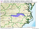
Wow Rah just issued WWA for tomorrow for border counties, including mine. Let's go!! Lol
Wow Rah just issued WWA for tomorrow for border counties, including mine. Let's go!! Lol
Sent from my SM-S156V using Tapatalk
Ryan87NC
Member
Up here in Wytheville looking like a good 2 to 4 inches before a changeover to freezing rain. Freezing rain is my concern with some models spitting out a inch of ice. The official forecast is for .25 to .50 ice. Nasty dangerous travel Tuesday am to Wednesday midday.
NBAcentel
Member
Wow I’m under a WWA now. Of course, being in the southern part of Orange County, I don’t think the advisory is as meant for MBY as folks further north in the county.
JP152
Member

