-
Hello, please take a minute to check out our awesome content, contributed by the wonderful members of our community. We hope you'll add your own thoughts and opinions by making a free account!
You are using an out of date browser. It may not display this or other websites correctly.
You should upgrade or use an alternative browser.
You should upgrade or use an alternative browser.
Wintry Feb 6-8 2022 Winter Potential
- Thread starter SD
- Start date
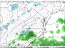
Yep, we’ve got enough time for this one to not give up on it yet, IMO (5 days out from the Monday/Tuesday timeframe). I don’t have my hopes up too much as temperatures look highly problematic, but you never know! It’s worth monitoring, at least.Yeah all models have lost the Sunday system and are keying in on Monday, although too warm GFS is close and ICON is coldest.
View attachment 112526
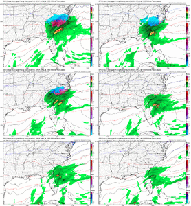
In fact ICON trying to go boom Monday night ?
View attachment 112527
View attachment 112528
06z eps little more juiced with the Monday/Tues system, also too warm but maybe close enough that if the trough can tilt more neutral like the ICON had, system wrap up a little and draw in a little more cold air. #graspingYep, we’ve got enough time for this one to not give up on it yet, IMO (5 days out from the Monday/Tuesday timeframe). I don’t have my hopes up too much as temperatures look highly problematic, but you never know! It’s worth monitoring, at least.

L
Logan Is An Idiot 02
Guest
Yeah, the Monday potential suddenly looks promising except that temperatures are on fire. The soundings outside the mountains on the 12z GFS aren’t even close, SMH. ?So laughable, this was for the Sunday potential
View attachment 112572
And this for the Monday night system........ smh. Need NW trend it goes south, temps warmup and you get a NW trend Lol
View attachment 112573
So are we tracking light rain and drizzle now? If so, I can change the title. Not sure how it's going to snow very much with the entire mid and low level column above freezing.Yeah, the Monday potential suddenly looks promising except that temperature are on fire. The soundings outside the mountains on the 12z GFS aren’t even close, SMH. ?
Wrong threadSo are we tracking light rain and drizzle now? If so, I can change the title. Not sure how it's going to snow very much with the entire mid and low level column above freezing.
Hypsometric
Member
Yes. We're talking about an entire air mass change is required now outside of higher elevations.So are we tracking light rain and drizzle now? If so, I can change the title. Not sure how it's going to snow very much with the entire mid and low level column above freezing.
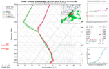
Even if the next upper trough arrived way earlier (only about a 48 hour adjustment needed at D5!!!), that still wouldn't fix the low-level problems.
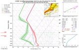
There is no mechanism to deliver another dry, cold air mass anytime early to middle of next week. This one is DOA IMO.
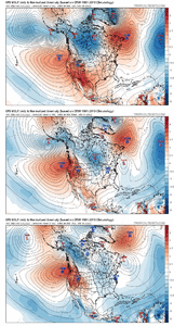
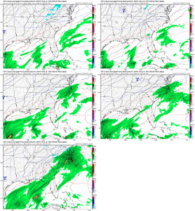
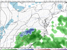
The ICON was pretty close, though, and the GGEM last night was, as well. The 12z GGEM is warmer, though the 0c 850 mb line straddles a line from CLT to Durham, which is just west of the extent of precip. The 12z ICON clown drops a dusting of snow for some in N/NE NC. The GFS and Euro are not even close, though.Yes. We're talking about an entire air mass change is required now outside of higher elevations.
View attachment 112582
Even if the next upper trough arrived way earlier (only about a 48 hour adjustment needed at D5!!!), that still wouldn't fix the low-level problems.
View attachment 112581
There is no mechanism to deliver another dry, cold air mass anytime early to middle of next week. This one is DOA IMO.
View attachment 112585
Is that the ICON for Monday/Tuesday or the Sunday one? I haven't looked at it beyond what was posted here earlier. Been busy with work stuff.The ICON was pretty close, though, and the GGEM last night was, as well. The 12z GGEM is warmer, though the 0c 850 mb line straddles a line from CLT to Durham, which is just west of the extent of precip. The 12z ICON clown drops a dusting of snow for some in N/NE NC. The GFS and Euro are not even close, though.
Monday/Tuesday. I don’t think any model even has precip sniffing the coast now for Sunday. The 12z Euro looked nice on the MSLP and precip panels for Monday/Tuesday, but temps were on fire again. Our goose is probably cooked. ?Is that the ICON for Monday/Tuesday or the Sunday one? I haven't looked at it beyond what was posted here earlier. Been busy with work stuff.
It wont miss 850 temps by 5C at this range. This thing is likely all rain below 3500 feet.Monday/Tuesday. I don’t think any model even has precip sniffing the coast now for Sunday. The 12z Euro looked nice on the MSLP and precip panels for Monday/Tuesday, but temps were on fire again. Our goose is probably cooked. ?
Yeah, I got a bit hopeful because true ICON and GGEM actually weren’t far off with temperatures last night, but that seems to be getting worse as the system pulls NW. Oh well. On to the next one (assuming there is a next one).It wont miss 850 temps by 5C at this range. This thing is likely all rain below 3500 feet.
Shaggy
Member
Most wimters we get.lucky to see any snow. We are literally looking for our 3rd or 4th wintry ptype event depending what parts of NC you're from. Nothing to complain about and I'd rather miss dry Sunday than 33 and rainMonday/Tuesday. I don’t think any model even has precip sniffing the coast now for Sunday. The 12z Euro looked nice on the MSLP and precip panels for Monday/Tuesday, but temps were on fire again. Our goose is probably cooked. ?
RDU is below climo through the end of January (just 2.7” so far), so I will continue to complain.Most wimters we get.lucky to see any snow. We are literally looking for our 3rd or 4th wintry ptype event depending what parts of NC you're from. Nothing to complain about and I'd rather miss dry Sunday than 33 and rain
Seems like everywhere around us is over climo (PGV, CLT, GAY, GSO), but no dice here.
L
Logan Is An Idiot 02
Guest
LukeBarrette
im north of 90% of people on here so yeah
Meteorology Student
Member
2024 Supporter
2017-2023 Supporter
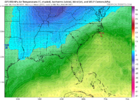
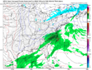
I’m not sure if this is the right thread for this but Western VA and NC folks could make this work if it NW trended some for more moisture. Upper level temps are all solid for snow it’s the Sfc temps that are kind’ve a problem and hover around 33-36 for lower elevation folks. Higher elevation could score either way as Sfc temps won’t be an issue.
rburrel2
Member
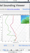
Imo, looks like there’s enough dry air at the surface for freezing rain/sleet Monday morning in the upstate if this “storm” trends more qpf. Here’s the sounding for clemson,sc on the gfs. Precip breaking out over clemson here but not heavy enough to wetbulb, close to a snow sounding…looking forward to the hi-res models when they get in range if this thing can keep trending stronger.
Attachments
rburrel2
Member
Euro had some really dry air in the upstate Monday morning. Clemson surface temp /dew on the euro is 35/22 with precip breaking out but very spotty/light. Think if we get some heavier rate trends you’re gonna see wetbulbing below freezing across the upstate.


