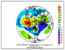
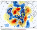
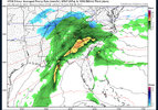
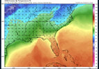
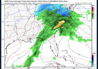
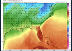
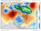
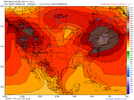
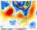
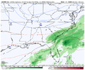
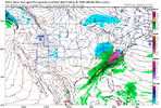
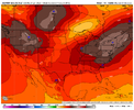
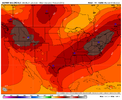
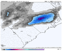
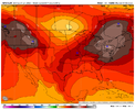
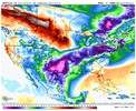
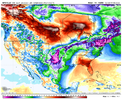
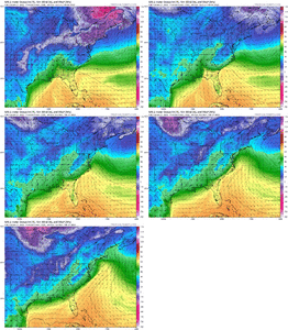
Very reminiscent to how extensive the snowpack was up there going into February 2004… a number of strong CADs set up from late January on and some weren’t even from highs all that strong… the 2/26-27 storm that year had a CAD high that was only 1030mb and not in the best locationNow this glacier to our north should help our future CADS tremendously. This would make a 1030 CAD get pretty cold down here
-
Hello, please take a minute to check out our awesome content, contributed by the wonderful members of our community. We hope you'll add your own thoughts and opinions by making a free account!
You are using an out of date browser. It may not display this or other websites correctly.
You should upgrade or use an alternative browser.
You should upgrade or use an alternative browser.
Wintry Feb 6-8 2022 Winter Potential
- Thread starter SD
- Start date
NBAcentel
Member
NBAcentel
Member
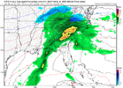
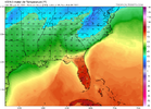
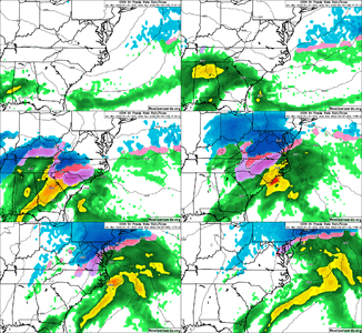
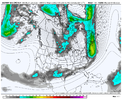
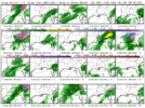
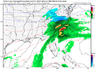
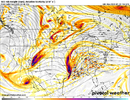
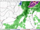
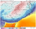
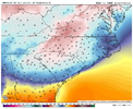
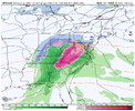
That wedge is so underdone! Wow! I can see.this going back into Eastern AL.ICON 00z says I hope you like ice storms View attachment 111869View attachment 111870View attachment 111871lView attachment 111872
NBAcentel
Member
Southern stream wave that gets left behind in the 4 corners looks much more consolidated this GFS run, like the icon ??
NBAcentel
Member
NBAcentel
Member
GFS develops precip but when the high is already moving out. but it’s slow with the progression of the southern stream and instead gets energy out of Canada which mucks things up. given how progressive the pattern is, we’re having to thread the needle with SS wave placement and high pressure
In my opinion, this threat currently looks icy. Therefore, I would like to lose the needle in the haystack instead.
Lifted ceiling potential, not virga. a lot of players on the field for next weekend.
RAH keeping an eye on the potential:
Saturday and Sunday: The upper trough over the Great Lakes will
progress through the Northeast and mid-Atlantic on Saturday while
the cutoff low over the southern Plains begins to move eastward.
Another northern stream wave will move east along the Canadian
border and into the Great Lakes Sat night/Sun, potentially picking
up the southern stream wave over the TN Valley on Sun as it does. At
the surface, high pressure will build into the area from a 1040 mb
high moving through the Northeast Sat and Sun. A coastal low could
develop off the FL coast and lift northeast Sun night into Mon. The
southern stream wave and coastal low could be the focus for some
additional precipitation over the Carolinas Sun/Sun night, but it is
too early to speculate if, where, when and what type of precip it
will be.
NBAcentel
Member
SnowNiner
Member
I'm a bit surprised there's a thread for this time period so early. Especially with the models being so hit and miss and being a week out. Pattern has been to hold STJ energy back in the SW so far so I'd say that's likely to happen again IMO.
D
Deleted member 609
Guest
Icon has the 540 line , right where the Ukmet and Euro do. Fact Ukmet and euro are further south. Unfortunately they don't have the precip Yet, the Icon is spitting out.
over9000
Member
For sure CAD signature


Blue_Ridge_Escarpment
Member
GFS coming in much colder.
D
Deleted member 609
Guest
Blue_Ridge_Escarpment
Member
That’s a classic textbook CAD wedge
NBAcentel
Member
Blue_Ridge_Escarpment
Member
Worrisome for two reasons.
1) Globals showing such a strong wedge at this lead time.
2) Surface temps actually get colder as the storm goes on versus rushing out.
If it’s classic then you best believe 85 corridor will be the rain line. Unless it’s an unusually strong CAD
You were just saying there was nothing to track. Now you're tracking and already setting up some farce about I-85 being a rain line, when past history has shown, the CAD is usually underdone. The run of the GFS would verify cooler further South, if anything.
Edit: The GFS is likely too progressive in the North and scurrying the High pressure out too quickly anyways.
- Joined
- Jan 23, 2021
- Messages
- 4,602
- Reaction score
- 15,197
- Location
- Lebanon Township, Durham County NC
It'll be interesting to see what the canadian shows, given it's preference by several forecast offices for the forecasting of CAD events.
- Joined
- Jan 23, 2021
- Messages
- 4,602
- Reaction score
- 15,197
- Location
- Lebanon Township, Durham County NC
over9000
Member
Yup, High location is not ideal and Low in the Canada will flood the area with WAA and Rain.You were just saying there was nothing to track. Now you're tracking and already setting up some farce about I-85 being a rain line, when past history has shown, the CAD is usually underdone. The run of the GFS would verify cooler further South, if anything.
Edit: The GFS is likely too progressive in the North and scurrying the High pressure out too quickly anyways.

NBAcentel
Member
Like Shawn said earlier the GFS tends to move high pressure out too fast and CAD always ends up stronger than modeled this far out.. if it’s already showing a bigger type of ice event I would start paying attention if you live anywhere in the CAD regionsYup, High location is not ideal and Low in the Canada will flood the area with WAA and Rain.

over9000
Member
Good PointLike Shawn said earlier the GFS tends to move high pressure out too fast and CAD always ends up stronger than modeled this far out.. if it’s already showing a bigger type of ice event I would start paying attention if you live anywhere in the CAD regions
NBAcentel
Member
GEFS has a deeper trough sliding east into SE Canada with a stronger high pressure following, it’s really the southern stream that has my concern right now
Probably can't overstate the massive snowpack to our NE, how models evolve over the coming days is critical.... we've been burned I know but hard to not start noticing a serious CAD icing event potential on the horizon.
A faster wave would lead to some serious problems, like, big time. Something to watch.
What??? That's why it is a CAD, the mountains block the low level cold air but plenty of moisture will be transported over top. Granted, the high is sliding out to sea, but with as much cold air there is, that really shouldn't be an issue.Yup, High location is not ideal and Low in the Canada will flood the area with WAA and Rain.

NBAcentel
Member

