Why not
-
Hello, please take a minute to check out our awesome content, contributed by the wonderful members of our community. We hope you'll add your own thoughts and opinions by making a free account!
You are using an out of date browser. It may not display this or other websites correctly.
You should upgrade or use an alternative browser.
You should upgrade or use an alternative browser.
Wintry Feb 6-8 2022 Winter Potential
- Thread starter SD
- Start date
LukeBarrette
im north of 90% of people on here so yeah
Meteorology Student
Member
2024 Supporter
2017-2023 Supporter
Time to reel in a Roanoke CAD classic…..?
Two events for the South and Southeast in the next 7 days. Page flipping back and forth...again! CAD for all. Buckle up.
I’m skiing at Sugar Mtn on February 5th, so this could be…interesting. ⛷
NBAcentel
Member
NBAcentel
Member
- Joined
- Jan 23, 2021
- Messages
- 4,602
- Reaction score
- 15,197
- Location
- Lebanon Township, Durham County NC
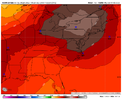
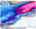
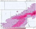
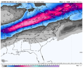
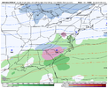
ICON is about 10” of snow here. Nice.
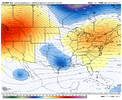
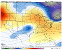
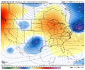
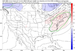
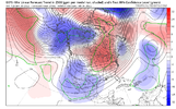
That's trending the wrong way for a good storm. Need that trough to be getting sharper and further south and west.Like to see that ridge behind the trough get stronger, this results in more descent behind the trough and likely a better Sfc high pressure View attachment 111760
NBAcentel
Member
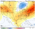
Yep. Result is a stronger sfc high this GEFS run in the NE, very impressive for a smoothed ensemble mean, it just looks like the gefs shears the wave and lacks qpfLike to see that ridge behind the trough get stronger, this results in more descent behind the trough and likely a better Sfc high pressure View attachment 111760
NBAcentel
Member
Actually, while that wouldn’t hurt, it’s not really going the wrong way and the trough overall has been bouncing around in strength/sharpness. the ridging behind and negative vorticity advection behind the cold but progressive trough is trending stronger, which results in more descent, and has trending the sfc high to be much stronger in the last couple of gefs runs. Great if your in the Carolinas. You can see on the 48 hour trend that we’re raising heights around/east of GLs and associated sfc high pressure. No bad trends hereThat's trending the wrong way for a good storm. Need that trough to be getting sharper and further south and west.
NBAcentel
Member
CMC has a N/S trough in Canada that causes LP around the GLs, that’s a issue when N/S is progressive as well
Z
Zander98al
Guest
Bruh I just want some snow, we all know the scenario here though. A big run of snow for everybody and then slow trend to nothing for everybody ?
olhausen
Member
NBAcentel
Member
NBAcentel
Member
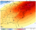
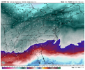
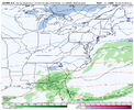
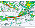
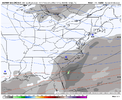
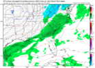
Euro really builds in some strong CAD .. very dry too dews we’re running in the single digits for a lot of people in the CAD regionsStill not a bad look View attachment 111793View attachment 111794
NBAcentel
Member
NBAcentel
Member
whatalife
Moderator
Flotown
Member
NBAcentel
Member
LukeBarrette
im north of 90% of people on here so yeah
Meteorology Student
Member
2024 Supporter
2017-2023 Supporter
packfan98
Moderator
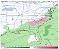
Pretty good signal for a CAD storm at hr 168 on the 18z GEFS.
NBAcentel
Member
D
Deleted member 609
Guest
Weird look with the rain north lol
Stephenb888
Member
Is it just me or does this look like a repeat from 2 weeks ago?
packfan98
Moderator
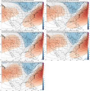
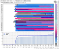
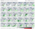
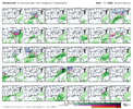
You can see from the individual members that #26 causes the rain printout above the CAD. It's the only one with rain to the north, but looks to be a strong system that skewed the mean.Weird look with the rain north lol
It definitely has that Miller B look to it. Right now with the snowpack over the northeast, any CAD has a strong chance of over performing.Is it just me or does this look like a repeat from 2 weeks ago?
NBAcentel
Member
Rain north due to lighter amounts...heavy precip would bring down more cold air. Who knows what is really going to happen.
NBAcentel
Member
That’s a pretty stout signal on the gefs for a Miller B/CAD setup. SE Canada trough, higher heights atop the GLs which allows subsidence for a damming high, nice shortwave over NE texas, trough over the northern plains/NW to keep a flatter flow, and a western ridge. Gonna be lots of changes however because when you have a trough over the Baja like that, models tend to struggle with interactions with the packet of energy/BN heights around that area, we could honestly lose the southern stream wave, keep it, or it get held back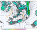

Seems like Ive been seeing a baja low all month. Every time I view a H5 map its there.
NBAcentel
Member
- Joined
- Jan 23, 2021
- Messages
- 4,602
- Reaction score
- 15,197
- Location
- Lebanon Township, Durham County NC
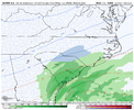
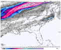
Fro, that swirl in Texas just got my attention. I was coming here to post similarly. That was gonna be a storm in 24-48 hours.18z euro/EPS looked much more interesting, Southern stream wave stronger View attachment 111849View attachment 111850
NBAcentel
Member
Yep, starting to get some momentum on the way this has been trending today on ensemblesFro, that swirl in Texas just got my attention. I was coming here to post similarly. That was gonna be a storm in 24-48 hours.
Jessy89
Member
Seems like feb 5th through 7th is the timeframe for this potential winter storm
Sent from my iPhone using Tapatalk
Sent from my iPhone using Tapatalk
Do you have the H5 set up for 2/2014… this set up doesn’t appear that much differentYep, starting to get some momentum on the way this has been trending today on ensembles
Now this glacier to our north should help our future CADS tremendously. This would make a 1030 CAD get pretty cold down here
- Joined
- Jan 23, 2021
- Messages
- 4,602
- Reaction score
- 15,197
- Location
- Lebanon Township, Durham County NC
NBAcentel
Member
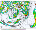
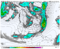
That bowling ball tho… if we can shorten wavelengths, decrease the ridging over us but increase the ridging over the Great lakes then we’re cooking. Only issue against that, is the pattern being progressive, id definitely favor mixed/a in-situ or perhaps hybrid setup right now with how fast the flow will be before the pattern amplifies again, but the 12z icon shows how we can get it done. It’s not even far out when the overall pattern sets up eitherView attachment 111859
View attachment 111860
So look at these two images. Reminder that the ICON was a major winter storm 18 hours after that image.

