-
Hello, please take a minute to check out our awesome content, contributed by the wonderful members of our community. We hope you'll add your own thoughts and opinions by making a free account!
You are using an out of date browser. It may not display this or other websites correctly.
You should upgrade or use an alternative browser.
You should upgrade or use an alternative browser.
JP152
Member
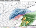
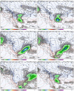
Classic climo storm.Euro HAMMERS western North Carolina oh myView attachment 168969
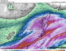
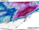
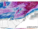
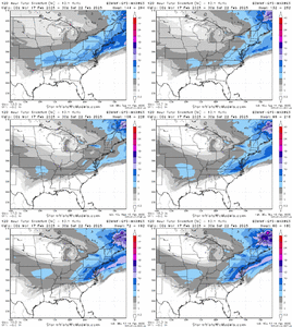
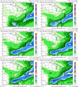
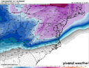
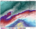
That would be far and away the worst ice storm I ever seen living here if that verified. Unpopular opinion but at that point just give me 34 and rain I'd take that over a crippler ice stormEuro is locked in on a significant ice storm. No major changes for last couple of runs. Colder then the 00z run at the sfc to View attachment 168960View attachment 168961View attachment 168962
Sent from my SM-S156V using Tapatalk
This...and yet I'm not convinced we are going to see an ice storm in the triangle just yet. Maybe a repeat of earlier this weekThat would be far and away the worst ice storm I ever seen living here if that verified. Unpopular opinion but at that point just give me 34 and rain I'd take that over a crippler ice storm
Sent from my SM-S156V using Tapatalk
WolfpackHomer91
Member
This would only be probably 1/10" - 1/4" ICE forecast. To get anything over 1/2" you need to be seeing 2" or more ICE on models. Cut the ICE accums by 75% most times. This is in no way a MAJOR ICE event as modeledThat would be far and away the worst ice storm I ever seen living here if that verified. Unpopular opinion but at that point just give me 34 and rain I'd take that over a crippler ice storm
Sent from my SM-S156V using Tapatalk
NBAcentel
Member
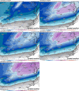
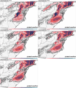
Yeah. EPS locking in on climo area snow, with 85 corridor ice storm, latest run looks to double down on that. Your not lying it’s getting consistentEPS has been locked in for a couple of days now..I don't really see a north trend past 36-48 hours but rather a tightening of the members. Ice storm probs going up.
Past 3 days of runs
View attachment 168974
packfan98
Moderator
Here's the Weatherbell EPS with the ice filtered out supposedly.EPS has been locked in for a couple of days now..I don't really see a north trend past 36-48 hours but rather a tightening of the members. Ice storm probs going up.
Past 3 days of runs
View attachment 168974

- Joined
- Jan 23, 2021
- Messages
- 4,602
- Reaction score
- 15,197
- Location
- Lebanon Township, Durham County NC
Compared to 0z at Hour 144(160 at 0z), it would appear EPS is further east with the biggest cluster of low locations
NBAcentel
Member
CNCsnwfan1210
Member
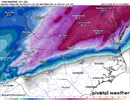
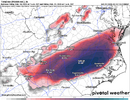
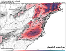
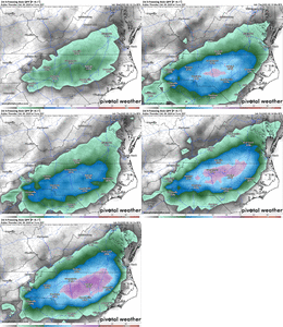
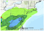
Euro zoomed in for the close up. FRAM ice as well. Pretty wild for Raleigh View attachment 168978View attachment 168979
These fram totals are probably closer to being correct. If so, that would be a pretty bad ice storm for a good chunk of central NC
Sent from my iPhone using Tapatalk
A 10 inch mean into north central NC? Us Charlotte to RDU guys will be yet again trying to use telepathy to pull that south about 50 milesEPS has been locked in for a couple of days now..I don't really see a north trend past 36-48 hours but rather a tightening of the members. Ice storm probs going up.
Past 3 days of runs
View attachment 168974
90% of that is some form of an ice stormA 10 inch mean into north central NC? Us Charlotte to RDU guys will be yet again trying to use telepathy to pull that south about 50 miles
CNCsnwfan1210
Member
EPS has been looking like this for a few days now with ice accumulation, certainly looks consistent and concerning at the same time if this holds
Sent from my iPhone using Tapatalk
NBAcentel
Member
Yes, but 50 miles further south would be a significant snow and ice storm, not just ice.
90% of that is some form of an ice storm
WolfpackHomer91
Member
Whats wild is if you look at the Snow placement on the maps you only need 50-70 Miles SE and ALL of our big citys "85 and N/W" would be satisfied imo with a 3-6" Range
- Joined
- Jan 23, 2021
- Messages
- 4,602
- Reaction score
- 15,197
- Location
- Lebanon Township, Durham County NC
One thing to remember is the south trend we've seen on the regular this year
The Euro pretty much stayed the same albeit it was a little colder for many sections. I know ice totals on the model maps are overdone but even 1/4 of the totals it is showing would cause major headaches for folks in the RDU area. Here's hoping future model runs move those snowfall totals more south later today. I'm not going to hold my breath while I'm waiting for that to happen though.
CNCsnwfan1210
Member
One thing to remember is the south trend we've seen on the regular this year
I certainly hope we see a southward trend, it’s been awhile since we’ve seen a significant ice storm in the central portion of NC
Sent from my iPhone using Tapatalk
Maybe I'm wrong but my gut says if this track verifies, classic Miller A, we have less icing issues than what models are currently showing. Would be more rn/sn transition with small corridor of mix bag. Time will tellWe haven't had a deep noreaster llke this in a while...it's a beauty of a track
View attachment 168984
WolfpackHomer91
Member
we need it now or a good portion of metropolitan NC is going to be in the darkOne thing to remember is the south trend we've seen on the regular this year
JP152
Member
That south trend has been happening as we get within three days of these events this winter. It wouldn't take too much of a south trend to give most of us a better shot of seeing more snow and less ice. The question for me at least is have the models finished the northwest trend that has been seen for most of the day? I hope they have.One thing to remember is the south trend we've seen on the regular this year
Some of y’all NC folks need to be out checking your generators yesterday. This is going to be a high impact winter weather event for a lot of people. If a euro like solution holds serve and we begin to get that uptick in precip field it’s going to be a memorable late season storm. Epic, even
That’s something that I keep thinking just from a climo standpoint. I could definitely still see a wide area getting a major sleet storm with this, but typically you only see a very narrow corridor of ZR with a Miller A. Also it looks to me like a lot of the area that’s showing these huge ice amounts have 925mb temperatures below freezing which would mean more sleetMaybe I'm wrong but my gut says if this track verifies, classic Miller A, we have less icing issues than what models are currently showing. Would be more rn/sn transition with small corridor of mix bag. Time will tell
Classic looking NC mtns slugging.
Exactly what I was thinking. I am not in the least worried about a freezing rain event.Maybe I'm wrong but my gut says if this track verifies, classic Miller A, we have less icing issues than what models are currently showing. Would be more rn/sn transition with small corridor of mix bag. Time will tell
Cad Wedge NC
Member
No, you are correct ... Miller A's typically have a smaller transition zone than Miller B's. It's still too early to know exactly where that rn/sn line sets up, but from everything I have seen today, it's pointing to the I-85 corridor. That would also be in line with climo. Can we get a little south push and get more folks in the game? .... Only time will tell. That NW trend on today's 12z runs was certainly concerning.Maybe I'm wrong but my gut says if this track verifies, classic Miller A, we have less icing issues than what models are currently showing. Would be more rn/sn transition with small corridor of mix bag. Time will tell
Cad Wedge NC
Member
I am sitting at 23 degrees (-5C) on that map. Should be cold enough for all sleet. Of course it depends how deep the sub-freezing layer is. I don't have Euro soundings, but if the only melting layer is between 800mb-700mb, then it will definitely be sleet.
RDUHeatIsland
Member
12z Euro AI is even more south/suppressed. Now that's interesting

