rburrel2
Member
Love seeing that after what other 12z modeling showed.12z Euro AI is even more south/suppressed. Now that's interesting
Love seeing that after what other 12z modeling showed.12z Euro AI is even more south/suppressed. Now that's interesting
Exactly what I was thinking. I am not in the least worried about a freezing rain event.
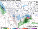
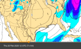
12z Euro AI
View attachment 168994
I would think that would translate to a colder look, but also a lighter event except for maybe eastern NC (late bloomer idea again?)
Sent from my iPhone using Tapatalk
Man, that's not even close for the big cities up North. Those guys have to be nervous right now.12z Euro AI
View attachment 168994
It has officially entered the NAVGEM camp lol12z Euro AI
View attachment 168994
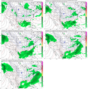
12z Euro AI
View attachment 168994
A miller A can certainly have ZR. It’s just that typically it’s in a much more narrow corridor than what these ice accumulation maps are showing. In the January 2017 storm I was in that corridor that was only about 30 miles wide but had a .3 of ice accrual from about 10 hours of ZRMe either. If snow is rare IMBY, a true ZR storm is even rarer, the combination of needing ample qpf with a constant feed of cold dry air from the NE to cool the latent heat release of the ice forming never works out for MBY. We don't have that here. It'll be sleet or rain IMO. I don't know about the Miller A thing. We have so few I can't differentiate what they do. All we get is Miller Bs or Miller A/B hybrids which always have ice.
EPS pretty much shuts the door on a whiff…not a single member at day 5-6 is a whiffTo me the AI seems to believe our 50/50 will be moving the the East quickly allowing the storm to basically be a fish snow storm as it escapes to the East, missing pretty much everybody from the Carolinas to New England. This has always been the major concern to me
It has officially entered the NAVGEM camp lol
Feels like the FV3 model all over again. Such hope. Such promise View attachment 168995
About as good as NC State is at BasketballHow good has the EURO AI been this winter?
What's happening here is the AI is still learning, my guess is it will start to shift back NW like it has previously. Having the JMA in it's camp isn't exactly noteworthy lolWell, the NAVGEM matches the 12z AI with the whiff! lol. I give up. No idea what's happening here.
i saw some NE/Mid-Atlantic folks salivating over the trends from overnight runs in their favor, and it was from people who just scored big at least twice in the past 6 weeks lol. let them be nervous!Man, that's not even close for the big cities up North. Those guys have to be nervous right now.
In the day 5-6 timeframe... it's been better than any other deterministic model and it's not close.How good has the EURO AI been this winter?
They live in a perpetual state of nervousness.i saw some NE/Mid-Atlantic folks salivating over the trends from overnight runs in their favor, and it was from people who just scored big at least twice in the past 6 weeks lol. let them be nervous!
I think it was the first storm the AI was the furthest south up until the day before. Then it came north back to the other models. All in all, for mby for this winter the AI has been very poor.How good has the EURO AI been this winter?
True, but it wasn't far off at 120hrs out. It had honed in by then. Those 7 straight runs were a much further lead time... and it gradually ticked further north to what actually verified in the 120-168hr timeframe.. right now it's been ticking south every run and we are at hr 120 to the event.The euro ai was giving mby 12-24 for like 7 straight runs last storm that ended up hitting northern Virginia suppressed and east is fine at this stage. End result from last storm was 33 and rain after euro ai honked for days.
Sent from my iPhone using Tapatalk
I'm with you, Its been as correct, if not more so than the physics models. Gets the big picture ( footprints/ h5 players pegged out and placed) pretty accurately. As always the back yard mitigating factors have to be worked out the ole fashioned way. Just like they still do with the physics models . BL, obs upstream, initialization errors etc.True, but it wasn't far off at 120hrs out. It had honed in by then. Those 7 straight runs were a much further lead time... and it gradually ticked further north to what actually verified in the 120-168hr timeframe.. right now it's been ticking south every run and we are at hr 120 to the event.
I look forward to the 18z model suite. It was good to us yesterday.In the day 5-6 timeframe... it's been better than any other deterministic model and it's not close.
The main thing the Euro AI is telling me today is to expect all the other globals to start coming in further south and colder. The odds it starts getting more amped on the ICON/GFS/CMC/Euro are very very low, imo.
My opinion is that in the medium range, the Euro AI was excellent for the Jan 10 storm (especially at how it handled 500mb). An averaged model blend was the best option for the Deep South / New Orleans storm on Jan 20-21How good has the EURO AI been this winter?
WPC buying the ZR threat to North Carolina and snow in Virginia in their new update View attachment 169004
Or maybe non-heavy snow?Lol, that looks like the suppressed late Miller A - AI footprint. Clt gets just plain non-heavy rain
Do they even have makers for Heavy Sleet??Or maybe non-heavy snow?
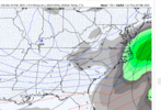
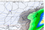
06z GFS graphcast just came out...
This is the 1pm Wednesday timestamp
View attachment 169009
View attachment 169010View attachment 169011
We laugh at it, but it did trend in the good direction (looks like 24 hrs of sleet for RDU):not the 12z! showing lots of wintry precip for most of NC, except near the coast
View attachment 169008
