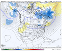
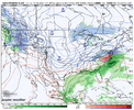
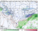
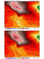
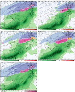
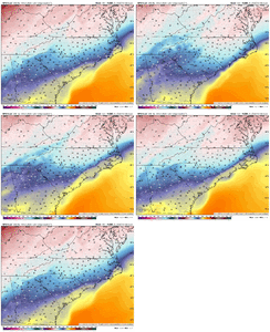
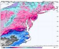
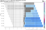
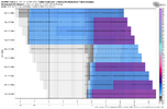
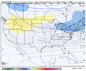
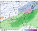
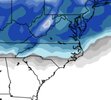
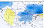
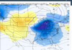
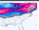
Good point…kind of scary it was still icy in that run.It’s definitely better then that pathetic 12z run with the confluence/cold feed on top of us, thank goodness that 12z run didn’t continue its look View attachment 169033
-
Hello, please take a minute to check out our awesome content, contributed by the wonderful members of our community. We hope you'll add your own thoughts and opinions by making a free account!
You are using an out of date browser. It may not display this or other websites correctly.
You should upgrade or use an alternative browser.
You should upgrade or use an alternative browser.
rburrel2
Member
If anyone wants to know what to watch for. The Euro AI doesn't begin to cut off this trough until after the current hr 120 mark. That is way later than all the traditional global modeling. Noticed it hasn't backed down at all from that idea over the last 4 runs. That trough has to cut off much earlier for this storm to climb the coast and deliver for the big cities.
This trough staying open keeps the height field suppressed and everything colder in the mid levels. Also leads to a weaker storm of course for us, but more snow and less ice. Also it cutting off late like this seems to be wanting to do some lee-side eddy enhancement stuff which is probably what's giving Mitch his snow.
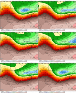
This trough staying open keeps the height field suppressed and everything colder in the mid levels. Also leads to a weaker storm of course for us, but more snow and less ice. Also it cutting off late like this seems to be wanting to do some lee-side eddy enhancement stuff which is probably what's giving Mitch his snow.

NCHighCountryWX
Member
- Joined
- Dec 28, 2016
- Messages
- 699
- Reaction score
- 1,918
Official guidance from the pros at GSP:
LONG TERM /MONDAY NIGHT THROUGH FRIDAY/
AS OF 239 PM FRIDAY: THE PATTERN REMAINS RATHER BENIGN HEADING INTO
TUESDAY WITH BROAD ZONAL FLOW PERSISTING ACROSS MUCH OF THE
SOUTHEAST CONUS, BUT A RETURN TO MORE ACTIVE WEATHER WILL BE LOOMING
ON THE HORIZON. A FAST MOVING SOUTHERN STREAM SHORTWAVE TROUGH WILL
BE DIVING ACROSS THE GREAT BASIN ON TUESDAY BEFORE EJECTING ACROSS
NORTHERN MEXICO AND ALONG THE GULF COAST BY WEDNESDAY MORNING. AT
THE SAME TIME, A ROBUST NORTHERN STREAM TROUGH AND ASSOCIATED CLOSED
UPPER LOW WILL DROP ACROSS THE NORTHERN PLAINS AND INTO THE MIDWEST.
THE TIMING AND INTERACTION BETWEEN THESE TWO FEATURES, ESPECIALLY
WITH REGARDS TO WHETHER THEY ARE ABLE TO PHASE, WILL HAVE MAJOR
IMPLICATIONS ON THE FORECAST WEDNESDAY INTO THURSDAY. COLD AND DRY
AIR WILL BE IN PLACE IN ADVANCE OF ANY PRECIPITATION AND WINTRY
WEATHER IS DEFINITELY IN THE CARDS. ULTIMATELY - WHERE, WHAT TYPE,
AND HOW MUCH WINTER WEATHER WILL HINGE ON THE QUALITY AND PLACEMENT
OF COLD AIR ALONG WITH TIMING/PHASING OF THE WAVES AND SUFFICIENT
QPF. THE GFS SOLUTION CONTINUES TO REMAIN THE MOST PROGRESSIVE AND
DOESN'T PHASE THE WAVES WITH A QUICK SHOT OF PRECIPITATION DURING
THE DAY ON WEDNESDAY AND ANY WINTRY WEATHER CONFINED TO THE
MOUNTAINS AND FAR NORTHERN NORTH CAROLINA FOOTHILLS. THE ECMWF AND
CMC SOLUTIONS, ON THE OTHER HAND, ARE SLIGHTLY SLOWER AND PHASE BOTH
WAVES. THIS RESULTS IN SIGNIFICANTLY MORE QPF OVER A LONGER DURATION
CONTINUING INTO THURSDAY MORNING ALONG WITH THE AVAILABILITY OF
COLDER AIR. IN THIS SCENARIO, WINTRY WEATHER WOULD BE POSSIBLE AS
FAR SOUTH AS THE I-85 CORRIDOR. GIVEN THE COMPLEXITY OF THE
FORECAST, WILL REFRAIN FROM TOO MUCH SPECULATION EITHER WAY AT THIS
POINT, BUT FORECAST TRENDS WILL NEED TO BE CLOSELY WATCHED HEADING
INTO NEXT WEEK.
Shawn don't like powdery snow lolView attachment 169034
ALRIGHT ALRIGHT
I don't blame him. When we got it a few weeks ago, it took an annoying amount of time to add up. Lol I prefer the wet snow with flakes the size of half dollars.Shawn don't like powdery snow lol
yeah im in cayce and it was painfulI don't blame him. When we got it a few weeks ago, it took an annoying amount of time to add up. Lol I prefer the wet snow with flakes the size of half dollars.
iGRXY
Member
NBAcentel
Member
GFS run is meh, the wave that’s cutting off in the northern tier isn’t as strong but there’s a slightly less confluent press to our NE. Will probably offset each other this run
NBAcentel
Member
GFS needs to be completely overhauled. Horrible model.
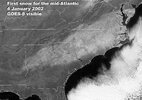
This storm reminds me of a warmer version of Jan 2002. Both have the MT / Dakotas surface high that is stuck to the west of the TPV that is elongating from the Midwest into the NE. 2002 has a sharper western ridge which later digs the TPV farther south for a strong and cold phase to the south. The 534 thickness line is in N VA on the left...it is in C NC on the right. It's a unique kind of setup. Jan 2022 was a big hit in Raleigh of course. This one could be a big hit in DC.
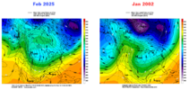


The problem in the southeast with high-ratio snow is when we get it, we count our precipitation totals in hundredths lol.I don't blame him. When we got it a few weeks ago, it took an annoying amount of time to add up. Lol I prefer the wet snow with flakes the size of half dollars.
Funny enough, I was thinking about this one earlier but I hadn't looked at any charts. I was also thinking about how if the darn western ridge would just be sharper what could be.This storm reminds me of a warmer version of Jan 2002. Both have the MT / Dakotas surface high that is stuck to the west of the TPV that is elongating from the Midwest into the NE. 2002 has a sharper western ridge which later digs the TPV farther south for a strong and cold phase to the south. The 534 thickness line is in N VA on the left...it is in C NC on the right. It's a unique kind of setup. Jan 2022 was a big hit in Raleigh of course. This one could be a big hit in DC.
View attachment 169041
View attachment 169046
NBAcentel
Member
rburrel2
Member
Richmond has been ground zero for this threat since it started showing up. Those guys can't miss.For today the GFS has "trended" away from a big NE hit. I know grain of salt...tomorrow it could go back the other way.
View attachment 169051
18z GFS freezing rain:
View attachment 169050
One thing for sure, most models are wanting to put ice over RDU.

re: those zr numbers around the triangle
NOVA has been the fairly unexpected jackpot area this winter for the East Coast, thats for sureIf I could be anywhere it would be VA up to DC. DC has more snow than PHL-NYC-BOS....its just their year.
View attachment 169054
GFS is wrong
Wish I could give more context but that’s all I know atm
Wish I could give more context but that’s all I know atm
NBAcentel
Member
WolfpackHomer91
Member
Look good…. NC wise if we make it through the night I’d say we’re locked into Wintry…. May already be there with even warm GFS looking like it’s a couple runs away…. Outside of 421 And North or Mountain counties the key word to see here is “WINTRY” … Snow/ICE/Sleet
Sent from my iPhone using Tapatalk
More interesting thing to me will be global vs ai models. Before the days of these new models the euro/eps/ukmet combo was solid from this range. Would be feeling confident here in northern foothills if it weren’t for the suppressed AI/graphcast models
Sent from my iPhone using Tapatalk
Sent from my iPhone using Tapatalk
GFS needs to be completely overhauled. Horrible model.
It and the ICON got to go in for a tuneup...they need to grease something, tighten a bolt or something.
packfan98
Moderator
Much more suppressive and colder look on the GEFS.
all im saying is look at that snowhole broIf I could be anywhere it would be VA up to DC. DC has more snow than PHL-NYC-BOS....its just their year.
View attachment 169054
i've had solid hits but i've been on the jackpot "flank" a lot if that makes sense
WolfpackHomer91
Member
If I could be anywhere it would be VA up to DC. DC has more snow than PHL-NYC-BOS....its just their year.
View attachment 169054
Lynchburg isn’t over 10” yet?? I swear they always seem to score
Sent from my iPhone using Tapatalk
rburrel2
Member
rburrel2
Member
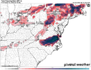
Somehow the precip/ptypes stay about the the same on the 18z Euro, but at 5h it was a huge jump towards the Euro AI.
iGRXY
Member
I find it hard to believe that RDU and eastern NC gets that much ZR and traditional CAD areas in SC are on the fringe like the EURO shows.
rburrel2
Member
Yeah I think that is right. TPV dropped a good bit farther south. Our problem east of the mountains is that our starting place is so “warm”. Need more cold air in place out front.Crazy that p-types are the same if not a little worse at this same timestamp. I guess it's because the closed low is bombing so much harder it's pulling in more warm to offset the lower heights. I bet the 18z EPS will trend better.
View attachment 169063
LukeBarrette
im north of 90% of people on here so yeah
Meteorology Student
Member
2024 Supporter
2017-2023 Supporter
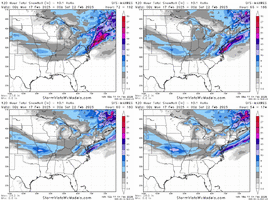
Any chance you can post a full snowfall map?Crazy that p-types are the same if not a little worse at this same timestamp. I guess it's because the closed low is bombing so much harder it's pulling in more warm to offset the lower heights. I bet the 18z EPS will trend better.
View attachment 169063
rburrel2
Member

