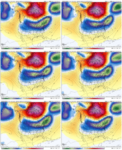
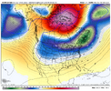
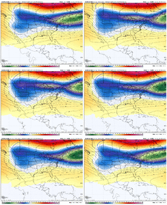
-
Hello, please take a minute to check out our awesome content, contributed by the wonderful members of our community. We hope you'll add your own thoughts and opinions by making a free account!
You are using an out of date browser. It may not display this or other websites correctly.
You should upgrade or use an alternative browser.
You should upgrade or use an alternative browser.
Its right there. Just a tweakTwo more ticks and it goes boom???
It's not far away at this point, we aren't far away from a 12-18 type storm with that AI evolution just not sure if this pattern has the goods to get us thereTwo more ticks and it goes boom???
bouncycorn will have your order ready here in a few
need the bouncycorn blender to whip us up a nice daiquiribouncycorn will have your order ready here in a few
Pops
Member
Nam be in range tomorrow. That will be a hoot!!
mx3gsr92
Member
Southern trend starts tonight. You heard it here first!
I hope so. It would not take much for Gadsden area to get in the game.Southern trend starts tonight. You heard it here first!
Pops
Member
We will seeSouthern trend starts tonight. You heard it here first!
WolfpackHomer91
Member
Nam be in range tomorrow. That will be a hoot!!
FWIW …. Means nothing …. 18Z NAM back in Feb 2014 was first Model to Paste us in NC…. It came in with 6-18” Murphy to Manteo …. That was the start they started the thread that night and rest was history. ICE was also a major threat then too until hour 36 then backed off to SN/IP
Sent from my iPhone using Tapatalk
NBAcentel
Member
Not sure if this matters or not and could be cope but
I would say my latest thoughts are that the EC AI is interesting and the fact it and the EPS continue to tick south at H5 is something to monitor. With the way this winter has gone, I'm not putting much stock in anything else right now (even though both of those suites have had big stumbles, overall, I feel they have been the most reliable if you ignore some bad runs here and there). Trying to say definitive statements at this range is probably unwise, but if we don't see a big move at H5 by tomorrow evening/Sunday morning we'll know relatively where we stand with the big picture features most likely.What are you latest thoughts?
SnowNiner
Member
Southern trend starts tonight. You heard it here first!
Don’t need south, the surface track is perfect for a wide spread winter storm on like all the models.
Not sure what we need other than a phase on the AI models, cause right now they don’t and they are whiffs.
The other models just aren’t cold enough. Thought it was a more consolidated quicker TPV near the lakes, but the GEFS did that and it still wasn’t cold enough.
NBAcentel
Member
mx3gsr92
Member
Don’t need south, the surface track is perfect for a wide spread winter storm on like all the models.
Not sure what we need other than a phase on the AI models, cause right now they don’t and they are whiffs.
The other models just aren’t cold enough. Thought it was a more consolidated quicker TPV near the lakes, but the GEFS did that and it still wasn’t cold enough.
You know what I meant brotato
rburrel2
Member
Not sure if this matters or not and could be cope but
It's copium. He picked a storm that all the models were off on. Go check out the Euro/GFS etc and they were even more wrong. Especially the GFS.
Comparatively, the Euro AI did the best with that storm in the day 5-7 timeframe.
(I'm not claiming victory here and saying the Euro AI will be right again this time)
Also: We're all expecting it sharpen up at least a little compared to what the Euro AI is showing now... but it's got long ways to go to crush the major cities. And I personally don't think it's gonna completely cave to the other models in that regard.
Last edited:
CNCsnwfan1210
Member
There’s that TPV making a definitive move east of Chicago, that’s a good trend if you ask me
Sent from my iPhone using Tapatalk
wow
Member
Same with Feb 2004. Things trended very well in the last 72 hrs on that one.FWIW …. Means nothing …. 18Z NAM back in Feb 2014 was first Model to Paste us in NC…. It came in with 6-18” Murphy to Manteo …. That was the start they started the thread that night and rest was history. ICE was also a major threat then too until hour 36 then backed off to SN/IP
Sent from my iPhone using Tapatalk
Its 32 and clear outside. Dont be shocked to see a flake or pellet by sunrise tommorow.
Remember that one well. I believe Feb 26-27th or close to itSame with Feb 2004. Things trended very well in the last 72 hrs on that one.
I have a hard time buying a flat, wide right, low precip solution. I'm categorically throwing anything that shows that in the recycle bin.
Pops
Member
This is literally..to me..one of the most interesting storms ..really close to something great for LOTSof us
wow
Member
It's copium. He picked a storm that all the models were off on. Go check out the Euro/GFS etc and they were even more wrong. Especially the GFS.
Comparatively, the Euro AI did the best with that storm in the day 5-7 timeframe.
(I'm not claiming victory here and saying the Euro AI will be right again this time)
Remember that one well. I believe Feb 26-27th or close to it
Yep. Man I wish I saved old model runs from that one. That was a fun one on WWBBRemember that one well. I believe Feb 26-27th or close to it
ForsythSnow
Moderator
Everything about the energy with this system screams a nothingburger. A lot of it doesn't really line up and I kinda "feel" this isn't going to be much UNLESS it starts trending a much further south dig. I could be wrong
NBAcentel
Member
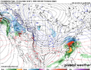
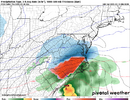
I could be seriously wrong but I like the icon already more so then 18z
Yup, I think just about everyone feels this. We are all holding our breath hoping it does something special.Everything about the energy with this system screams a nothingburger. A lot of it doesn't really line up and I kinda "feel" this isn't going to be much UNLESS it starts trending a much further south dig. I could be wrong
iGRXY
Member
Agree. To me over amplification is the biggest threat right now. Not a flat and suppressed solution.I have a hard time buying a flat, wide right, low precip solution. I'm categorically throwing anything that shows that in the recycle bin.
iGRXY
Member
CNCsnwfan1210
Member
Came here to post the same.
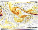
View attachment 169089
50/50 block looks much better and closer to Maine
Sent from my iPhone using Tapatalk
It actually is further west than even the 18z EC AI at 75 hrs.50/50 block looks much better and closer to Maine
Sent from my iPhone using Tapatalk
NBAcentel
Member
Wonder if the icon is going to have a 2 part system here
NBAcentel
Member
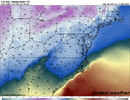
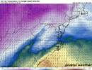
It’s late to the party. First round of moisture brings the cold with it. Sedondary overruns. Not a big gap in time between. That’s the issue. Its timing. Which it usually is anyway. This is not classic overrunningI love how for some reason the cold is just stopping at the NC/SC line but whatever. CAD don’t work like it used to I guess.

