-
Hello, please take a minute to check out our awesome content, contributed by the wonderful members of our community. We hope you'll add your own thoughts and opinions by making a free account!
You are using an out of date browser. It may not display this or other websites correctly.
You should upgrade or use an alternative browser.
You should upgrade or use an alternative browser.
A Major winter storm is coming. Devil in the details. That we know for sure right now i think its safe to say.
Packfan gonna love Jimmys ground zero post when he wakes in the a.m.
Packfan gonna love Jimmys ground zero post when he wakes in the a.m.
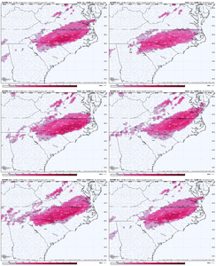
The LP track on the Canadian is much further West than all other operational and AI models, which in turn are further West than their respective ensembles. Don't think that inland track is going to be the final outcome here.
CNCsnwfan1210
Member
Canadian showed what an early phase can do, I’m really not buying into that solution
Sent from my iPhone using Tapatalk
Sent from my iPhone using Tapatalk
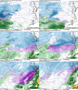
You got snow and sleet maps from Canadian?
NBAcentel
Member
Me either. Unless later guidance looks like it, I’m legitimately tossing that run. Leaf model should be renamed the phase modelCanadian showed what an early phase can do, I’m really not buying into that solution
Sent from my iPhone using Tapatalk
Let's see what the UKMet has to say, that's the one you like pretty good...A Major winter storm is coming. Devil in the details. That we know for sure right now i think its safe to say.
Packfan gonna love Jimmys ground zero post when he wakes in the a.m.
WolfpackHomer91
Member
Barring a disaster overnight ... I agree, its time to accept a Winter Storm is Likely in NC. Mixed Bag but 75% Certainty its gonna occur....The nothing and dry and OR Nothing and ALL Rain can be put to rest. By this time tomm we will be in NAM range, its coming we survived and can stop saying "The long range model x,y,z" were 4.5 days out. Time to just iron out details nowA Major winter storm is coming. Devil in the details. That we know for sure right now i think its safe to say.
Packfan gonna love Jimmys ground zero post when he wakes in the a.m.
Yes in this situation, day 4-7, it and euro are hard combo to beat.Let's see what the UKMet has to say, that's the one you like pretty good...
By the way the record for the totality of Duke energy customers in only Carolinas without power at one time. Came not from Hugo,Fran etc its at 57% from Dec 4-5 , 2002.
Iceagewhereartthou
Member
Great low track for the upstate but no cold. Too much SER.
Significant winter storm for NC/VA, the NE gets whiffed
Sent from my iPhone using Tapatalk
NBAcentel
Member
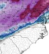
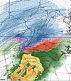
Well that stinks! Thanks for posting.I don’t have sleet maps but snow maps look like they are pushed back to 5k feet for “all snow” . That particular line moved northwest from 12zView attachment 169124
NBAcentel
Member
Euro AI has about 500 miles to come west to catch the Canadian. I wouldn’t sweat it Frosty!Well that stinks! Thanks for posting.
Ukmet is runing. Should put the canadian super amp out to Pasteur here in a few. If it doesnt an agrees, ill sit up straighter.
tennessee storm
Member
Go big or go homeUkmet is runing. Should put the canadian super amp out to Pasteur here in a few. If it doesnt an agrees, ill sit up straighter.
NBAcentel
Member
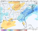
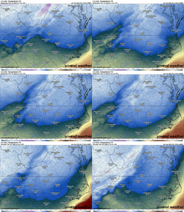
Just to keep thisYea 1010 over Georgetown SC lmao... View attachment 169119
Look at that freaking Bird Beak from 500-850

NBAcentel
Member
WolfpackHomer91
Member
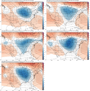
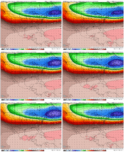
500mb looks like 00Z from last night up to 81 jmoMore upstream confleunce so gonna be colder at the sfc. Could be amped with a stronger appendage back west to View attachment 169131
WolfpackHomer91
Member
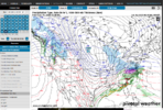
Looks slightly Colder than 12Z, Definitely Slower , on 12Z by 03Z Thursday (Same frame) LP was in N Outer Banks. With it being Feb id imagine an overnight storm would possibly help some edge ppl but idk
EDIT : Goes on to Hammer NYC - Boston lol
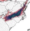
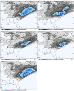
Nice clown map at hr 129 ukmet. Lot more snow front end. Several 6+ along upper 2 tier countie va/nc line.
Need a line from Jimmy to SD to get in this one.
Need a line from Jimmy to SD to get in this one.
NBAcentel
Member
Now hopefully the Euro will follow the UKMetNice clown map at hr 129 ukmet. Lot more snow front end. Several 6+ along upper 2 tier countie va/nc line.
Need a line from Jimmy to SD to get in this one.
NBAcentel
Member
Looks like the euro is gonna come in with stronger upstream confluence as well, that’s all modeling tonight. Hopefully we see that continue, that’s our ticket for more snowier runs if that feature continues
NBAcentel
Member
NBAcentel
Member
Probably gonna be a huge ice storm this euro run. More shallow cold then prior runs but 850mb is still torching
NBAcentel
Member
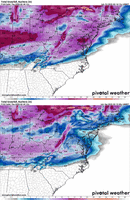
I mean all I have to say is this is scary consistent for the 85 corridor. This run got GSP involved to View attachment 169138
Not very much freezing rain in the foothills was there more sleet there or just a lack of precip?
Sent from my iPhone using Tapatalk
Not very much freezing rain in the foothills was there more sleet there or just a lack of precip?
Sent from my iPhone using Tapatalk

Sent from my iPhone using Tapatalk
Euro is 6 hrs slower, comes inland sw GA, amped like rest tonight

Sent from my iPhone using Tapatalk
Much better than freezing rain. But I’m sure there will be many more changes, but don’t need the .75-1.00 like central NC. Wow Thanks!
Sent from my iPhone using Tapatalk
Exits MYB. Shes wound up. Big qpf east tn to coast
That track is what will happen early amp gulf coast. Can and euro attest
my maps are slow but here’s where I’m at now. Looks like snow and a lot of it
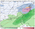
Low goes from south of PCB then jets inland into south GA View attachment 169139
Yeah boy, love to stay away from that heavy ice. Thanks!
Sent from my iPhone using Tapatalk

