• Hello, please take a minute to check out our awesome content, contributed by the wonderful members of our community. We hope you'll add your own thoughts and opinions by making a free account!

Wintry Feb. 19-20

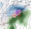
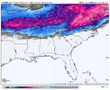
Looks like the GFS is more amped but way colder at the SFC again, gonna probably be a big winter storm for NC this run regardless, more towards the euro

08d2956a698ba7b54682d7cdd41f984a.gif

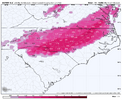
6z GFS has a significant winter storm for most of NC/VA, 2m temps stay near or below freezing the entire event for the northern 2/3rds of NC


Sent from my iPhone using Tapatalk
 
The models are pretty much in agreement now that many of us in Virginia and the Carolinas will be seeing a significant winter storm. Now its time to watch trends and see if they push the snow/ice line south as the storm gets closer. Just fifty to one hundred miles south would put central North Carolina in a more favorable position to avoid a lot of damage from ice accural. WIth temperatures in the upper twenties for much of this storm and that strong wam nose aloft with plenty of QPF to work with the potential is there for something on the scale of December 2002 or even worse for the Raleigh area.
 
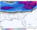
Euro even colder than 0z and dipped the snow accumulations about 30 miles south and east.
I at least want us to move into the sleet "zone" of the storm. RAH also (currently) thinking ice:

.LONG TERM /MONDAY THROUGH FRIDAY/...
As of 300 AM Saturday...

Dry and chilly weather still on track for Monday and Tuesday with
cold high pressure building over the area from the north and
northwest.

The next weather system for the mid- to late-week period is becoming
more interesting with every new model run. All of the longer-term
deterministic models and many of the ensemble members show an
impactful winter event affecting much of our area beginning as early
as Wednesday morning and potentially lasting through Thursday
morning, with accumulating snow and ice possible for the usual
colder NW half of our CWA (basically from the Triangle north and
west
). This is all due to a highly amplified and complex upper
trough pattern that moves across the eastern half of the county,
along with a resulting sfc low that moves NE along the SE coastline.
Given the vigorous SW flow and WAA above an otherwise cold BL
(lingering cold sfc airmass as noted in the Monday-Tuesday time
period)... models have been trending toward more of a freezing rain
scenario for our area with this system... with heavy snow displaced
farther north either north of our CWA or confined to the northern-
most portions of our CWA. Obviously it`s still way too soon to offer
fine details about this system as there are still dozens of future
model runs between now and then and things are still likely to
change...and of course the eventual track of the sfc low will
determine how much and what types of precip occur across our area.
That said, you`ll definitely want to keep a close eye on forecast
updates as we head through the coming days. If today`s model runs
were to verify (again, low confidence right now of that happening
simply because how far we`re still out from it), we could be talking
about an impactful amount of ice across parts of central NC!


&&
 
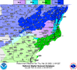
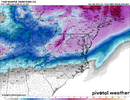
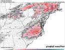
I think the NBM has a very good idea of the frozen precip footprint, keep in mind the snow map includes sleet so that would not be all snow, and the zr potential continues to increase. I mean it's starting to get to close to warning criteria ice accruals 4 days out, that's getting the NWS attention for sure

1739620877822.png
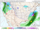
1739620934584.png
 
The Euro is one of the warmest models with the mid levels on Wednesday. That being said... it's very close to a nuke job for GSP Wednesday morning.

It's got GSP at 33/30 at 10am Wednesday moring, -1 C 925mb temps, 1c 850mb temps, -3C 700 mb temps. and .15 inches has fallen in the last couple hours.

Most of the other modeling keeps the 850mb freezing line well below GSP. So this is somewhat Intriguing.

Furthermore, the 1 inch snow mean on the EPS for GSP is mostly coming from the potential Wednesday morning front end thump.
 
There will be some evaporational cooling of the mid levels and column crashing early Wednesday morning when the precip starts. I'm to the point now of wishing for a quicker onset of precip and colder starting conditions for snow. That hurts my area a little in the surface cold department, but helps tremendously in the snow chances.

The 06z Icon is a perfect scenario for all that, but for some reason it has a torching boundary layer compared to the Euro. If it's surface temps were closer to the euro it would be showing 2-3 inches of snow for Oconee/Pickens/Greenville/Spartanburg counties in SC on Wednesday morning.

The problem, I think, is some of what makes the boundary layer colder on the Euro is also what's making the mid levels a little warmer. So I'm not sure we can get both things to line up just right.
 
There will be some evaporational cooling of the mid levels and column crashing early Wednesday morning when the precip starts. I'm to the point now of wishing for a quicker onset of precip and colder starting conditions for snow. That hurts my area a little in the surface cold department, but helps tremendously in the snow chances.

The 06z Icon is a perfect scenario for all that, but for some reason it has a torching boundary layer compared to the Euro. If it's surface temps were closer to the euro it would be showing 2-3 inches of snow for Oconee/Pickens/Greenville/Spartanburg counties in SC on Wednesday morning.
Typical icon warm surface level bias.
 
Like I said earlier, it’s unheard of to get eastern Nc in that much of a wedge and it not fall into traditional CAD areas of SC. Euro finally shows that not being the case the last 2 runs. The wedge is trending stronger and stronger. If you have low to mid 20’s at the surface all the way down to under I40, you’re going to get mid to upper 20’s at worst in the upstate. With that said, the soundings are close to a very wet snow imby and you’re seeing the mean on the EPS to creep up and further south. I’m still more worried about ZR though. The confluence and wedge at the surface is trending stronger but the SER is still very much involved and it just screams warm mid layers and ice for a lot of people.
 
Typical icon warm surface level bias.
I'm sure that's some of it, but the Euro AI is also pretty warm at the surface too even with it's much colder mid-levels. Some of it's issue is it's not wanting to wetbulb us all the way down though b/c the precip is so light.

It's clear all this can come together the right way because it's the reason we have a 1-1.5 inch snow mean on the EPS.
 
Like I said earlier, it’s unheard of to get eastern Nc in that much of a wedge and it not fall into traditional CAD areas of SC. Euro finally shows that not being the case the last 2 runs. The wedge is trending stronger and stronger. If you have low to mid 20’s at the surface all the way down to under I40, you’re going to get mid to upper 20’s at worst in the upstate. With that said, the soundings are close to a very wet snow imby and you’re seeing the mean on the EPS to creep up and further south. I’m still more worried about ZR though. The confluence and wedge at the surface is trending stronger but the SER is still very much involved and it just screams warm mid layers and ice for a lot of people.
I agree 100% for your location, but for GSP back to my area, we will definitely be a little warmer at the surface in this type of wedge scenario. (which is why i'm sweating boundary layer issues).

When you've got a building in wedge with the high centered in the Great plains and a surface low that's tracking pretty far south, it favors a more NNE fetch and place like Charlotte/Raleigh get that cold air delivery quicker.

Where we do better in wedges is when they're fully entrenched and also we are the last places to have it erode away. We also do better in wedge's comparatively with Miller B's because we get that more ENE fetch banking against the mountains.

I could see a scenario where a place like campobello takes perfect advantage of both the low-level wedge cold, and the mid-level cold at onset and getting a nice front end thump where places further west in SC struggle with boundary layer issues and places further East struggle with warm nosing.
 
Like I said earlier, it’s unheard of to get eastern Nc in that much of a wedge and it not fall into traditional CAD areas of SC. Euro finally shows that not being the case the last 2 runs. The wedge is trending stronger and stronger. If you have low to mid 20’s at the surface all the way down to under I40, you’re going to get mid to upper 20’s at worst in the upstate. With that said, the soundings are close to a very wet snow imby and you’re seeing the mean on the EPS to creep up and further south. I’m still more worried about ZR though. The confluence and wedge at the surface is trending stronger but the SER is still very much involved and it just screams warm mid layers and ice for a lot of people.
That fact that areas north of us will have a fresh snowpack only helps the CAD further
 
Two things, I am praying RAH area cools some and gets more sleet, if not, get your heavy quilts out. To Frosty and others in the far NW Piedmont, remember the models do not pick up the expansion on the NW side of the snow line until the day of and always under estimate the QPF. You are sitting pretty Frosty, my guess would be 4-6+sn
 
A full phased, negatively tilted bomb is coming. It’s a quick mover only reason we aren’t seeing 2ft totals

View attachment 169171
I’m here for it. Hoping for a sleet bomb. It’s a shame that it’s not a little slower to crash the column and flip more over to snow. Hopefully there will be a little more snow on the front end stuff.

How’s the high pressure funneling in look to you? In similar situations, we can trend colder at the surface until game time and have more impact.
 
Just my two cents, but I think this is setting up to be an absolute snow mauler for Greensboro to Richmond to the southern tip of Delaware. I think places to the north of that strip will get less snow. Wouldn't be shocked if D.C. gets blanked.

Icon/GFS/Euro AI/ Euro Graphcast/GFS graphcast/ Pangu all sort of agree on that cut off to the north. I think the Euro/CMC/Ukmet will come back to meet up with them today.
 
I’m here for it. Hoping for a sleet bomb. It’s a shame that it’s not a little slower to crash the column and flip more over to snow. Hopefully there will be a little more snow on the front end stuff.

How’s the high pressure funneling in look to you? In similar situations, we can trend colder at the surface until game time and have more impact.
Everything looks fine…it’s just too bad cold wasn’t entrenched before it comes but still, any other decade this is snow/sleet for many…not frzn. I refuse to believe a coastal delivers that much freezing rain. It’s either going to be rain or sleet/snow. You definitely getting something big.

Reminds me Jan 2017.


IMG_3052.gif
 
Man the Euro graphcast/Pangu/GFS graphcast are so much colder at 850mb... would be all snow for most of NC, and mostly snow for the upstate as well on all those models.

I hope they're on to something.
Would love to see that final trend that went colder and colder at the mid levels to push it all snow to 85 ... Ala Feb 04. Looking at the wide spread of the "wintry mix" area I think it's possible. If mix is to go that far east in the state with this low traxk then the snow/mix line is going to be east as well
 
Would love to see that final trend that went colder and colder at the mid levels to push it all snow to 85 ... Ala Feb 04. Looking at the wide spread of the "wintry mix" area I think it's possible. If mix is to go that far east in the state with this low traxk then the snow/mix line is going to be east as well

Feb 2004 Was the #4 or 6 Analog when I posted Thursday Eve


Sent from my iPhone using Tapatalk
 
It’s a typical cold air chasing moisture setup for 85% of the Southeast. MS/AL/GA/SC have virtually zero way to score here. Potential big scores here are the top 2 rows of counties in TN/NC, as well as the NC mountains. Typical winter solution for most of us to bring in Spring.
 
Feb 2004 Was the #4 or 6 Analog when I posted Thursday Eve


Sent from my iPhone using Tapatalk
2004 had the upper down in the deep south...its over Chicago for this event. But still...would hope more snow/sleet than frzn.

And I am little concerned this could get yanked further west than even the Euro/CMC is showing.

GZ_D5_PN_120_0000.gif2004022606.gif
 
Dec 2018 was similar...540 thickness up in n-VA. I remember that event about to start and RAH and WRAL had no clue what to do...they thought it would be more rain than snow and clearly it wasn't.

2018120918.gif
 
The 6z GEFS was probably the best track yet. I wouldn’t be surprised if the Euro is a little too amped…maybe wishful thinking though.

View attachment 169176
Maybe I'm looking at it too hard and it's playing mind games with me but with the track of that low I'm with u I'm finding it a bit difficult to believe that's an ice solution

Sent from my SM-S156V using Tapatalk
 
Back
Top