• Hello, please take a minute to check out our awesome content, contributed by the wonderful members of our community. We hope you'll add your own thoughts and opinions by making a free account!

Wintry Feb. 19-20

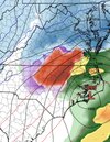
Dec 2018 was similar...540 thickness up in n-VA. I remember that event about to start and RAH and WRAL had no clue what to do...they thought it would be more rain than snow and clearly it wasn't.

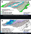
View attachment 169182
And if I'm not mistaken didn't GSO get like a foot of snow with that storm?

Sent from my SM-S156V using Tapatalk
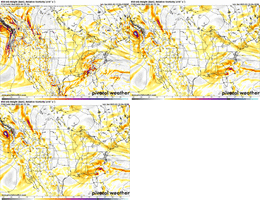
 
Everything looks fine…it’s just too bad cold wasn’t entrenched before it comes but still, any other decade this is snow/sleet for many…not frzn. I refuse to believe a coastal delivers that much freezing rain. It’s either going to be rain or sleet/snow. You definitely getting something big.

Reminds me Jan 2017.


View attachment 169172
January 2017 is exactly the storm I keep thinking about looking at how the modeling is trending. That storm had a very narrow corridor, only about 30 miles wide with significant ZR. Unfortunately for me I was in that corridor and 4-6” of forecasted snow turned into .3” of ZR and then about an inch of snow on top of it. I expect a similar size corridor with this possibility setting close to the US-1. This set up does appear to get a stronger cold push out ahead of the storm than January 2017 storm did and much better snowpack in place to the north.
 
da255bf7abdfd160349d67a30167212c.jpg

Yall throw your shots at me idc…. It’s been too long since I’ve lived through anything Decent that little 4” With ICE topper in 2022 was a Tease…. I want the whole thing … bring me Cat 6 we’re so close in NC can we pull it off idk. But gimme something to tell my Grandkids I will pick up debris after as the payment. Granted I’ve got a Generator that will power every outlet in my home and Gas logs but yea


Sent from my iPhone using Tapatalk
Do we know what the wind is supposed to be for this or is that too early to know?

Sent from my SM-S156V using Tapatalk
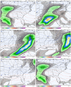
 
It’s a typical cold air chasing moisture setup for 85% of the Southeast. MS/AL/GA/SC have virtually zero way to score here. Potential big scores here are the top 2 rows of counties in TN/NC, as well as the NC mountains. Typical winter solution for most of us to bring in Spring.
Well considering the cold air is coming from CAD on the EAST side of the mountains this is literally nothing like a cold chasing moisture setup at all.
 
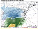
Euro AI looks like more sleet and freezing rain than snow in the I-85 corridor to me. Even up through the Triad if I’m reading it correctly.
View attachment 169184
Looks like the 06z AI has abandoned the NAVGEM camp. Whew. So that’s good if we like a little precipitation with our low level cold.
 
da255bf7abdfd160349d67a30167212c.jpg

Yall throw your shots at me idc…. It’s been too long since I’ve lived through anything Decent that little 4” With ICE topper in 2022 was a Tease…. I want the whole thing … bring me Cat 6 we’re so close in NC can we pull it off idk. But gimme something to tell my Grandkids I will pick up debris after as the payment. Granted I’ve got a Generator that will power every outlet in my home and Gas logs but yea


Sent from my iPhone using Tapatalk

December 2002, was a 5 on that index card here locally. It can happen and we had 0 wind. The accums is what did it, temps low 20s. Not saying thats gonna take place with this storm by no means. Just younger folks, need to not always boo boo the frzng rn maps. I get why they do it. But it can an does happen. You get accums to.75, to me thats when you cross dangerous turf power wise widespread. With or without wind.
 
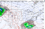
The Euro tracks the 850 low right over NC...ICON keeps it south. But, its all alone in that.


View attachment 169183

Canadian started the inland track last night…. It had a 1010 over Georgetown at one point….. now that EURO is moving towards it gotta atleast say it’s a possibility


Sent from my iPhone using Tapatalk
 
December 2002, was a 5 on that index card here locally. It can happen and we had 0 wind. The accums is what did it, temps low 20s. Not saying thats gonna take place with this storm by no means. Just younger folks, need to not always boo boo the frzng rn maps. I get why they do it. But it can an does happen. You get accums to.75, to me thats when you cross dangerous turf power wise widespread. With or without wind.

Yea, true. I wish Webber or one of the smart ppl here had access to model run archives to see what they had in certain storms. I just find it hard to not cut 75% off even the FRAM maps… bc we see these insane world ending numbers it seems 70% of our QPF loaded events and they never verify. As it stands I still say even verbatim this is WORST case 1/4 - 1/2” Verified Accums as modeled in worst areas


Sent from my iPhone using Tapatalk
 
So do other places in the southeast has a chance of seeing something besides Tennessee and both of the carolina’s?
 
Yea, true. I wish Webber or one of the smart ppl here had access to model run archives to see what they had in certain storms. I just find it hard to not cut 75% off even the FRAM maps… bc we see these insane world ending numbers it seems 70% of our QPF loaded events and they never verify. As it stands I still say even verbatim this is WORST case 1/4 - 1/2” Verified Accums as modeled in worst areas


Sent from my iPhone using Tapatalk
I wouldn't sweat amounts or p-types just yet. Until the LP placement gets more sorted out. This thing is still 5 days out. Suffice to say we have a storm coming with multiple p-types.
 
Guidance ZR totals get chewed down because:
-underestimated cold at 925mb
-surface temps too warm (self limiting etc etc)
-good ole dry slot
-even if the above conditions aren’t satisfied it’s rare to accrue at 100% efficiency. You lose qpf to runoff if…
-its raining too hard
-there’s no breeze (helps “air out” that latent heat release)
-marginal temps (think 31.8)

It’s just hard to get right. Models still struggle with phase changes in a falling hydrometeor which is why it can be hard to forecast this
 
Yea, true. I wish Webber or one of the smart ppl here had access to model run archives to see what they had in certain storms. I just find it hard to not cut 75% off even the FRAM maps… bc we see these insane world ending numbers it seems 70% of our QPF loaded events and they never verify. As it stands I still say even verbatim this is WORST case 1/4 - 1/2” Verified Accums as modeled in worst areas


Sent from my iPhone using Tapatalk
Not webber, but the only thing I will say is comparing old model runs (in my opinion) wouldn't produce much value. These models are upgraded routinely (increasingly vertical and horizontal resolution, new parameterizaton schemes such as microphysics, land surface model, PBL, cumulus and new data assimilation methods, etc.) and so a model run of the ECMWF from years ago is basically an entirely different model than the current ECMWF.
 
I don’t post much, longtime winter weather lover. I really just get on here in the winter months to self educate. I’m 43 and been in the upstate my whole life. Could be completely wrong, but this system is starting to remind me of FEB 26 2004. Need some luck but the CAD seems to be trending in the right direction, just need the cold to push sooner or L to slow. The 04 storm was about over in the GSP area but it started to crank and put down over 8” at GSP. Back end development that far east was not predicted. I say this, because back end development on Lee side continues to show up on the models. Hoping for the best!

 
Guidance ZR totals get chewed down because:
-underestimated cold at 925mb
-surface temps too warm (self limiting etc etc)
-good ole dry slot
-even if the above conditions aren’t satisfied it’s rare to accrue at 100% efficiency. You lose qpf to runoff if…
-its raining too hard
-there’s no breeze (helps “air out” that latent heat release)
-marginal temps (think 31.8)

It’s just hard to get right. Models still struggle with phase changes in a falling hydrometeor which is why it can be hard to forecast this
We were getting ZR with the first system in January and I was shocked at the runoff that occurs even around 29-30 with light to moderate rain
 
We were getting ZR with the first system in January and I was shocked at the runoff that occurs even around 29-30 with light to moderate rain
Yea FRAM tries to take runoff in to account, but I bet it only goes off hourly precip rates, (if that).

You have to think that within an hour of precip, there are 5-10 minutes periods of much heavier precip that's gonna be lost to run off at a quicker rate, so if the hourly precip is 2/10ths and fram thinks 1/10th of that can freeze... if most of that 2/10th's comes over a ten minute period, you might realistically only get 2/100ths of accrual.
 
I'm not a met, but been through a lot of these ice scenarios over the years. I've found the major ones usually require a long duration (12+ hrs at least, preferably 18+) of steady/moderate frz rn combined w/ surface temps at 28 or below. I mean it can happen close to 30, but only with longer duration. It's very tough to get those 2 factors to line up. (not saying that won't happen here, but more highlighting why it doesn't happen more often)
 
Last edited:
Looking like the Euro led the way here and the Euro AI(and other AI models) were hot dog water. Basically just trust which models give Richmond to Boston the most snow and you'll be right for any given storm this year.
 
Didn't someone post the CMC was more inland and eps was tilting that way a bit. The trend could be an inland runner?
 
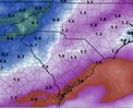
As much as I don't want it...this shaping up to be like Dec 2002. That was about 1-1.25" QPF and GSO was a 29-30F during heaviest freezing rain accum.


View attachment 169186
If that’s the storm I’m thinking about, it was a core memory for me here in the upstate. It’s about as bad as it can get winter wx wise.
 
Back
Top