Teach Lesley
Member
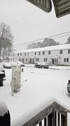
It did. Decent snow just south and east of me all day. Never could get here. I came in with 15 flakes.What ever happened with that derecho in the Gulf which was supposed to disrupt moisture transport?
View attachment 170898
It did. Decent snow just south and east of me all day. Never could get here. I came in with 15 flakes.What ever happened with that derecho in the Gulf which was supposed to disrupt moisture transport?
View attachment 170898
Kat Campbell just reported sleet on the WRAL patio.A little sleet mixing in around Raleigh, might cut down on snow totals a bit.

I’m right with you. My son went out and measured right at 3”. And it’s still coming down.3 inches in Youngsville!!
Sent from my iPhone using Tapatalk

Moyock might be in trouble
Moyock might be in trouble
Filling back in around the clt metro a bit. Good sign for those further east View attachment 170900
I swear to God if we just get on and off snow showers all night until the ULL pulls through I'm gonna laughFilling back in around the clt metro a bit. Good sign for those further east View attachment 170900

I don’t think it’s helpful to the public thinking the “bust” is over with a decaying advisory about to expire. It’s likely there will be more than one location that gets a quick inch with already frozen surfaces and temperatures in the mid to upper 20’s. I don’t know of anyone that even knows about these streamers that may or may not come in tomorrow.I’m aware just relaying what the NWS is saying. They opted to do a widespread winter weather advisory for up to 2” of snow until 1pm tomorrow. Better for the public to receive advanced warning.
Moyock might be in trouble

If its snowing in Wendell that cant be the sleet line
If its snowing in Wendell that cant be the sleet line
Maybe longer for you if it keeps filling in like it iswral saying this will go to 8pm but guessing more like 6pm for my locale based on the radar