Xlhunter3
Member
600 crashes reported across North Carolina.
10-15 car pileup on I-85 near Orange/Durham Country Line.
10-15 car pileup on I-85 near Orange/Durham Country Line.
It’ll go beyond that. Charlotte still seeing returnswral saying this will go to 8pm but guessing more like 6pm for my locale based on the radar
Looks like mixing along wake and harnett line
Raleigh NWS doesn’t like us I guess!We are somehow still not under a warning
Getting some big snowflakes under this View attachment 170906

Definite back building to precip, filling in nicely west of Henderson again almost back to Roxboro!
General admission with no ticket required at the smith center tonight due to the snow
Coldest air temperature of the day now here in South CLT, yet precipitation has changed to mostly sleet or tiny tiny flakes.
For the record, it has been mostly a snowFALL event here. Only a dusting on the plants and some grassy areas. Seems to be more ground cover up in North Charlotte / Mecklenburg and obviously further North and East.
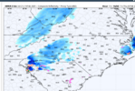
Hrrr keeps coming in more juiced with every run.@rburrel2 streamer angle setting up already? Blow wind blow View attachment 170911

Dang and I see nothing on radar in Concord.Gaining back what I lost to melting earlier, it’s legit coming down
this just in: thats where we are at hahahaweather dot com needs to stop embarrassing itself - ive checked about hourly since the hard snow started around noon just to see what it would say, and it has not budged on saying "1 inch left in 24 hrs" even though at noon it said 0 inches had fallen, 1 inch to go lmao. now it is "3 inches fallen, 1 inch to go...."
lets get to "5 inches fallen, one to go?!"

It likes to break containment there between Asheville and Cullowhee. Something about the topography there. It has a name but I can’t recall
