smast16
Member
Good news indeed, I've been freezing, and i'm ready for green leaves and birds singing.Good news , if that’s the case , and I mean you better guarantee this for me fro … I’m 100% in on the weekend blizzard . Where do I sign ?
Good news indeed, I've been freezing, and i'm ready for green leaves and birds singing.Good news , if that’s the case , and I mean you better guarantee this for me fro … I’m 100% in on the weekend blizzard . Where do I sign ?

I'll cash in on this now!Enjoy the cold for the rest of the month because it might be replaced by this for who knows how long:
View attachment 110161

Unfortunately you’re looking at a very long range image here. These very much do not come to reality. Most things passed 300 are what we call fantasy land .. where storms go to frolic but when you get towards 240 hours out you start seeing actual signs of what a pattern may look like in that range .. overall ensembles are painting a picture that we get south eastern ridging to take over come February at least for the first half .. now interesting to note a lot of the ensembles want to bring a sort of CAD issue for those areas in the piedmont regions but this similarly happened last February where we ended up torching and people west of us cashed in on the cold airMaybe the feb warmup will be temporary. We can hope. This would be great just a little more south


Well, I tried to pick a good mix of hot and cold names in my top 10. Maybe we can flip back to a more favorable pattern to end the month.Torch. Torch and torch.
GEFS is a southeast ridge torch.
EPS is a zonal pacific blaster torchView attachment 110217View attachment 110218

Only if there was ensemble support
 And not a - tilted GOA ridge as the main signal


Going to be so hard to get cold again too, having to get it all the way back over here from Siberia and all. #torchforeverOnly if there was ensemble support
That’s how you go zonal 60’s to winter storm in 24 hours.
Somehow the NAO will trend negative.. our SER will scream and then we will CAD our way into some cold rain .. maybe ice if we’re lucky but probably cold rain plus some warm days in between .. really hoping latter month towards early March can come back and give us a little 2 week stretch of something to really track but you know how those set ups go .. we gotta worry about a lot more variablesOnly if there was ensemble support


Judah is about as reliable as BAM. It's going to be warm in the east. This is a contra-indicator.February About to get saved View attachment 110321
I wonder What has BAM been saying the past few weeks lmaoJudah is about as reliable as BAM. It's going to be warm in the east. This is a contra-indicator.


.png")
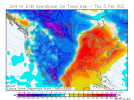
I know this is rain here but it could be more south in 15 days. I dont think Feb is totally lost.


I wonder if the dying La Nina has anything to do with it.EPS is really close to another +PNA event… I guess models are feeling that +EAMT after all. I thought the event was gonna whiff View attachment 110451View attachment 110452
Golf weather. I love cold but my knuckles are all split from the heat running for the whole month. I wouldn’t mind a couple days of window opening weather.Yes please

Except when it didn’t last December .Even with all this potential extended SER for a couple of weeks, we are going to figure out a way to CAD at least half of those days I’d almost bet. Go ahead and get prepared to see upper 60’s go to upper 40’s the closer we get to verification. Happens every time.
Check west coast, we’ll never get rid of this positive PNA View attachment 110544