• Hello, please take a minute to check out our awesome content, contributed by the wonderful members of our community. We hope you'll add your own thoughts and opinions by making a free account!

Pattern Failbruary Thread

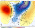
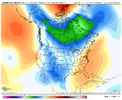
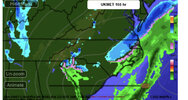
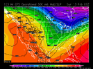
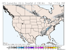
Things that will work .. this! .. also +PNA is the real deal and is the only reason we were able to have a streak of good storm potential like we just had .. I will root for that more than anything else at this point. -NAO is great and all but it didn’t help with any storm potential of our past 3 so we don’t need it really View attachment 112060View attachment 112059
False
 

Yeah if you overlap the recent pattern with a -nao we'd probably have 2x snow or more
While I agree a -NAO coupled with +PNA would have us score quite easily.. I would take a plain +PNA over a plain -NAO .. last year is a good example of having the amazing -NAO but no +PNA and just getting cold rain all the time.. no good .. straight up +PNA has given us 3 weeks of winter weather every weekend.. so it is not “false” to say we don’t need the
-NAO as that’s been proven by the last 3 weeks (see below we’ve had a +NAO all month with a good ole +PNA doing all the work) but I agree that having BOTH mechanisms to work with would give us a fat thanksgiving big dog feast A24FED16-48D5-4872-AAD9-7429451ACDA8.jpeg767CB3C6-23C4-4897-8148-71E9E972639F.jpeg
 
While I agree a -NAO coupled with +PNA would have us score quite easily.. I would take a plain +PNA over a plain -NAO .. last year is a good example of having the amazing -NAO but no +PNA and just getting cold rain all the time.. no good .. straight up +PNA has given us 3 weeks of winter weather every weekend.. so it is not “false” to say we don’t need the
-NAO as that’s been proven by the last 3 weeks (see below we’ve had a +NAO all month with a good ole +PNA doing all the work) but I agree that having BOTH mechanisms to work with would give us a fat thanksgiving big dog feast View attachment 112078View attachment 112079

I'm not a believer in you have to have a -nao for us to get a big dog here. That said in this fast northern stream dominant regime a -nao would have given us a shot at much larger events the last 2 weekends imo
 
I'm not a believer in you have to have a -nao for us to get a big dog here. That said in this fast northern stream dominant regime a -nao would have given us a shot at much larger events the last 2 weekends imo
100% agree I would even go to say it probably would have given us a big dog or at least a much larger portion of the SE a big dog. I was simply talking to the point that if we had to pick having one being dominant over the other I would take +PNA all day over a
-NAO
 
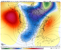
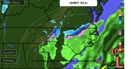
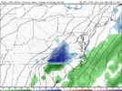
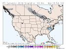
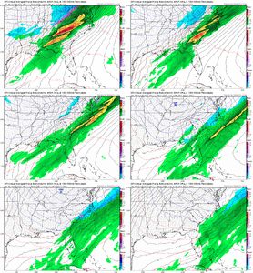
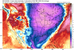
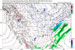
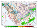
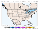
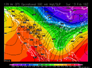
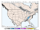
The next weekends threat is already being primed and set on the 00z GFS .. obviously fantasy stuff but the every weekend winter threat is quite comical to keep up with View attachment 112097
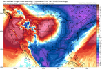
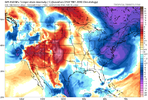
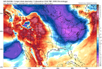
What's interesting is that it's trying to develop a -NAO in the long range.
gfs_z500a_namer_48.png

Also that +PNA block!
 
NAO is not just nice. It's extremely helpful when it comes to SE snowstorms. You can absolutely get cold without a -NAO. You can absolutely get winter storms without a -NAO. But we need to remember that it helps slow the pattern down and keep the storm track suppressed. A PNA is nice, but it doesn't suppress the storm track. The downstream effect is a trough in the east. But the flow still remains pretty fast and you need great timing for big winter storms. You still need great timing with a -NAO, but adding that in (and I'm not saying it's the only piece) gives you a bigger (and maybe much) bigger eye of the needle.

I don’t disagree with any of what you’re saying. It all makes sense. Regardless, I looked in my files and actually found an analysis I did of RDU 6"+ SN/IP and posted here back in 2017. I just added 1/17-18/2018 and 12/9-10/2018 to complete the list.

(2/24-26/2015 and 1/13/14/1982 were both not included since both of those periods' snow were actually from two different storms with the heaviest at 5". 2015 would have counted as +NAO and 1982 neutral)

Here's the NAO for the 21 Raleigh 6"+ SN/IP storms since 1950. (I'm calling neutral NAO to be from +0.25 to -0.25):

-1/19/1955: -NAO

- 12/11/1958: neutral NAO

- 3/2-3/1960: neutral NAO

- 3/9/1960: neutral NAO

- 2/26/1963: neutral NAO

- 1/25-7/1966: -NAO

- 2/9/1967: +NAO

- 3/1/1969: -NAO

- 1/7-8/1973: -NAO

- 2/18-9/1979: neutral NAO

- 3/1-2/1980: +NAO

- 3/24/1983: neutral NAO

- 2/6/1984: +NAO

- 1/7-8/1988: +NAO

- 2/17-8/1989: +NAO

- 1/24-5/2000 (“Crusher”): -NAO

- 1/2-3/2002: -NAO

- 2/26-7/2004: -NAO

- 12/25-6/2010: -NAO

- 1/17-8/2018: +NAO

- 12/9-10/2018 +NAO


Tally:

-NAO: 8

Neutral NAO: 6

+NAO: 7


Though 2000-2010’s four big storms including the Crusher were all during -NAO, this shows a pretty even split through the entire period and the sample size isn’t small. Note that the last two were during +NAO as well as very notable storms like 3/1980 and 1/1988.

I don’t know. I’m admittedly a bit surprised the numbers are this balanced. Perhaps some of this is due to how the NCEP based NAO is defined/calculated. I mean I think you can still have good blocking near Greenland and it not officially be calculated as -NAO. What do you think?

By the way, I also did a similar analysis for the NAO five days before each storm and the result didn’t change much with any -NAO advantage still small.
 
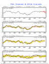
Good news is that we still have a +PNA that will continue for awhile per GEFS. But the bad news is that there’s currently no -NAO or -AO (other than next few days) in sight (per GEFS forecast):

PNA:
870035DD-D40A-42F8-BE64-0360E8036C67.gif

NAO:
265B9D0E-AC95-4AB0-92DA-7FC371C37B80.gif

AO:
4BFCDC4F-A78E-4B6C-8427-C2F5514543A7.gif

Edit: About two weeks ago I made a prediction of 3 BN or colder 2/1-14 at ATL and RDU. With the early Feb warmth now through 2/4 instead of just 2/3 and with models suggesting a warmup next week after the cooldown, it is not looking so good right now. Going to need a cooling trend on the models to get the -3, especially for ATL.
 
Last edited:
Back
Top