Stephenb888
Member
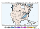
Man if only this wasn’t a million hours away.A true classic winter storm late GFS 12z ????????View attachment 112819
Man if only this wasn’t a million hours away.A true classic winter storm late GFS 12z ????????View attachment 112819

How is it possible that these clown maps never verify…not even once in a blue moon? You would think at some point they would hit on something even this far out. Why do the models always think we’re gonna have perfect conditions 2 weeks out?Classic. Only 2 weekss to go ?
View attachment 112820
Because the models are wrong about 99% of these monster storms down here.How is it possible that these clown maps never verify…not even once in a blue moon? You would think at some point they would hit on something even this far out. Why do the models always think we’re gonna have perfect conditions 2 weeks out?
Yep should be interesting starting about a week from nowSeems like all of the models are starting to recognize anamolous west coast ridge better in the long range sparking more pinchy/phasey stuff flowing down it. Euro,CMC,ICON, GFS have all went from showing little opportunity to lots of threatening waves in the last few cycles. Very good signs!
Pretty to look at, but it’s way out in voodoo territory.Classic. Only 2 weekss to go ?
View attachment 112820
Yeah with over a foot of snow on the ground??Wow, I know it’s long range but, -2 in Florence AL
View attachment 112827
I know it’s said a lot, but this is a true Jan ‘88 footprint, with lower totals!Classic. Only 2 weekss to go ?
View attachment 112820
Looks like a cutter, it may be very good for the western southeast.View attachment 112837


Most of the SE winter storms have trended SE this winter, so this is a good look
Like you pointed out a few days ago the models have all had this ridge starting farther west and as we towards medium range and verification time it corrects further westward which is what has continued to have us in a favorable pattern through the end of January and now through mid Februarythe warmest look in a while and it still isn’t even that great for warmth, that ridge in the GOA is still trying to slide east, now we could turn this into a torch it the ridge axis shifts more towards the Aleutians View attachment 112851

The gfs had the system until 12z yesterday and then lost it and hasn't brought it back yet or an extreme weakened versionGfs was close with the vday storm as well
Sent from my iPhone using Tapatalk
