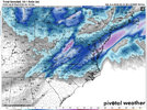
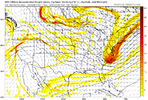
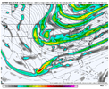
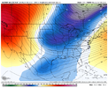
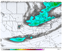
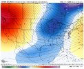
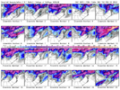
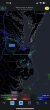
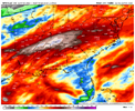
All models have at least shown something for this time period.. meaning the pieces are on the board to create a storm .. but we are far from a final solution that’s for sure and we need to make sure we keep the pieces together
-
Hello, please take a minute to check out our awesome content, contributed by the wonderful members of our community. We hope you'll add your own thoughts and opinions by making a free account!
You are using an out of date browser. It may not display this or other websites correctly.
You should upgrade or use an alternative browser.
You should upgrade or use an alternative browser.
Pattern Failbruary Thread
- Thread starter SD
- Start date
stephend122080
Member
00z EPS 500mb is baby stepping in the right direction IMO

Sent from my SM-A115U1 using Tapatalk

Sent from my SM-A115U1 using Tapatalk
Six Mile Wx
Member
Had a 20 minute flizzard here in Elizabeth City.
HSVweather
Member
View attachment 112900
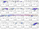
Euro had the above outcome as Nicky posted, 6Z GFS was a whiff but this is not far from a storm. Anyone have the ensembles?
HSVweather
Member
Flotown
Member
Smidgen better??
HSVweather
Member
For our area, a few less members showing compared to 0Z and 18z but a signal.Smidgen better??
NCHighCountryWX
Member
- Joined
- Dec 28, 2016
- Messages
- 699
- Reaction score
- 1,918

WeatherBELL Analytics
Precision weather forecasting, data services and decision support for your industry
- Joined
- Jan 23, 2021
- Messages
- 4,602
- Reaction score
- 15,197
- Location
- Lebanon Township, Durham County NC
Ocean effect?Had a 20 minute flizzard here in Elizabeth City.
LukeBarrette
im north of 90% of people on here so yeah
Meteorology Student
Member
2024 Supporter
2017-2023 Supporter
This might be one of DTs best videos if you’re interested. Says he likes the idea of a system in 13th-15th timeframe. After that he believes teleconnections will go to crap for east coast.
Southern Track
Member
This might be one of DTs best videos if you’re interested. Says he likes the idea of a system in 13th-15th timeframe. After that he believes teleconnections will go to crap for east coast.
Think I agree. After mid- month it looks like we will lose our favorable west coast which has been driving everything since last month.
stephend122080
Member
12z icon was close

Sent from my SM-A115U1 using Tapatalk

Sent from my SM-A115U1 using Tapatalk
ATLwxfan
Member
GFS about to do something at Hr 174. Better cold press and it’s juiced up but still suppressed. The trend is a friend.
Sent from my iPhone using Tapatalk
Sent from my iPhone using Tapatalk
ATLwxfan
Member
Well it got shredded.
Sent from my iPhone using Tapatalk
Sent from my iPhone using Tapatalk
- Joined
- Jan 23, 2021
- Messages
- 4,602
- Reaction score
- 15,197
- Location
- Lebanon Township, Durham County NC
Sound effect! That’s what I meant. Such a cool phenomenon.
This has been happening all morning.


lexxnchloe
Member
Still alot better than 06Z. Trended in the right didrection. Cold front faster and just need a few more adjustmentsWell it got shredded.
Sent from my iPhone using Tapatalk

ATLwxfan
Member
Still alot better than 06Z. Trended in the right didrection. Cold front faster and just need a few more adjustments

Frustrating part has been the favorable trends that just seem to stop short over and over. But yes no doubt a better look.
Sent from my iPhone using Tapatalk
ATLwxfan
Member
Sent from my iPhone using Tapatalk
As I heard it once well described in a previous forum, there is a lot of “positively tilted trash” on the models. We need more consolidated energy at the base of this trough to get something.Frustrating part has been the favorable trends that just seem to stop short over and over. But yes no doubt a better look.
Sent from my iPhone using Tapatalk
I heard the pna was enough for snow and didn't need helpAs I heard it once well described in a previous forum, there is a lot of “positively tilted trash” on the models. We need more consolidated energy at the base of this trough to get something.
NBAcentel
Member
I miss -PNA induced Miller BsI heard the pna was enough for snow and didn't need help
I miss any semblance of a +pna/-naoI miss -PNA induced Miller Bs
NWMSGuy
Member
Yes the entire month of January shows this .. but a -NAO always could help any winter pattern obviouslyI heard the pna was enough for snow and didn't need help
Actually January showed how having a +pna with no Atlantic blocking is going to verify faster/weakerYes the entire month of January shows this .. but a -NAO always could help any winter pattern obviously
Yep true and still scored 3 winter events .. I bet if we only had a -NAO we would have scored 3 cold rainsActually January showed how having a +pna with no Atlantic blocking is going to verify faster/weaker
Ok and I bet if we had a -nao/+pna we have a foot plus seasonal total instead of 3 mediocre events that seem to be top notch in your opinion. You've missed the point here but whateverYep true and still scored 3 winter events .. I bet if we only had a -NAO we would have scored 3 cold rains
Oh BTW we had 2 snow events last year with a -nao and whatever that pacific was so....
NBAcentel
Member
-NAO would have probably gave us some monster winter storms considering it would have slowed down the 50/50 low the first storm, slowed the flow with the second storm, and would have promoted slowed flow for digging with the 3rd. It’s a huge help
Yep it's not that western ridges are a bad thing but they have small margins for error and typically accelerate the flow. Having a -nao in addition to the pna widens the margins for error and slows the flow. I'm fine with a western/pna ridge alone but I understand that it's going to take a near perfect setup to get a significant snow event from it.-NAO would have probably gave us some monster winter storms considering it would have slowed down the 50/50 low the first storm, slowed the flow with the second storm, and would have promoted slowed flow for digging with the 3rd. It’s a huge help
Ok and I bet if we had a -nao/+pna we have a foot plus seasonal total instead of 3 mediocre events that seem to be top notch in your opinion. You've missed the point here but whatever
Oh BTW we had 2 snow events last year with a -nao and whatever that pacific was so....
Here’s some actual data to consider about the importance of -NAO at RDU:
Here's the NAO for the 21 Raleigh 6"+ SN/IP storms since 1950. (I'm calling neutral NAO to be from +0.25 to -0.25):
-1/19/1955: -NAO
- 12/11/1958: neutral NAO
- 3/2-3/1960: neutral NAO
- 3/9/1960: neutral NAO
- 2/26/1963: neutral NAO
- 1/25-7/1966: -NAO
- 2/9/1967: +NAO
- 3/1/1969: -NAO
- 1/7-8/1973: -NAO
- 2/18-9/1979: neutral NAO
- 3/1-2/1980: +NAO
- 3/24/1983: neutral NAO
- 2/6/1984: +NAO
- 1/7-8/1988: +NAO
- 2/17-8/1989: +NAO
- 1/24-5/2000 (“Crusher”): -NAO
- 1/2-3/2002: -NAO
- 2/26-7/2004: -NAO
- 12/25-6/2010: -NAO
- 1/17-8/2018: +NAO
- 12/9-10/2018 +NAO
Tally:
-NAO: 8
Neutral NAO: 6
+NAO: 7
Though 2000-2010’s four big storms including the Crusher were all during -NAO, this shows a pretty even split through the entire period and the sample size isn’t small. Note that the last two were during +NAO as well as very notable storms like 3/1980 and 1/1988.
I don’t know. I’m admittedly a bit surprised the numbers are this balanced. Perhaps some of this is due to how the NCEP based NAO is defined/calculated. I mean I think you can still have good blocking near Greenland and it not officially be calculated as -NAO.
By the way, I also did a similar analysis for the NAO five days before each storm and the result didn’t change much with any -NAO advantage still small.
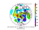
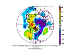
I just quickly pulled the first 2 neutral Nao years. I'd argue they both had west based blocking in the hudson bay region that quantifies as a neutral nao but doesnt act like it,that gets into semantics a little I guess.
Last edited:
I never said the COMBO -nao and +pna is not the most ideal I have always agreed with that .. I said if we are going to have just 1 of these teleconnections on our side it should be the +PNA over the -NAO .. the events this year were not top notch and I never said that. we had one decent winter storm with 3-4 inches of snow, an ice storm, and then some novelty stuff. Still I find this winter much better than the 15 or so cold rains we got last year. But you are right we did get a 1.5 jackpot storm last year with the -NAO but that was it. Maybe since last year we had all -NAO and this year all +PNA next year we can have the beautiful combo!Ok and I bet if we had a -nao/+pna we have a foot plus seasonal total instead of 3 mediocre events that seem to be top notch in your opinion. You've missed the point here but whatever
Oh BTW we had 2 snow events last year with a -nao and whatever that pacific was so....
This is great I wonder what the real data says about +PNAs past couple decades. Thanks for the research!Here’s some actual data to consider about the importance of -NAO at RDU:
Here's the NAO for the 21 Raleigh 6"+ SN/IP storms since 1950. (I'm calling neutral NAO to be from +0.25 to -0.25):
-1/19/1955: -NAO
- 12/11/1958: neutral NAO
- 3/2-3/1960: neutral NAO
- 3/9/1960: neutral NAO
- 2/26/1963: neutral NAO
- 1/25-7/1966: -NAO
- 2/9/1967: +NAO
- 3/1/1969: -NAO
- 1/7-8/1973: -NAO
- 2/18-9/1979: neutral NAO
- 3/1-2/1980: +NAO
- 3/24/1983: neutral NAO
- 2/6/1984: +NAO
- 1/7-8/1988: +NAO
- 2/17-8/1989: +NAO
- 1/24-5/2000 (“Crusher”): -NAO
- 1/2-3/2002: -NAO
- 2/26-7/2004: -NAO
- 12/25-6/2010: -NAO
- 1/17-8/2018: +NAO
- 12/9-10/2018 +NAO
Tally:
-NAO: 8
Neutral NAO: 6
+NAO: 7
Though 2000-2010’s four big storms including the Crusher were all during -NAO, this shows a pretty even split through the entire period and the sample size isn’t small. Note that the last two were during +NAO as well as very notable storms like 3/1980 and 1/1988.
I don’t know. I’m admittedly a bit surprised the numbers are this balanced. Perhaps some of this is due to how the NCEP based NAO is defined/calculated. I mean I think you can still have good blocking near Greenland and it not officially be calculated as -NAO.
By the way, I also did a similar analysis for the NAO five days before each storm and the result didn’t change much with any -NAO advantage still small.

