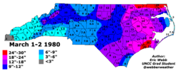
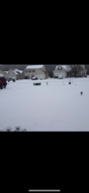
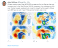
This was a good one too… I got that 6.3” on top of the 4” that had fallen on the 11th
-
Hello, please take a minute to check out our awesome content, contributed by the wonderful members of our community. We hope you'll add your own thoughts and opinions by making a free account!
You are using an out of date browser. It may not display this or other websites correctly.
You should upgrade or use an alternative browser.
You should upgrade or use an alternative browser.
Pattern Failbruary Thread
- Thread starter SD
- Start date
olhausen
Member
SnowNiner
Member
I tend to lean on being done too honestly. Simply statistics of already having a 4 inch storm, what's the chances of another imby? That plus the issues we're having with the southern stream, generally dry ensembles till mid month, etc. Better chance than most years perhaps with cold nearby I guess. Hopeful, looking, but low expectations.
Heelyes
Member
L
Logan Is An Idiot 02
Guest
100% chance more snow
I thought the last 10 days of Feb is prime time around here but I'm a newbie
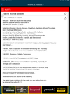
The 6 day period 2/26-3/3 has had more 6”+ snowstorms (7) at RDU than any other 6 day period:
Link:
Pattern - Failbruary Thread
Looking at OPs over ensembles especially in the long range is the fastest way to get the wrong result. All the signals are showing a prolonged cold extension with a potential of the southern jet ramping up some as the La Nina is starting to break down. Don't know about any winter storms but God...
southernwx.com
Do you happen to have the same info for CLTThe 6 day period 2/26-3/3 has had more 6”+ snowstorms (7) at RDU than any other 6 day period:
Link:
Pattern - Failbruary Thread
Looking at OPs over ensembles especially in the long range is the fastest way to get the wrong result. All the signals are showing a prolonged cold extension with a potential of the southern jet ramping up some as the La Nina is starting to break down. Don't know about any winter storms but God...southernwx.com
Do you happen to have the same info for CLT
No, sorry. But anyone could come up with the list of snowstorms on each date over whatever level they choose by going here though a lot of time would be needed to compile (that’s what I did for RDU):
ATLwxfan
Member

We have hope…in March…2009 to 2014 was awesome.
Sent from my iPhone using Tapatalk
SnowNiner
Member
I tend to lean on being done too honestly. Simply statistics of already having a 4 inch storm, what's the chances of another imby? That plus the issues we're having with the southern stream, generally dry ensembles till mid month, etc. Better chance than most years perhaps with cold nearby I guess. Hopeful, looking, but low expectations.
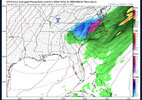
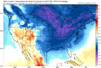
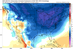
With that said, right now right at mid month looks like a chance, time frame to watch. Southern stream looks a bit more juiced to meet the cold. ?
ATLwxfan
Member
With that said, right now right at mid month looks like a chance, time frame to watch. Southern stream looks a bit more juiced to meet the cold.
View attachment 112505
View attachment 112506
View attachment 112507
It’s a precarious venture to see if mid February cold will actually verify.
Sent from my iPhone using Tapatalk
That March 1983 was definitely one to remember… CLT had 10.3” and from reading the snow depth records it actually stuck around for a couple days despite the high sun angle
We have hope…in March…2009 to 2014 was awesome.
Sent from my iPhone using Tapatalk
Januworry is prime climo for the Carolinas, but think some of the top snows have happened in March! Winters not over by a long shot! Put the MrGolf clubs away till AprilI thought the last 10 days of Feb is prime time around here but I'm a newbie
Not even CLOSE to being done. Something BIG on the horizon!!Curious if we took a poll real quick. Who thinks their backyard is done or not done for the winter.
Ill chalk up not done for mine. And this is with NOTTA showing for it on any models currently.
FACTSHowever from about 2/10 on, it seems that you have a better chance at a big dog if you get a storm. I’ve experienced some great storm in late February into March
I've convinced myself that winter was over starting in February from what Webber was saying. If we can continue the colder pattern, I'll be pleasantly surprised; especially if we can get snow.Curious if we took a poll real quick. Who thinks their backyard is done or not done for the winter.
Ill chalk up not done for mine. And this is with NOTTA showing for it on any models currently.
Heelyes
Member
Yeah Webbers never wrongI've convinced myself that winter was over starting in February from what Webber was saying. If we can continue the colder pattern, I'll be pleasantly surprised; especially if we can get snow.
Well, he hasn't made any, "I told you so" tweets yet, so I have a feeling it's not going to plan.Yeah Webbers never wrong
SnowNiner
Member
That March 1983 was definitely one to remember… CLT had 10.3” and from reading the snow depth records it actually stuck around for a couple days despite the high sun angle
Meh, not a fan of March snow at all. I'm in till 3/1 then I'm out. Never had a satisfying March snow that I can remember. So melty, non-sticky meh. Come March I'm ready for spring.
I wish I could remember 83, perhaps my opinion would be different. 09 was a slopfest imby.
NoSnowATL
Member
Keep us postedWell, he hasn't made any, "I told you so" tweets yet, so I have a feeling it's not going to plan.
Where were you at in March 2009? I lived in the Mallard Creek area of north Charlotte not far from Northlake Mall and had 6” with thundersnow… and the ground actually stayed fairly well covered for a couple days after.Meh, not a fan of March snow at all. I'm in till 3/1 then I'm out. Never had a satisfying March snow that I can remember. So melty, non-sticky meh. Come March I'm ready for spring.
I wish I could remember 83, perhaps my opinion would be different. 09 was a slopfest imby.
iGRXY
Member
Last storm we had where I really remember seeing transformers blowing left and right. March winter storms actually really deliver around here. They just don’t have staying power after it snows usuallyWhere were you at in March 2009? I lived in the Mallard Creek area of north Charlotte not far from Northlake Mall and had 6” with thundersnow… and the ground actually stayed fairly well covered for a couple days after.
SnowNiner
Member
Northwest Charlotte near Mt Holly Huntersville Road. Think had about 3 to 4 sloppy inches.Where were you at in March 2009? I lived in the Mallard Creek area of north Charlotte not far from Northlake Mall and had 6” with thundersnow… and the ground actually stayed fairly well covered for a couple days after.
Yes I remember having to drive to work at 4am in the morning as there was still some light snow falling. Harris Blvd in CLT was an absolutely mess and you could still see flashes from transformers blowing.Last storm we had where I really remember seeing transformers blowing left and right. March winter storms actually really deliver around here. They just don’t have staying power after it snows usually
Another coastal. Nice. ?
SE trend!Another coastal. Nice. ?
NBAcentel
Member
smast16
Member
Going with bull city. We done. SER is coming.Curious if we took a poll real quick. Who thinks their backyard is done or not done for the winter.
Ill chalk up not done for mine. And this is with NOTTA showing for it on any models currently.
smast16
Member
If you like cold temps, don't look at the 00z Gfs. It's all just meh.
Yea he had me convinced as well. Telling you I was out planting trees the week between Christmas and New Year. Told the familia if we get 30 minutes of snow and the mulch covers up, its a win this year. Almost 5 weeks latter and we have had 4 stellar events that involved all snow and some sleet. Still with the warm rain, we have the last little bit preserved by the shade about to bite the dust/melt off today. Sitting right at 9 for the year. Could have easily ended up 15-20 range. The hardest and prettiest snow was the 1st we had the day the temps flipped. Believe it was upper 50's/ close to 60 at midnight and by 8am poured snow for about 5 hours.I've convinced myself that winter was over starting in February from what Webber was saying. If we can continue the colder pattern, I'll be pleasantly surprised; especially if we can get snow.
2 of the 3 biggest snows I've seen in person in NC are
February 28 2004 =17.5
March 1993 = 15+
Also think off the top of my head late Feb into March 2013 ( may be year, could be 2014/ cant remember) we had like 3-4 frozen events ( mostly ice). I do know we where in a La nina year. Think we lucked up and caught a rabbit in the hat out in the NE Pacific/ pattern for a few weeks.
NBAcentel
Member
Stephenb888
Member
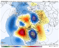
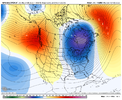
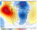
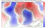
Looks great but can we finally get a gulf low that rides up the coast instead of out to sea?Western ridge this past jan and being modeled again is on roids, ensembles look great View attachment 112538View attachment 112541View attachment 112540
SnowNiner
Member
Looks great but can we finally get a gulf low that rides up the coast instead of out to sea?
Yeah, doesn't look like it. Looks pretty dry to me overall. Doesn't mean something can't pop, but we're likely looking to mid month before something can get going imo. 6Z starts to juice up mid month but it looks like cutters this run. I'll take a cutter at this point. It's been so long since anything amped. Lol.


NBAcentel
Member
We were bn for precip in jan for CLT yet it was the snowiest jan in a while,Yeah, doesn't look like it. Looks pretty dry to me overall. Doesn't mean something can't pop, but we're likely looking to mid month before something can get going imo. 6Z starts to juice up mid month but it looks like cutters this run. I'll take a cutter at this point. It's been so long since anything amped. Lol.

s
Last edited:
- Joined
- Jan 23, 2021
- Messages
- 4,602
- Reaction score
- 15,197
- Location
- Lebanon Township, Durham County NC
Lots of banter in this thread, we literally have 2 other threads specifically for that and especially the whamby for all the "we're done", weather whining post. Going to start deleting post as we move forward and this thread becomes more active.
First you need the cold for any wintry weather. It's pretty obvious, but that's the first thing to look for. So, check, we'll have the cold. Feb is usually a stormier month, too. I'm sure there will be a good chance or two going forward.
SnowNiner
Member

