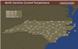
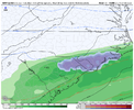
@metwannabe wedge there yet?
-
Hello, please take a minute to check out our awesome content, contributed by the wonderful members of our community. We hope you'll add your own thoughts and opinions by making a free account!
You are using an out of date browser. It may not display this or other websites correctly.
You should upgrade or use an alternative browser.
You should upgrade or use an alternative browser.
Pattern Fail or Fab February 2023 Pattern Thread
- Thread starter RBR71
- Start date
W
WSW
Guest
Yeah, but their events are always pretty small. Every time i see Dallas and wintry weather its like this tiny little ice coating...LOLMeanwhile Dallaska strikes again. So sick of hearing about winter in Texas. At least we have the snowless I-95 corridor to warm the cockles of our hearts.
Sent from my iPhone using Tapatalk
J1C1111
Member
Sent from my iPhone using Tapatalk
[/QUOTE]
[/QUOTE]
I agree. It's a huge cut off down there for you guys as well. I've experienced it several times over and it's real. Feast or famine. Since we're talking about gradients im going to throw in the Rutherford county nc gradient. It's one that never gets much mention but it should with the elevation change as there's a huge gradient here in the county and if you have lived here long enough you know. You go from the upstate to the mountains from the southern end of the county to the north western end of the county. From the state line NC/SC state line just out of Chesnee in to RC to Chimney Rock there is a crazy difference in elevation and snow totals north to south. I'm a mile south of the 74 bypass sitting at 1000ft elevation and there's a big gradient there as well 74 south to 74 north with the snow totals. Just one example off the top of my head Dec 18 2009. Chesnee maybe around 2 inches. My location Danieltown right off of 221 5 miles south of Rutherfordton 6 inches. Rutherfordton 10 inches and Chimney Rock 14 inches in that storm. Elevation is king.Just to reinforce some of what's been posted here today about the 85 Gradient.
There's a reason why !
Also that pic that IGRXY posted was very telling.
You see the sharp cutoff in GVL & Spg counties.
On this board you always hear about the Wake gradient but,
That's not nearly as noticable to my eyes on that pic as in SC.
You can distinctly see the difference in what looks to be measurable snowfall just a few miles to nothing.
18z gfs was a wedge machine
I think it’s not out of the realm of possibility to see some freezing drizzle or rain from Raleigh and places NW late Wednesday night into Thursday morning. Some short range models have us flirting with freezing with some precip in the area. Key would be getting the precip in early enough and also making it down to freezing. Best chance would be around @metwannabe 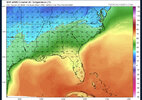

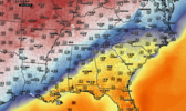
Not yet but it's knocking on the door. It should be rather noticeable when it drops through@metwannabe wedge there yet?
Excited to track my first big gradient drop on my weather station like all of you and be able to post my fancy graph ? lolNot yet but it's knocking on the door. It should be rather noticeable when it drops through
Drizzle Snizzle
Member
What kind of weather station ?Excited to track my first big gradient drop on my weather station like all of you and be able to post my fancy graph ? lol
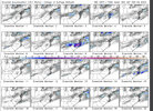
When cold chasing moisture does work at all, it's setups like this. If can get a slp to form to hekp slow precip exit some and orientation of caa (more northerly component and not w/nw) then maybe just maybe a few lucky souls see those splattering raindrops on the windshields lolCan’t imagine the GEFS pulling something out here but the majority want to mix in some sort of snow flakes on the northern edge of precip. About as razor thin of a margin as we can get. (Don’t look at member 8) View attachment 131933
What kind of weather station ?

WeatherFlow Tempest ???What kind of weather station ?
ATLwxfan
Member
Yeah, but their events are always pretty small. Every time i see Dallas and wintry weather its like this tiny little ice coating...LOL
Umm…they get events. In town Atlanta hasn’t in half a decade, token flakes notwithstanding.
Sent from my iPhone using Tapatalk
Itryatgolf
Member
They fixing to get an ice storm with main trough swinging out tomorrowUmm…they get events. In town Atlanta hasn’t in half a decade.
Sent from my iPhone using Tapatalk
ATLwxfan
Member
They fixing to get an ice storm with main trough swinging out tomorrow
That’s on top of what they’ve had the last two days. That said they can keep the ice storm.
Sent from my iPhone using Tapatalk
Flotown
Member
interestingCan’t imagine the GEFS pulling something out here but the majority want to mix in some sort of snow flakes on the northern edge of precip. About as razor thin of a margin as we can get. (Don’t look at member 8) View attachment 131933
CNCsnwfan1210
Member
It probably doesn't mean a hill of beans, but GFS showing a trend of a slower exit of precip on Friday

Sent from my SM-A136U1 using Tapatalk

Sent from my SM-A136U1 using Tapatalk
It could mean a hill of slushy raindrops thoughIt probably doesn't mean a hill of beans, but GFS showing a trend of a slower exit of precip on Friday
Sent from my SM-A136U1 using Tapatalk
Last edited:
CNCsnwfan1210
Member
Trying to find a silver lining somewhere
Sent from my SM-A136U1 using Tapatalk
Sent from my SM-A136U1 using Tapatalk
I'm with you, actually slowing precip down is first step in direction of any snowflakes on backsideTrying to find a silver lining somewhere
Sent from my SM-A136U1 using Tapatalk
- Joined
- Jan 23, 2021
- Messages
- 4,602
- Reaction score
- 15,197
- Location
- Lebanon Township, Durham County NC
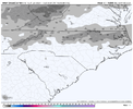
There's one member that went bonkers that skews it. I think only 3 or 4 members have snow and the ptype pop is 15%. All of that said I'm in why notOf course, don’t take the accumulations seriously but there is a little bit of noise on SREF
View attachment 131934
- Joined
- Jan 23, 2021
- Messages
- 4,602
- Reaction score
- 15,197
- Location
- Lebanon Township, Durham County NC
We had 30% ish of GEFS members. Waiting to see if that goes up.There's one member that went bonkers that skews it. I think only 3 or 4 members have snow and the ptype pop is 15%. All of that said I'm in why not
Flotown
Member
i see 13 with some (at my house)should be taken serious or not??Can’t imagine the GEFS pulling something out here but the majority want to mix in some sort of snow flakes on the northern edge of precip. About as razor thin of a margin as we can get. (Don’t look at member 8) View attachment 131933
Also with the trajectory that the cold air is coming in, this is way that it can push in faster than what we typically see east of the mountainsI'm with you, actually slowing precip down is first step in direction of any snowflakes on backside
- Joined
- Jan 23, 2021
- Messages
- 4,602
- Reaction score
- 15,197
- Location
- Lebanon Township, Durham County NC
17/30 GEFS members have some snow at IGX. 16/30 at RDU. 15/30 at TDF.
?
?
rburrel2
Member
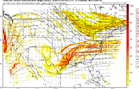
Usually they do. I seem to remember the Euro and few EPS panels were trying to that a couple days ago. Honestly these are the type of trends that can happen inside of 72 hours that can make things interesting.If our s/w could get a little more neutral tilt before it shears out this could trend in to something. Don't these normally hold together a little better than models show sometimes?
View attachment 131940
I agree. It's a huge cut off down there for you guys as well. I've experienced it several times over and it's real. Feast or famine. Since we're talking about gradients im going to throw in the Rutherford county nc gradient. It's one that never gets much mention but it should with the elevation change as there's a huge gradient here in the county and if you have lived here long enough you know. You go from the upstate to the mountains from the southern end of the county to the north western end of the county. From the state line NC/SC state line just out of Chesnee in to RC to Chimney Rock there is a crazy difference in elevation and snow totals north to south. I'm a mile south of the 74 bypass sitting at 1000ft elevation and there's a big gradient there as well 74 south to 74 north with the snow totals. Just one example off the top of my head Dec 18 2009. Chesnee maybe around 2 inches. My location Danieltown right off of 221 5 miles south of Rutherfordton 6 inches. Rutherfordton 10 inches and Chimney Rock 14 inches in that storm. Elevation is king.[/QUOTE]Sent from my iPhone using Tapatalk
Preach. I live In Bostic which is maybe 6-10 miles N of your location. The cherry mountain chain ( 1,600’) is right in front of me and yellow top to my NNE.
Right at 1000’ here with 1,100 close by.
The gradient is super tight through here!
Sent from my iPhone using Tapatalk
You’ll have that on those big arctic outbreaks like this one ?
W
WSW
Guest
Low to mid 30's right now in Northern Virginia.
Yep in true backdoor front fashion, down to 46 here now.
You can see it here: http://hint.fm/wind/Yep in true backdoor front fashion, down to 46 here now.
Itryatgolf
Member
SD, there is a cold front somewhere ?
- Joined
- Jan 23, 2021
- Messages
- 4,602
- Reaction score
- 15,197
- Location
- Lebanon Township, Durham County NC

