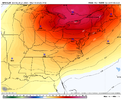
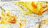
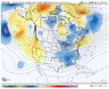
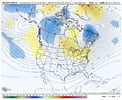
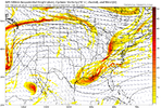
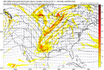
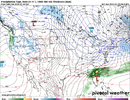
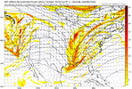
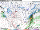
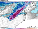
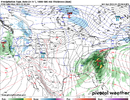
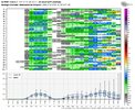
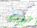
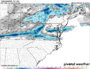
Sucks the gfs has the sub 850 layer roaring out of the S. We actually have a great column for snow minus about 875-950
-
Hello, please take a minute to check out our awesome content, contributed by the wonderful members of our community. We hope you'll add your own thoughts and opinions by making a free account!
You are using an out of date browser. It may not display this or other websites correctly.
You should upgrade or use an alternative browser.
You should upgrade or use an alternative browser.
Pattern Fail or Fab February 2023 Pattern Thread
- Thread starter RBR71
- Start date
Webberweather53
Meteorologist
rburrel2
Member
That gfs run is an ugly zr scenario from US1 west. Dews in the upper single digits to teens when this gets going it would be hard to push that above freezing until you've dropped .25-.5 of qpfSleet never a doubt View attachment 131658
JHS
Member
I'm not sure it warms up as much as shown either since a high pressure center pops nearby. Another .25 could fall before it warms up. 28 near Columbia SC and 33 in the GSP metro is suspect too for a CAD event.That gfs run is an ugly zr scenario from US1 west. Dews in the upper single digits to teens when this gets going it would be hard to push that above freezing until you've dropped .25-.5 of qpf
rburrel2
Member
Still a lot of time for large scale things to change, but in a general sense we do well in these scenarios where we get a cold/dry airmass entrenched at the surface and then have to worry about the main CAD high pulling out to sea. The leftover in-situ wedge/high usually performs better/stronger/colder than models show, even in the short range.That gfs run is an ugly zr scenario from US1 west. Dews in the upper single digits to teens when this gets going it would be hard to push that above freezing until you've dropped .25-.5 of qpf
Webberweather53
Meteorologist
DobsonCityWx
Member
I’m not buying the snow solution either we need to rely on this big high cad in an otherwise gay pattern. We can get the temperatures at the surface and let the higher levels blaze. Then we will just need moisture which I will have more to talk about later this week. I could the setup favoring more east and less further west and north.
rburrel2
Member
I'm hoping we do both!I would personally rather phase -->bomb this than hope for insitu/hybrid wedging but I'm speaking for mby onlysince my location is meh in wedgingView attachment 131662
Cary_Snow95
Member
Realistically with that look verbatim how much cold air could we wrap down with a phase
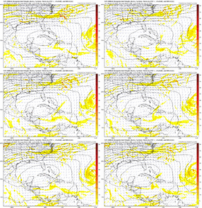
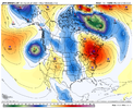
JMA definitely has the best look at day 7 as it wants to dig a deeper low anomaly to the south into the S Plains with weaker anomaly running west to east into the Great Lakes. Any quicker and/or stronger low anomaly / waviness running west to east into the Great Lakes will want to kick our damming high off the coast quicker.If this threat comes to fruition I just want to point out the JMA lead the way... and it's honking again today.View attachment 131649
JMA images…
- Joined
- Jan 23, 2021
- Messages
- 4,602
- Reaction score
- 15,197
- Location
- Lebanon Township, Durham County NC
A sentence no one has ever said
Crazy how this has turned around the last couple of days. We went from a possible day 7 storm to nothing, and now here we are with potentially two events in the next 7/8 days.So the 18z GFs has two events for us to look at: Day 5/6 and day 7/8
I would expect 0 events or you may end up very disappointed againCrazy how this has turned around the last couple of days. We went from a possible day 7 storm to nothing, and now here we are with potentially two events in the next 7/8 days.
Cary_Snow95
Member
Cary_Snow95
Member
NCHighCountryWX
Member
- Joined
- Dec 28, 2016
- Messages
- 699
- Reaction score
- 1,918
Another good NC High Country snow upcoming this week. That will make 8 for the season so far and around 40” in the best locations
Don’t miss out by just focusing on one’s ‘back yard’.
Don’t miss out by just focusing on one’s ‘back yard’.
iGRXY
Member
GFS was close
LukeBarrette
im north of 90% of people on here so yeah
Meteorology Student
Member
2024 Supporter
2017-2023 Supporter
Seems like it’s alway close but no cigar. Tired of it.GFS was close
I would have had 40 inches so far based on GFS close but no cigar. Its never right anymore unless within 3 days and that's a stretchSeems like it’s alway close but no cigar. Tired of it.
lexxnchloe
Member
GFS was close
Close to what? Alot further away from 6 hours ago.
Another good NC High Country snow upcoming this week. That will make 8 for the season so far and around 40” in the best locations
Don’t miss out by just focusing on one’s ‘back yard’.
Yeah. We made the drive to beech last week to hit the sledding hill. Totally worth it but not the same as back yard snow. Super cool though.
Sent from my iPhone using Tapatalk
CNCsnwfan1210
Member
6z GFS showing frozen precip for parts of NC/SC next weekend.

Sent from my SM-A136U1 using Tapatalk

Sent from my SM-A136U1 using Tapatalk
Nomanslandva
Member
Last nights EPS was so much worse than 24 hours ago for next weekend. I got a lot of firewood ready yesterday because it looks like a pretty gloomy and cool week ahead.
And just to think if most or all of this precipitation was overrunning in a frozen form, what a storm it would have been.Can’t help laugh…probably the most miserable winter that I can remember. Just a complete washout this week. ???
View attachment 131690
Webberweather53
Meteorologist
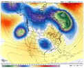
every time i see your little hurricane avatar i know you're going to post something that puts me in a worse moodThere's one trend you can usually bank on when it comes to the GFS:
The subtropical ridge trending stronger inside the medium range.
View attachment 131691
NoSnowATL
Member
Y’all might want to lower that wall.
LukeBarrette
im north of 90% of people on here so yeah
Meteorology Student
Member
2024 Supporter
2017-2023 Supporter
I can tell you with 100% certainty that none of that 2 inches at my house would actually stick

