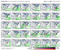
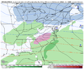
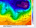
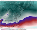
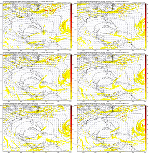
Anyone notice how we have pretty good runs at 12z but all the overnight stuff sucks?
-
Hello, please take a minute to check out our awesome content, contributed by the wonderful members of our community. We hope you'll add your own thoughts and opinions by making a free account!
You are using an out of date browser. It may not display this or other websites correctly.
You should upgrade or use an alternative browser.
You should upgrade or use an alternative browser.
Pattern Fail or Fab February 2023 Pattern Thread
- Thread starter RBR71
- Start date
NBAcentel
Member
Handful of members with insentropic upglide sat night over the CAD dome. I like those setups there pretty Efficient at accruing
Ha ha.. yeah, I'll wake up at night to disappointment, then have the 6z bring something back, then have the 12z show some real promise, which then leads into 18z happy hour.Anyone notice how we have pretty good runs at 12z but all the overnight stuff sucks?
Yeah with SER flexing it’s going to be really hard to get snow… maybe we get lucky and get a strong FGEN band to set up a front end thump, but other than that the big hope would be to keep 925s cold enough to favor more sleetMany gonna have to realize this isn’t a great setup for snow, but rather for sleet/ice. I think I’m down bad to the point where I’d take anything however and be happy
NBAcentel
Member
I bet CMCE will be excited
rburrel2
Member
Hopefully the euro and EPS jump on board today, because they were really bad last night with respect to getting a storm/precip. I'm optimistic b/c it seems most models have trended trended better since then but who knows.
Webberweather53
Meteorologist
Hopefully the euro and EPS jump on board today, because they were really bad last night with respect to getting a storm/precip. I'm optimistic b/c it seems most models have trended trended better since then but who knows.
These 50-50 lows are so fickle this far out.
Over the years, I’ve noticed models have a habit of being too progressive with big 50-50s like this & it’s one reason why CAD events usually trend better inside the medium range (day 5-7 ish & in)
iGRXY
Member
This has the makings of a pretty significant event. Stronger subtropical ridge, the airmass over Southeast Canada is the coldest in the northern hemisphere. Mixing airmasses like that screams precipitation and especially if we can trend our energy stronger and further south as it comes across the plains. If we can get a 1040+ and honestly seeing the GFS spitting out 1050 HP and the CMC have a 1044 the idea of at least a 1040 isn't out of the question. Even in a progressive flow, a deepening 50/50 low will slow things down enough and having that strong of a HP sitting over that type of cold will lock in some pretty cold low level temperatures even with a Sliding east HP. Don't forget that the precipitation also locks in CAD as well. It will be interesting to see if we can get some FGEN driven front end snow as well.
Let’s pump the breaks a bit before we start talking about FGEN snow lol.. let’s just see if we can keep the storm signal .. we may have cold but it’s still a delicate balance between perfect amount of cold and storm placement and storm strength .. this could easily be onset ice to rain deal let’s take it one step at a timeThis has the makings of a pretty significant event. Stronger subtropical ridge, the airmass over Southeast Canada is the coldest in the northern hemisphere. Mixing airmasses like that screams precipitation and especially if we can trend our energy stronger and further south as it comes across the plains. If we can get a 1040+ and honestly seeing the GFS spitting out 1050 HP and the CMC have a 1044 the idea of at least a 1040 isn't out of the question. Even in a progressive flow, a deepening 50/50 low will slow things down enough and having that strong of a HP sitting over that type of cold will lock in some pretty cold low level temperatures even with a Sliding east HP. Don't forget that the precipitation also locks in CAD as well. It will be interesting to see if we can get some FGEN driven front end snow as well.
rburrel2
Member
In a broader sense... seems like most of the models have our wetbulb temps around 23-25 Sunday morning thanks to the dry air blast from the wedge/CAD high. As such, even if/when we see the parent high move off the coast... you'd be looking at freezing rain lasting quite a while as we slowly warm from 23-25 to 32 with latent heat release. I don't see any mechanism to scour the remnant wedge so I think we would be in one of those latent heat release warming to end ice situations as it stands.
TLDR, if we actually get steady precip starting Sunday morning, the insitu wedge conditions look to be cold/dry enough for significant ice accretions before warming to freezing. imo (assuming the models/ensembles are right on the CAD strength and cold air transport Saturday).
TLDR, if we actually get steady precip starting Sunday morning, the insitu wedge conditions look to be cold/dry enough for significant ice accretions before warming to freezing. imo (assuming the models/ensembles are right on the CAD strength and cold air transport Saturday).
iGRXY
Member


The airmass is so cold we are already well below freezing before the first drop of precip reaches us. Also the first clue of a really good deep cold airmass for CAD is when you have single digit dews on the Va/NC border. That has to happen
iGRXY
Member
Nobody is talking about this being a done deal lol. Simply pointing out that tends to be a typical process of overrunning especially with airmasses this cold and WAA being forced over it.Let’s pump the breaks a bit before we start talking about FGEN snow lol.. let’s just see if we can keep the storm signal .. we may have cold but it’s still a delicate balance between perfect amount of cold and storm placement and storm strength .. this could easily be onset ice to rain deal let’s take it one step at a time
rburrel2
Member
I'm a little worried about relying on the isentropic upglide over a wedge as the main driver of precip Sunday morning. I mean it's certainly possible, but we had a recent wedge event where that was forecasted and wound up never materializing(maybe 2019 or 2020). We were forecasted to get roughly .1-.2 liquid from the upglide before a front pushed through and most places wound up getting either nothing and a trace... when the main front came through 8-10 hours later we had finally warmed to around 32 and that fell as just rain as expected.
Every setup is different though and this one could work out well.
Every setup is different though and this one could work out well.
Last edited:
iGRXY
Member
We will need a strong and deepening wave as it comes into the southeast. The CMC showed this. Once you get that you won't have any issues getting isentropic upglide and forcing. Right now the Cold air isn't the issue. We are going to have exceptionally cold air to our north and a H5 pattern that supports CAD. It's really just a matter of getting the energy to dig far enough south and be strong enough to not get squashed by the TPV sliding east.I'm a little worried about relying on the isentropic upglide as the main driver of precip Sunday morning. I mean it's certainly possible, but we had a recent wedge event where that was forecasted and wound up never materializing(maybe 2019 or 2020). We were forecasted to get roughly .1-.2 liquid from the upglide before a front pushed through and most places wound up getting either nothing and a trace... when the main front came through 8-10 hours later we had finally warmed to around 32 and that fell as just rain as expected.
Every setup is different though and this one could work out well.
Euro looks like a swing and a miss ?? let’s not get too excited lol
WXinCanton
Member
Euro has a 1028 HP ?
NBAcentel
Member
Euro had a 1042 but kicked out real quickEuro has a 1028 HP ?
iGRXY
Member
Euro had a 1042 but kicked out real quick

By the time the wave makes it to the southeast, our High is about 1000 miles due east of Newfoundland lol
It may very well be right, but is it just me or has the Euro become the model with more of a progressive bias. You used to never see it move features faster than the GFS
By the time the wave makes it to the southeast, our High is about 1000 miles due east of Newfoundland lol
Webberweather53
Meteorologist
I'm having a hard time buying the progressive solutions w/ the 50-50 low.
It's a tough sell for me knowing a persistent, shallow, and unusually intense cold air mass sitting east of the Appalachians will tug on/slow down the +PVa aloft more than forecast by NWP (through generation of low-mid level static stability above the CAD dome >> +PV )
Here's the graphic I made ~ 5 weeks ago to explain how this physical process works:
If we had -NAO over the top, the easterly flow under the ridge would slow this trough down even further, but beggars can't be choosers.
Last edited:
iGRXY
Member

EPS is similar to the OP in lifting the 50/50 out fast. Like Webber said, deepening 50/50 lows slow the progression of the pattern so I am a little skeptical myself. (Those big fantasy runs we had this month was typically due to a deepening 50/50 low that slowed the progression of the N/S). A -NAO would put the 50/50 in neutral. RIght now the EURO and EPS have this thing going 70 mph. A deepening 50/50 with no -NAO will be more like slowing up to 40mph, which is really all we need right now. The trailing wave is only about a day too slow right now which is nothing at this range.
Nomanslandva
Member
Yea, looks like white rain to me, but it would be the best we've had, so... Im behind and getting caught up and with 4 pages this afternoon, there must be some more excitement ahead.I can tell you with 100% certainty that none of that 2 inches at my house would actually stick
rburrel2
Member
LukeBarrette
im north of 90% of people on here so yeah
Meteorology Student
Member
2024 Supporter
2017-2023 Supporter
Definitely hoping for a slight win with thisYea, looks like white rain to me, but it would be the best we've had, so... Im behind and getting caught up and with 4 pages this afternoon, there must be some more excitement ahead.
I'm having a hard time buying the progressive solutions w/ the 50-50 low.
It's a tough sell for me knowing a persistent, shallow, and unusually intense cold air mass sitting east of the Appalachians will tug on/slow down the +PVa aloft more than forecast by NWP (through generation of low-mid level static stability above the CAD dome >> +PV )
Here's the graphic I made ~ 5 weeks ago to explain how this physical process works:
If we had -NAO over the top, the easterly flow under the ridge would slow this trough down even further, but beggars can't be choosers.
I seem to remember that around 5-7 days before last years storm on 1/16, the models… I think the Euro and UK especially were trying to move the 50/50 low out to fast. It would make sense that it should slow down and every thing behind if it’s deepening as much as modeled. Your right though that it’s shame we couldn’t get one in place a few weeks back when we had a strong negative NAO
- Joined
- Jan 23, 2021
- Messages
- 4,602
- Reaction score
- 15,197
- Location
- Lebanon Township, Durham County NC
Webberweather53
Meteorologist
GFS keeps amping the subtropical ridge more over the Gulf in the short range.
NBAcentel
Member
Big difference vs the failed 50/50 from jan, was the fact that in that January head fake storm, it was driven off a random piece of energy diving down around Atlantic Canada in a fast progressive pattern, that was limited on cold. this Time we already have tons of cold on top, and a big TPV, but pattern is still somewhat progressive. But a big wound up TPV is harder to move Vs a random piece of N/S energy. H5 imo is better this time.
Webberweather53
Meteorologist
This is a comical subtropical ridge trend. I expect nothing less from the GFS
View attachment 131743
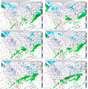
Yeh that's pretty bad.
iGRXY
Member
Good and bad things. Will help supply more WAA to drive overrunning as long as we get the 50/50 to continue to slow but you're quickly tilting to a heavy Ice storm potential here with added WAA aloft.This is a comical subtropical ridge trend. I expect nothing less from the GFS
View attachment 131743
iGRXY
Member
Day 5 and it changed that much in 48 hours.View attachment 131744
Yeh that's pretty bad.
Webberweather53
Meteorologist
View attachment 131744
Yeh that's pretty bad.
This well known weak subtropical ridge bias in the GFS (which also shows up in the hurricane season and is probably related to the model’s CP scheme) is another reason why I didn’t like this event several days ago. Hopefully a few folks find a way to get some sleet or snow at the onset
iGRXY
Member


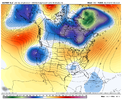
Stronger TPV and one that is further south. Also looks like the 2nd system is coming in faster out of the northwest. That stronger TPV should continue to help slow the progression if this continues in future runs.
iGRXY
Member

50/50 is about 14 millibars stronger and is slower. n extremely stout HP as well
iGRXY
Member

50/50 is about 14 millibars stronger and is slower. n extremely stout HP as well

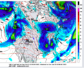
You can see the 50/50 deepening and slowing way down. That's the type of trend you want to see as it will quickly slow our HP way down. And folks that sucker is legit. basically another 1050.
packfan98
Moderator
Where’s the precip going to come from? Everything looks anemic at the times we are cold enough.
You can see the 50/50 deepening and slowing way down. That's the type of trend you want to see as it will quickly slow our HP way down. And folks that sucker is legit. basically another 1050.

