DT I think summed it up pretty well this evening...........
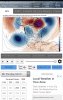
ABOUT FEB 12 **POSSIBLE** THREAT FOR SNOW ICE VA MD WAV DEL PA NJ
WXRISK.COM·
WEDNESDAY, FEBRUARY 6, 2019
The mild interval is going to come to an end on Friday night / Saturday morning as a strong cold front moves across the Appalachian Mts and n sweeps through the East Coast during the predawn hours on Saturday. Indeed by Saturday 7:00 AM most temperatures over central and Eastern Virginia will be in the middle 20s low 20s over most of central and Eastern Maryland... upper 20s over the northern third of North Carolina and in the 18-22 degree range of over southwest Virginia ...the Shenandoah Valley western Maryland ...and West Virginia.
This weekend will end up being seasonally cold both Saturday Sunday and even into Monday before the next event arrives.
On Monday a reinforcing cold front coming of the Midwest will push through the region with and stall over Arkansas Tennessee and North Carolina. The front will probably have some showers with it as it pushes through the Middle Atlantic region. Behind the front a new arctic HIGH will move across the Great Lakes into southeastern Canada and northern New England for the first half of next week. The movement of this cold HIGH pressure area will drive a colder temperatures into the Middle Atlantic region.
To the south a wave of LOW pressure will develop on the front Monday night into Tuesday morning..
The operational regular GFS model as well as the high resolution improved FV3 model develops this wave of LOW pressure and produces significant overrunning precipitation across Virginia Maryland Delaware West Virginia the and then up into Pennsylvania and New Jersey on Tuesday, February 12-13.
According to these models because of the area of HIGH pressure still located over Montreal Canada and northern New England ...the LOW level temperatures will be cold enough to support sleet and snow at the start of the precipitation from the Virginia / North Carolina border northward into PA. This results in several inches of snow across a good portion of Virginia -except for Hampton roads - as well as portions of Maryland and West Virginia.
The problem with this scenario is twofold.
First the European model and the European ensembles do NOT support this an area. They have less cold air coming southward on Monday, February 11 so the temperatures are only cold enough to support sleet and freezing rain over the northwest third of Virginia and central and Western Maryland. The rest of the Middle Atlantic region sees all rain according to the European model
SECOND problem with this winter weather event scenario the is that the overall upper air pattern is generally not supportive of the winter weather type of situation for the Middle Atlantic region.
Typically For the East Coast winter weather pattern we like to see a ridge over the West Coast and Rockies and a trough over the eastern US However the overall Jet stream pattern across North America currently features a deep broad trough over the West Coast and Rockies. And this corresponds to a ridge over the Southeastern states (which is why it has been so warm over the past few days). This pattern does NOT change next week and as a result it makes it very difficult to get a moderate or significant east coast Low pressure areas that bring about winter storms for the Middle Atlantic region.
Indeed even if the GFS model solutions turns out to be correct the whole event is still turns over rain as a big area of LOW pressure develops over Missouri and moves into Illinois and close to Chicago on February 12 and 13.
At this point is difficult to say which solution is correct but I am against the idea of a significant snowfall in the Middle Atlantic region. I think the European solution of seeing some ice over the northwest third of Virginia .. western and central Maryland and the eastern third of West Virginia is probably the correct scenario.
Experience in the overall patterns across North America is hard to ignore the and right now the pattern does not support a big event next week for the Middle Atlantic region")


.png")