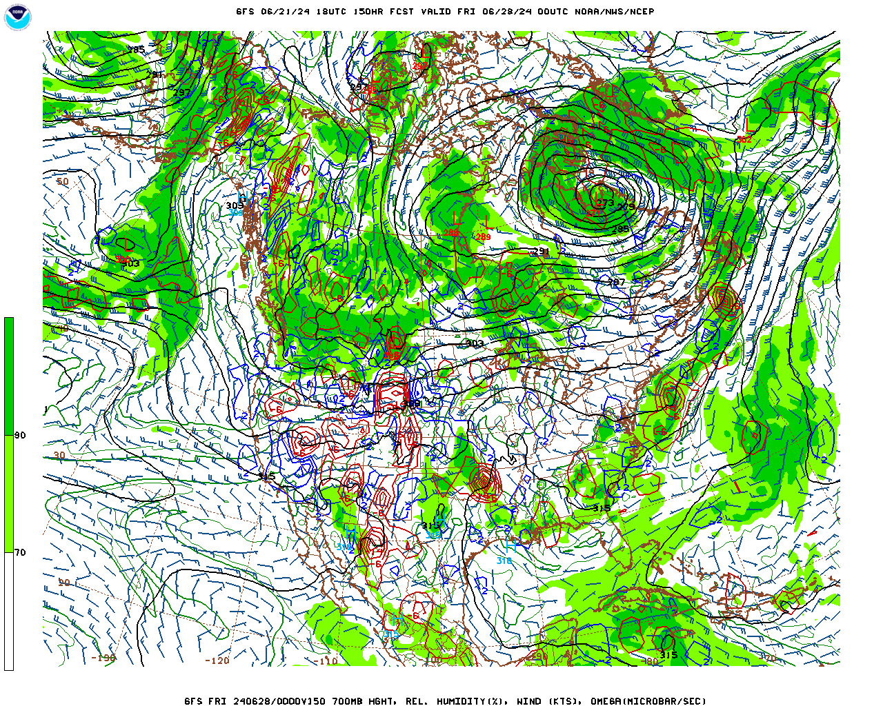
And there it is folks. that high to the north means business! This is what could happen around 2/1-3. The ZR on this is major. That isn't snow in SE GA/coastal SC. That is mainly ZR I think..
-
Hello, please take a minute to check out our awesome content, contributed by the wonderful members of our community. We hope you'll add your own thoughts and opinions by making a free account!
You are using an out of date browser. It may not display this or other websites correctly.
You should upgrade or use an alternative browser.
You should upgrade or use an alternative browser.
Pattern Fabulous February
- Thread starter PEA_RIDGE
- Start date
packfan98
Moderator
Well ----. Lol
Sent from my iPhone using Tapatalk
I've learned from many years reading his posts on American WX as well as his current posts on this forum that when "Larry starts crowing get the snow blowers going!" He has an uncanny ability to call out winter storms for the SE well in advance based on his vast knowledge of weather history for this area. He has a better than average track record for storms in the 7-10 day range. Not to take anything away from Delta, Webb, 1300m, etc. but for a non-professional, I take extra notice when Larry starts honing in on pattern trends and dates. So, Larry let us know when you officially go into "crowing mode!" Please move to banter if needed.And there it is folks. that high to the north means business! This is what could happen around 2/1-3.
whatalife
Moderator
Yeah that is what I say too. NW trend will not be kind to us on a storm 9 days out as modeled...LOLWell poop. Lol
packfan98
Moderator
I didn't see a whole lot of support for the Feb storm on the EPS that the operational had.
whatalife
Moderator
I didn't see a whole lot of support for the Feb storm on the EPS that the operational had.
You have some suppressed members and a few members that support but it’s meh on it for now.
Sent from my iPhone using Tapatalk
Kylo
Member
Webberweather53
Meteorologist
Snow mean was weak but some members showing something day 8.
View attachment 13281
Verbatim support doesn't seem to be there using snow maps but closer inspection reveals there's a signal for a storm of some fashion in that timeframe.
Webberweather53
Meteorologist
Fyi, the GFS is consistently trending southward with the big PV lobe later next week which favors even colder air getting closer to the SE US. Having some snow cover on the ground from the preceding arctic front (or coastal low if you're in eastern NC) would certainly help produce bitterly cold, possibly record breaking cold temperatures if this trend were to continue.


GeorgiaGirl
Member
I've got a very weird feeling with this early February thing that if we see it work it's going to trend a bit north and wind up being an ice storm for areas in East Central Georgia through the midlands. Just a gut feeling really, would be happy to be wrong but we'll see, don't think we've really had any trends though except storms appearing off and on, but this period does seem to have some legs as a pattern breakdown storm.
Larry's already tried to make a call btw this winter, hopefully this call brings it.
Larry's already tried to make a call btw this winter, hopefully this call brings it.
I've got a very weird feeling with this early February thing that if we see it work it's going to trend a bit north and wind up being an ice storm for areas in East Central Georgia through the midlands. Just a gut feeling really, would be happy to be wrong but we'll see, don't think we've really had any trends though except storms appearing off and on, but this period does seem to have some legs as a pattern breakdown storm.
Larry's already tried to make a call btw this winter, hopefully this call brings it.
I don't know if there were to be something major the rest of winter for much of the forum that it would be during this period. Climo/history peak has actually been a bit further into Feb than this fwiw. But I do know that this high is progged to have the coldest temps in Chicago and good chuck of the Midwest in many years by a good margin and that it obviously will very likely be the coldest of the entire winter. When there is an a very rare extremely cold Midwest high that doesn't plunge down into the SE with bitter and dry NW winds but instead sort of skims the SE with the bottom of the very cold via cold enough for trouble NE winds/wedge, that's a recipe for a potential rare deep SE major wintry event including major ZR. That being said, the odds are high nothing like this will be on the next run.
In other words, about a "1" on the crow meter! Don't worry, Larry...if we have to wait until later in the month for peak climo to get a deep south snow or ice event, it'll be worth it!I don't know if there were to be something major the rest of winter for much of the forum that it would be during this period. Climo/history peak has actually been a bit further into Feb than this fwiw. But I do know that this high is progged to have the coldest temps in Chicago and good chuck of the Midwest in many years by a good margin and that it obviously will very likely be the coldest of the entire winter. When there is an a very rare extremely cold Midwest high that doesn't plunge down into the SE with bitter and dry NW winds but instead sort of skims the SE with the bottom of the very cold via cold enough for trouble NE winds/wedge, that's a recipe for a potential rare deep SE major wintry event including major ZR. That being said, the odds are high nothing like this will be on the next run.
Webberweather53
Meteorologist
Cute little wave trying to get its act together in the northern Gulf on this GFS run by the 31st, our primary wave that could trigger an overrunning event in the Feb 1-3 timeframe is entering stage left as the big cold vortex departs. It really is a classic setup for a nice southern US event in a general sense, just need to get the pieces in the right places at the right time.


Cute little wave trying to get its act together in the northern Gulf on this GFS run by the 31st, our primary wave that could trigger an overrunning event in the Feb 1-3 timeframe is entering stage left as the big cold vortex departs. It really is a classic setup for a nice southern US event in a general sense, just need to get the pieces in the right places at the right time.
View attachment 13325
Lots of moisture pooling along the old front on the FV3. Just need the wave.

GaWx & Stormsfury are really good when it comes to rare deep south events in the medium-long term. If you're around the CAE and South, pay close attention to their posts for sure. They know this area well.
Webberweather53
Meteorologist
pcbjr
Member
NBAcentel
Member
You really got to like this look, especially if your east of the apps, nice 50/50 low feature, ensembles continue to hint at some storm late next week during this time, what a good look that is, also with that western ridge, I would not be surprised if there is a winter storm at this timeframe then things switch back to average, but this setup kinda resembles the first week of December at H5

dsaur
Member
Could be my fabled sleet stormI've got a very weird feeling with this early February thing that if we see it work it's going to trend a bit north and wind up being an ice storm for areas in East Central Georgia through the midlands. Just a gut feeling really, would be happy to be wrong but we'll see, don't think we've really had any trends though except storms appearing off and on, but this period does seem to have some legs as a pattern breakdown storm.
Larry's already tried to make a call btw this winter, hopefully this call brings it.
NBAcentel
Member
Pacific air torching it’s way in lol on that 384 gefs
Webberweather53
Meteorologist
NBAcentel
Member
Yep, if I’m not mistaken is that a 50/50 low at the very top right of the map Webb? Also i think already that this storm would have more qpf due to it being likely more southern stream and we know how the southern stream has been
Webberweather53
Meteorologist
Yep, if I’m not mistaken is that a 50/50 low at the very top right of the map Webb? Also i think already that this storm would have more qpf due to it being likely more southern stream and we know how the southern stream has been
Yes, we have a deep vortex in that spot, the wave over the Lakes squashes the wave as it emerges from the southern plains and northern Gulf. We either want this wave to slow down & dig southwestward, have a stronger/slower southern wave to work w/ from the beginning or for this Lakes s/w to get out of the way quicker. The current look verbatim is the worst timing-wise between these two features but we have a little over a week to figure this out.
We're very close to getting a board-wide overrunning event on February 1st-2nd.
View attachment 13451
I'm starting to get afraid we might not like it as much as we want it now. Really starting to wonder if Larry may get his ice storm.
It would be fitting for another winter storm to hit when ATL hosts the Super Bowl after having to wait 19 years because of an ice storm.We're very close to getting a board-wide overrunning event on February 1st-2nd.
View attachment 13451
Jessy89
Member

What are the chances this trends northwest. Seems like most people most realistic chance
Sent from my iPhone using Tapatalk
GeorgiaGirl
Member
Some of the GEFS members are trying to give it a whirl before we really moderate for the first of the month. It's a mixed bag. (edit: I'd say 10 of 20 try)
ajr
Member
Looking longer range, I get the feeling the next 2 weeks or so are it for this winter - seems milder 240+ hrs out on ensembles
GeorgiaGirl
Member
Looking longer range, I get the feeling the next 2 weeks or so are it for this winter - seems milder 240+ hrs out on ensembles
We're punting for a while after there possibly being a chance early in the month. Question is if we can get things to reload after a week or if the pacific jet wakes up and blasts all of the cold air out of the US again. If we can get to 6-7-8 before the MJO stalls (probably more like 6-7), the next shot will be when we get the response to that in 2 weeks. If we can't and/or the pacific jet does it's thing, turn out the lights for most of us.
cd2play
Member
I think NC cashing in early December didn't help matters for the rest of us.Hate to be negative but I’ve already turned the lights out on winter. And it’s sad considering winter is my favorite season. Didn’t get the snow I hoped for
Sent from my iPhone using Tapatalk
MichaelJ
Member
I expect the cold pattern to last into mid March with perhaps a 7 day period of normal temps being the only time we won't be below normal compared to the averages. After March 1st it will be much tougher for areas of Ga and even SC to cash in as the averages shoot up pretty quick in late Feb. In NC and TN (and parts of NW SC) however snow is very possible into mid or late March. I would show the EPS weeklies for the next 6 weeks to verify this but can't because it is a pay site, maybe next week.
The weeklies weeks 2-4, have been looking great, for the last 2-4 weeks, and not really panned out!
cd2play
Member
Now that would be the kicker for this winter if February had thunderstorms all month! #rockinFebruaryFeb 4th Euro..No that’s not ice. Those are thunderstorms...
View attachment 13603
whatalife
Moderator
18z GEFS tries to give a little hope for next weekend for a possible overrunning event for many on the board.


Sent from my iPhone using Tapatalk


Sent from my iPhone using Tapatalk
Last edited:


