Blue_Ridge_Escarpment
Member
Well judging by its last performance, the euro has until 12Z the day of the event to get it correct.
This. I would lean on the UkieWell judging by its last performance, the euro has until 12Z the day of the event to get it correct.
ONLY 5 days out. Will the Euro be the triple Crown 12z run today?
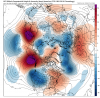
View attachment 32938
View attachment 32939


 "
".gif")
I will look at the stats when I get home but I feel like RDU averaged more snow since 2000 in nina/cold netural versus nino.Though averaging warmer than normal, recent El Niño winters have actually averaged colder than recent La Niña winters at least based on KATL per an earlier post I made in here.
The bigger problem imo isn’t ENSO. It is how warm it is in and near the Maritime Continent vs surrounding waters. That has apparently been leading to a higher than normal % of days in winter in MJO phases 4 and 5/more SER. This conclusion was reached in a recent paper that was posted in the GW thread. Combine with a warmer globe and that’s what you get.
Whatever chance(s) we had of getting a legitimate Nina this summer are rapidly fading. CANSIPS (& other climate models) are playing catch up to the increasingly obvious central Pacific El Nino that's developing.
View attachment 32944


Nino summers tend to have more thunderstorm activity if I recall which helps to keep the highs relatively cool. I seem to recall they help steer the hurricanes away a bit too.The advancement towards El Nino this spring will continue for the foreseeable future. -NPO/+TNH/-EPO/-WPO coupled w/ persistence of tropical +AAM is indicative of a pattern that favors weak trades in the eastern Pacific. The next westerly wind burst could really set this event off and forestall any NINA until after early-mid summer.
I will look at the stats when I get home but I feel like RDU averaged more snow since 2000 in nina/cold netural versus nino.
Regardless I am all for ninas so maybe we can take a shot at shaking things up globally. Continuing to throw nino's out there isn't going to change the base state we are in.
I will look at the stats when I get home but I feel like RDU averaged more snow since 2000 in nina/cold netural versus nino.
Regardless I am all for ninas so maybe we can take a shot at shaking things up globally. Continuing to throw nino's out there isn't going to change the base state we are in.
| 2013-2014 | 6.5 | nina |
| 2008-2009 | 7.1 | nina |
| 2017-2018 | 7.1 | nina |
| 2002-2003 | 7.4 | nino |
| 2009-2010 | 7.9 | nino |
| 2014-2015 | 7.9 | nino |
| 2018-2019 | 8.7 | nino |
| 2010-2011 | 9.1 | nina |
| 2001-2002 | 10.8 | neutral |
| 2003-2004 | 14.9 | nino |
| 1999-2000 | 25.8 | nina |
Wow, that canadian hammers just a few miles from meONLY 5 days out. Will the Euro be the triple Crown 12z run today?
View attachment 32938
View attachment 32939
Not a record though. It in the low 80's this day in 1989. Then down in the teens 7 days later.+23 departure from normal today. 77F
+23 departure from normal today. 77F
Almost time for me to officially throw in the towel on this winter.
 wondering now if I might get stuck up there lmao
Not me. But that was really pretty far east of here. 5:04 am. People in NE NC were closer than me.Anyone feel the earthquake in Virginia today,center of state. 2.7, not even sure that's noticeable.


Winter Storm Watch one county away!
WINTER STORM WATCH IN EFFECT FROM LATE TUESDAY NIGHT THROUGH
WEDNESDAY AFTERNOON...
* WHAT...Heavy sleet possible initially with a transition over to
snow. Total sleet accumulations of up to 1 inch with an
additional 1 to 2 inches of snow possible.

The wrf is trying to be interesting even here in the metro but dang that band 2 hours to my NW is consistent
View attachment 32970

a lot of mixing going on the further SE you go. Pivotal maps filter out sleet.
Just glancing at models it seems the snow band has shifted a bit further SE today. Or maybe it’s just wider than it was.
View attachment 32971


Unbelievable! 0z Euro will save us! I really can’t believe how bad this winter has turned out. smh!Even if you saw it coming, it still hurts. It’s not even the pattern that sucks. It’s all the valuable time you waste stuck in it.
View attachment 32975
.png")