I bet you do. Of course I would like to see that shift westward about 50 miles.I have decided I like this sites precip algorithm better for GFS Feb 7th storm, this isagain close to big deal for us in eastern NC
View attachment 32602
I bet you do. Of course I would like to see that shift westward about 50 miles.I have decided I like this sites precip algorithm better for GFS Feb 7th storm
View attachment 32602
If we can get a nice strong high (+35) that SER could help make a nice overriding event. The models keep fluctuating on the high strengths.At this point I’m thinking the only way anyone sees anything in the south east would be with a CAD event .. if that SER rages like it’s showing only way we’re going to combat it is through big systems moving in leaving some cold air behind and hopefully getting another on it’s heels .. if not we’re royally screwed
More than you got in Tahoe, lol

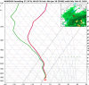
I'm looking at the 12k NAM and it still looks good (snow wise) for the NC mountains out to hr 39. And about the same for your area (at the same time span). But this will probably be a high elevation snow event. Looking at the grid forecast the NWS has snow for areas >4000 feet. Even Boone is mostly cold rain. Time to head to Beach Mountain:NAM 3km does not look as good for snow mountains or foothills and my sounding has a pesky little warm nose
Central mountain and western foothills special.I'm looking at the 12k NAM and it still looks good (snow wise) for the NC mountains out to hr 39. And about the same for your area (at the same time span). But this will probably be a high elevation snow event. Looking at the grid forecast the NWS has snow for areas >4000 feet. Even Boone is mostly cold rain. Time to head to Beach Mountain:
Today
A 20 percent chance of snow after 4pm. Patchy fog before 11am. Otherwise, cloudy, with a high near 33. South wind 7 to 10 mph.
Tonight
Patchy fog after 2am. Otherwise, mostly cloudy, with a low around 27. Southeast wind 7 to 11 mph.
Friday
A slight chance of snow before noon, then a chance of rain and snow between noon and 4pm, then a chance of snow after 4pm. Mostly cloudy, with a high near 37. South southeast wind 6 to 11 mph. Chance of precipitation is 50%. Little or no snow accumulation expected.
Friday Night
Snow likely, mainly between 10pm and 11pm. Cloudy, with a low around 29. Southeast wind 7 to 9 mph becoming northwest after midnight. Chance of precipitation is 60%. New snow accumulation of 1 to 2 inches possible.
Saturday
A chance of snow before 1pm, then a chance of rain and snow between 1pm and 4pm, then a chance of snow after 4pm. Mostly cloudy, with a high near 34. Breezy, with a west wind 13 to 22 mph. Chance of precipitation is 40%.
Saturday Night
A 30 percent chance of snow, mainly before 9pm. Mostly cloudy, with a low around 25. Windy.

I'm looking at the 12k NAM and it still looks good (snow wise) for the NC mountains out to hr 39. And about the same for your area (at the same time span). But this will probably be a high elevation snow event. Looking at the grid forecast the NWS has snow for areas >4000 feet. Even Boone is mostly cold rain. Time to head to Beach Mountain:
Today
A 20 percent chance of snow after 4pm. Patchy fog before 11am. Otherwise, cloudy, with a high near 33. South wind 7 to 10 mph.
Tonight
Patchy fog after 2am. Otherwise, mostly cloudy, with a low around 27. Southeast wind 7 to 11 mph.
Friday
A slight chance of snow before noon, then a chance of rain and snow between noon and 4pm, then a chance of snow after 4pm. Mostly cloudy, with a high near 37. South southeast wind 6 to 11 mph. Chance of precipitation is 50%. Little or no snow accumulation expected.
Friday Night
Snow likely, mainly between 10pm and 11pm. Cloudy, with a low around 29. Southeast wind 7 to 9 mph becoming northwest after midnight. Chance of precipitation is 60%. New snow accumulation of 1 to 2 inches possible.
Saturday
A chance of snow before 1pm, then a chance of rain and snow between 1pm and 4pm, then a chance of snow after 4pm. Mostly cloudy, with a high near 34. Breezy, with a west wind 13 to 22 mph. Chance of precipitation is 40%.
Saturday Night
A 30 percent chance of snow, mainly before 9pm. Mostly cloudy, with a low around 25. Windy.
We're are definitely on two different pages of the ENSO. Where are you getting your SSTs from? Far as I got for the latest departures:That's not an ENSO neutral pattern and that's also not the characteristics of a NINO pattern. It's a NINA pattern w/ an active subtropical jet. Also, when you make composites, make sure you use a base period that's actually relevant for the years you're analyzing. If you have a bunch of "analogs" in the 60s and 70s, don't use 1981-2010 like you did here. Why? Your composite will be biased cold. Use 1951-2010 or possibly even 1895-2000
I’m not talking about the sst anomalies, your interpretation of what’s an ENSO neutral pattern over North America is completely wrong. There’s no signal in the pattern during neutral enso.We're are definitely on two different pages of the ENSO. Where are you getting your SSTs from? Far as I got for the latest departures:
Nino 4 - 0.9°C
Nino 3.4 - 0.3°C
Nino 3 - 0.0°C
Nino 1+2 - -0.2°C
Sent from my SM-A102U using Tapatalk


Looks like the EuroIcon was interesting for that Feb 7 timeframe..probably not what y’all were hoping for but interesting nonetheless ? ?
View attachment 32617

Hey Mississippi is considered the SE.Icon was interesting for that Feb 7 timeframe..probably not what y’all were hoping for but interesting nonetheless ? ?
View attachment 32617

#BAM
Speaking for my area (foothills) have had our best snowstorms during season changes in early to mid December and early to mid March...My worse winter gave my 1" of snow. So I've never been blanked while living in this area. So far I haven't seen a sleet pellet.
I hate to start mentioning March, but that may be our best chance to see anything. This pattern should break down with the arrival of the spring pattern (shorter wave lengths). Our odds will still be (normally) low, but at least we'll have a chance.
Hey Mississippi is considered the SE.

He linked an old Bam tweet. I'm not defending BAM, #natgas, but the tweet is from 12/30.That MJO forecast map is a month old and misleading. The weather is bad enough that you shouldn't have to use misleading data to make your point. GRRR!
Got it. I didn't realize that. All of the other graphics were from today.He linked an old Bam tweet. I'm not defending BAM, #natgas, but the tweet is from 12/30.
We bloom.
Reality setting in. I didn't look at the 0z runs but imagine this wasn't an improvement.
View attachment 32631View attachment 32630

Ag disaster inbound or the longest growing season everLeaf out tracker exploding by the day! Leaf out occurring as much as 3weeks earlier than the normal. That’s very very early.View attachment 32634
Ag disaster inbound or the longest growing season ever

Maybe we can at least get pollen season over sooner.
It's still too soon up this way, we can get decent freezes through 3/15 no problem and really through 4/1I vote for long growing season.
Just scroll through the 12z gfs. Almost no temps below 32 for anyone outside mountains.
this is the coldest morning for those outside mountains. View attachment 32635
#BAM
Being a farmer I will say disaster, we will have a frost in April like always but the bugs will get a head start.Ag disaster inbound or the longest growing season ever
Apples in trouble again?Ag disaster inbound or the longest growing season ever