BHS1975
Member
HRRR did pretty good with this setup.
Sent from my iPhone using Tapatalk
Sent from my iPhone using Tapatalk
Yeah, I definitely like this short-range model. Maybe this winter we'll get some chances to use it for winter events.HRRR did pretty good with this setup.
Sent from my iPhone using Tapatalk


Birds ? Cicadas?
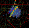
It looks almost like a disbursement pattern from an explosion or if a rock had fallen into a body of water. That is interesting.
RAH already pointing out that the rich will get richer tomorrow along 95 and RDU north. Most of us will be parched again by the end of next week
Solid start to the event along a line from Kinston to Williamston, areas just SW of Grifton already closing in on 7” this morning with a FFW now in effect. Someone’s getting a foot by the time all is said and done Saturday, of course not me.
View attachment 148472
Other than temporary lulls it's hard to imagine we lose a wetter pattern through the end of July with next weekend potentially being the wettest pattern we have seen regionally.
Interesting to hear window rattling thunder for going on 3 hours now. Storms about 10 miles to the east and wind from the north. Not moving inland unfortunately.
Hoping so. The NBM is trending east still with the area of >1” totals running almost on top of the Waccamaw river and points east. Gonna need a new drought category if we don’t get a dump and it’s in the upper 90s next week. The extension office is throwing out 50% loss in yield for corn and potentially worse than that. Beans are hanging on from rain 2 weeks ago but the next week or two is critical.It will it's really not suppose to get widespread till tomorrow into Sat....
Haha showers forming just to our west moving west. Showers moving in from the east dissipating lololololWelp fronts back through cape is increasing and pwats are near 2 and increasing. Let's see what the next 36 hours can do
We are winning so hardHaha showers forming just to our west moving west. Showers moving in from the east dissipating lolololol
We can't seem to catch a break! The National Weather Service at RDU has backed off the chances of rain for tonight. The forecasters still seem pretty confident that we will get widespread coverage tomorrow. We can only wait and see what happens.Haha showers forming just to our west moving west. Showers moving in from the east dissipating lolololol
.01Got .27".
