-
Hello, please take a minute to check out our awesome content, contributed by the wonderful members of our community. We hope you'll add your own thoughts and opinions by making a free account!
You are using an out of date browser. It may not display this or other websites correctly.
You should upgrade or use an alternative browser.
You should upgrade or use an alternative browser.
Pattern Dry July 2024
- Thread starter SD
- Start date
Shaggy
Member
We have heard drought begets drought and if you look at where the small pop ups in Eastern NC have been its almost exactly over areas that have been having persistent rains.
Same thing over here.We have heard drought begets drought and if you look at where the small pop ups in Eastern NC have been its almost exactly over areas that have been having persistent rains.
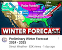
So is the winter battle zone a battle between cold rain and mild rain?Since its so hot, probably 120 on the RDU Al Gore Runway themometer. This will cool you off. Copy and paste winter pre season forecast. We are only 100 days away as the crow flies,for the average first killing frost here imby. Hang in there.
View attachment 148445
I discovered the concern with RDU appearing to be too hot on sunny summer afternoons only recently based on others posting about it here and elsewhere. I also started posted about this at American, where I just got this reply:
“It was 98 yesterday at the Southeast Regional Climate Center in a shady, tree-filled, low-density part of Chapel Hill, but carry on kvetching about the RDU temperatures. Pretty sure the SERCC knows how to reliably measure temperature.”
Does this person have a valid point about Chapel Hill? I need help on this because being in GA I’m likely not as familiar with RDU’s station as many of you and I know nothing about Chapel Hill. I had already posted there the Brad P. tweet about it potentially being a “surroundings” issue as opposed to a “sensor” issue. He has not addressed what Brad said and instead appears to be ignoring that.
I’m not trying to take sides. I’m not anti-RDU. I just enjoy stat based analyses and there’s evidence imho that there may really be a warm bias at RDU. I’m not thinking it’s intentional (conspiracy). Why would it be? I’m just trying to look at this as objectively as possible.
So, I would appreciate any help based on factual evidence, especially from those of y’all from the RDU area.
Please tell me more about Brad P., who I know also isn’t in the RDU area. Do y’all like him? Is he well respected for objective fact based analyses? Does anyone think he has a hidden agenda? Has he had a beef with RDU before? Does him not being in RDU weaken his argument? TIA
Last edited:
I believe it. Here 3 of the last 5 years have had a flood/drought cycle all summer. We’re supposed to get a majority of our JJA precip from seabreeze storms propagating inland. The last 4 summers especially they seem to pop up 5-8 miles inland and die instead of moving westward until they run out of steam around the Little Pee Dee river 35 or so miles inland. Old timers blame the excessive land clearing for homes and the limestone mines. I don’t personally know why it’s like this now because Brunswick county has a lot of clearing and still gets reliable seabreeze storms but they also have the confluence that keeps them going. The 701 corridor from just north of Conway through Loris is the highest part of the county at 100-125’ and we have different soils than east or west of that topographical “spine.” Whatever is causing it is enormously frustrating.We have heard drought begets drought and if you look at where the small pop ups in Eastern NC have been its almost exactly over areas that have been having persistent rains.
I’ll have to dig up some info from KFLO in Florence because they had a similar issue some years back. The surface and buildings were modified around the sensor until one day it got noticed. It read high for months if not a couple of years.I discovered the concern with RDU appearing to be too hot on sunny summer afternoons only recently based on others posting about it here and elsewhere. I also started posted about this at American, where I just got this reply:
“It was 98 yesterday at the Southeast Regional Climate Center in a shady, tree-filled, low-density part of Chapel Hill, but carry on kvetching about the RDU temperatures. Pretty sure the SERCC knows how to reliably measure temperature.”
Does this person have a valid point about Chapel Hill? I need help on this because being in GA I’m likely not as familiar with RDU’s station as many of you and I know nothing about Chapel Hill. I had already posted there the Brad P. tweet about it potentially being a “surroundings” issue as opposed to a “sensor” issue. He has not addressed what Brad said and instead appears to be ignoring that.
I’m not trying to take sides. I’m not anti-RDU. I just enjoy stat based analyses and there’s evidence imho that their may really be a warm bias at RDU. I’m not thinking it’s intentional (conspiracy). Why would it be? I’m just trying to look at this as objectively as possible.
So, I would appreciate any help based on factual evidence, especially from those of y’all from the RDU area.
Please tell me more about Brad P., who I know also isn’t in the RDU area. Do y’all like him? Is he well respected for objective fact based analyses? Does anyone think he has a hidden agenda? Has he had a beef with RDU before? Does him not being in RDU weaken his argument? TIA
Brad does give good objective analysis, though he can sometimes speak in absolutes a little too early and it’s come back to bite him. He did post last week a side by side picture of where RDU’s sensor is compared to CLT’s… CLT has it in a open field with no pavement while RDU’s has pavement close byI discovered the concern with RDU appearing to be too hot on sunny summer afternoons only recently based on others posting about it here and elsewhere. I also started posted about this at American, where I just got this reply:
“It was 98 yesterday at the Southeast Regional Climate Center in a shady, tree-filled, low-density part of Chapel Hill, but carry on kvetching about the RDU temperatures. Pretty sure the SERCC knows how to reliably measure temperature.”
Does this person have a valid point about Chapel Hill? I need help on this because being in GA I’m likely not as familiar with RDU’s station as many of you and I know nothing about Chapel Hill. I had already posted there the Brad P. tweet about it potentially being a “surroundings” issue as opposed to a “sensor” issue. He has not addressed what Brad said and instead appears to be ignoring that.
I’m not trying to take sides. I’m not anti-RDU. I just enjoy stat based analyses and there’s evidence imho that there may really be a warm bias at RDU. I’m not thinking it’s intentional (conspiracy). Why would it be? I’m just trying to look at this as objectively as possible.
So, I would appreciate any help based on factual evidence, especially from those of y’all from the RDU area.
Please tell me more about Brad P., who I know also isn’t in the RDU area. Do y’all like him? Is he well respected for objective fact based analyses? Does anyone think he has a hidden agenda? Has he had a beef with RDU before? Does him not being in RDU weaken his argument? TIA
Brad does give good objective analysis, though he can sometimes speak in absolutes a little too early and it’s come back to bite him. He did post last week a side by side picture of where RDU’s sensor is compared to CLT’s… CLT has it in a open field with no pavement while RDU’s has pavement close by
I saw that CLT RDU comparison (also a building nearby?) and thought it was a great tweet. So, I also posted that there. Someone there also posted this a couple of days ago:
“ The new runway is also going up right where the station is. I wonder if anymore vegetation has been removed or if there is any construction equipment nearby.”
Then he just posted this:
“Going back to my comment about runway construction at RDU, here's a sat photo from 06/08. Compared to the Google Maps satellite photo, there is some significant tree/forest removal going on in the area. The station is circled in red:
For what it's worth I recorded 101.9 for a high on 07/05.”
- Joined
- Jan 5, 2017
- Messages
- 3,767
- Reaction score
- 5,958
I'm sitting at 6.6" over the past 20 days...so that should hold me for a week or so.
Typically this issue at RDU happened on SW or W wind days which would mean the wind is over the runway and potentially the rental car lots and aviation parkway. That to me meant that it's an issue of the heat from those surfaces getting blown towards the sensor. But recently the same issue has happened with S and SE wind which is far less likely to be impacted by asphalt.I discovered the concern with RDU appearing to be too hot on sunny summer afternoons only recently based on others posting about it here and elsewhere. I also started posted about this at American, where I just got this reply:
“It was 98 yesterday at the Southeast Regional Climate Center in a shady, tree-filled, low-density part of Chapel Hill, but carry on kvetching about the RDU temperatures. Pretty sure the SERCC knows how to reliably measure temperature.”
Does this person have a valid point about Chapel Hill? I need help on this because being in GA I’m likely not as familiar with RDU’s station as many of you and I know nothing about Chapel Hill. I had already posted there the Brad P. tweet about it potentially being a “surroundings” issue as opposed to a “sensor” issue. He has not addressed what Brad said and instead appears to be ignoring that.
I’m not trying to take sides. I’m not anti-RDU. I just enjoy stat based analyses and there’s evidence imho that there may really be a warm bias at RDU. I’m not thinking it’s intentional (conspiracy). Why would it be? I’m just trying to look at this as objectively as possible.
So, I would appreciate any help based on factual evidence, especially from those of y’all from the RDU area.
Please tell me more about Brad P., who I know also isn’t in the RDU area. Do y’all like him? Is he well respected for objective fact based analyses? Does anyone think he has a hidden agenda? Has he had a beef with RDU before? Does him not being in RDU weaken his argument? TIA
I saw sometime in this thread had posted where a met had a theory about soil type. That would track if a good portion of the surrounding region wasn't clay as well also given that the airport hasn't changed soil types why would it be new?
Finally I have thought that maybe it was due to the sfc trough that has a tendency to setup just to the east of the airport. I see this trough causing something like what we've see at rdu when I compare my tempest to my parents. On days with a solid trough sitting roughly along US1 I'll be at say 94vwith a dew of 74 but by parents S of RDU and west of the trough would be at 98 with a dew of 67. Even this though doesn't fully explain it since RDU has had extreme temps in months where the mean flow across the state was the same and there wasn't a trough.
Maybe RDU is really just the hottest place in the state. I personally don't believe it since historically the hottest corridor in the carolinas has been from CAE to FLO to FAY to GSB. This rdu cooking on hot days is a relatively new thing and doesn't make sense to me in the overall long term of the area. Something has changed and given that the airport sensor is well removed from urban raleigh and Durham UHI doesn't explain it either
Last edited:
Yeah I actually got up to 103 on the 5th which was only a degree off the highest I’ve recorded since I moved into this house in 2010. If I’m not mistaken that was the day RDU recorded 106 which seems high but it wasn’t way over all the other areas in the stateI saw that CLT RDU comparison (also a building nearby?) and thought it was a great tweet. So, I also posted that there. Someone there also posted this a couple of days ago:
“ The new runway is also going up right where the station is. I wonder if anymore vegetation has been removed or if there is any construction equipment nearby.”
Then he just posted this:
“Going back to my comment about runway construction at RDU, here's a sat photo from 06/08. Compared to the Google Maps satellite photo, there is some significant tree/forest removal going on in the area. The station is circled in red:
For what it's worth I recorded 101.9 for a high on 07/05.”
The dam will break eventually. We got 3.05” last night and another .17” today.Same thing over here.
Shaggy
Member
I was speculating earlier in the thread that it seems the seabreeze races inland and fires north of me probably due to how hot inland areas have been. Seems to really help that seabreeze race inland and away from the typically favored coastal areas.I believe it. Here 3 of the last 5 years have had a flood/drought cycle all summer. We’re supposed to get a majority of our JJA precip from seabreeze storms propagating inland. The last 4 summers especially they seem to pop up 5-8 miles inland and die instead of moving westward until they run out of steam around the Little Pee Dee river 35 or so miles inland. Old timers blame the excessive land clearing for homes and the limestone mines. I don’t personally know why it’s like this now because Brunswick county has a lot of clearing and still gets reliable seabreeze storms but they also have the confluence that keeps them going. The 701 corridor from just north of Conway through Loris is the highest part of the county at 100-125’ and we have different soils than east or west of that topographical “spine.” Whatever is causing it is enormously frustrating.
For what it's worth I've seen sustained 15mph gusting to 20mph and my station is in the middle of a grass field so no wind tunnel effect. Purely from the seabreeze and I'm 20 miles inland. Sometimes I'll look at the radar and see the seabreeze line almost to Dillon by 6pm which is nuts.I was speculating earlier in the thread that it seems the seabreeze races inland and fires north of me probably due to how hot inland areas have been. Seems to really help that seabreeze race inland and away from the typically favored coastal areas.
It's not only ------------- who is a well respected meteorologist that has commented on the temperature readings at KRDU. Greg Fishel who is still a household name even after his retirement when it comes to TV weather forecasting in the Triangle area has also expressed his doubts about some of the record highs recorded at KRDU recently.I discovered the concern with RDU appearing to be too hot on sunny summer afternoons only recently based on others posting about it here and elsewhere. I also started posted about this at American, where I just got this reply:
“It was 98 yesterday at the Southeast Regional Climate Center in a shady, tree-filled, low-density part of Chapel Hill, but carry on kvetching about the RDU temperatures. Pretty sure the SERCC knows how to reliably measure temperature.”
Does this person have a valid point about Chapel Hill? I need help on this because being in GA I’m likely not as familiar with RDU’s station as many of you and I know nothing about Chapel Hill. I had already posted there the Brad P. tweet about it potentially being a “surroundings” issue as opposed to a “sensor” issue. He has not addressed what Brad said and instead appears to be ignoring that.
I’m not trying to take sides. I’m not anti-RDU. I just enjoy stat based analyses and there’s evidence imho that there may really be a warm bias at RDU. I’m not thinking it’s intentional (conspiracy). Why would it be? I’m just trying to look at this as objectively as possible.
So, I would appreciate any help based on factual evidence, especially from those of y’all from the RDU area.
Please tell me more about Brad P., who I know also isn’t in the RDU area. Do y’all like him? Is he well respected for objective fact based analyses? Does anyone think he has a hidden agenda? Has he had a beef with RDU before? Does him not being in RDU weaken his argument? TIA
I have lived or near the Triangle area for all of my fifty plus years and Fayetteville and Charlotte were usually the warmest reporting weather stations in North Carolina for around fifty of those years. For the past five years or so, Raleigh has taken their place as the hot spot. That doesn't bother me except that other weather stations close to the airport and even my home weather station are consistently reporting high temperatures anywhere from three to five degrees cooler than Raleigh's readings. I think the weather station at the airport is in a poor location and if it could be moved, it would be advisable.
Shaggy
Member
Downeastnc
Member
We get put in the Winter Battle Zone every year on these maps, whatever that means (basically nothing).Since its so hot, probably 120 on the RDU Al Gore Runway themometer. This will cool you off. Copy and paste winter pre season forecast. We are only 100 days away as the crow flies,for the average first killing frost here imby. Hang in there.
View attachment 148445
What’s strange is that usually RDU is no more than a few degrees warmer than GSO, sometimes even cooler. This month RDU has been warmer every single day and the average high is a full 6 degrees warmer than GSO. RDU is even running warmer than FAY, which is insane. Maybe it’s just a long string of coincidences, but it’s very odd.I discovered the concern with RDU appearing to be too hot on sunny summer afternoons only recently based on others posting about it here and elsewhere. I also started posted about this at American, where I just got this reply:
“It was 98 yesterday at the Southeast Regional Climate Center in a shady, tree-filled, low-density part of Chapel Hill, but carry on kvetching about the RDU temperatures. Pretty sure the SERCC knows how to reliably measure temperature.”
Does this person have a valid point about Chapel Hill? I need help on this because being in GA I’m likely not as familiar with RDU’s station as many of you and I know nothing about Chapel Hill. I had already posted there the Brad P. tweet about it potentially being a “surroundings” issue as opposed to a “sensor” issue. He has not addressed what Brad said and instead appears to be ignoring that.
I’m not trying to take sides. I’m not anti-RDU. I just enjoy stat based analyses and there’s evidence imho that there may really be a warm bias at RDU. I’m not thinking it’s intentional (conspiracy). Why would it be? I’m just trying to look at this as objectively as possible.
So, I would appreciate any help based on factual evidence, especially from those of y’all from the RDU area.
Please tell me more about Brad P., who I know also isn’t in the RDU area. Do y’all like him? Is he well respected for objective fact based analyses? Does anyone think he has a hidden agenda? Has he had a beef with RDU before? Does him not being in RDU weaken his argument? TIA
Yesterday was more of the same. GSO 93, FAY 97, RDU 98. RDU is already 4 degrees warmer than FAY and 5 degrees warmer than GSO this morning.
Shaggy
Member
Winter battle zone is another term for warm and rainy.We get put in the Winter Battle Zone every year on these maps, whatever that means (basically nothing).
Direct Weather, MSBGCM, and Ryan Hall Y'all are nincompoops.
Shaggy
Member
BHS1975
Member
What’s strange is that usually RDU is no more than a few degrees warmer than GSO, sometimes even cooler. This month RDU has been warmer every single day and the average high is a full 6 degrees warmer than GSO. RDU is even running warmer than FAY, which is insane. Maybe it’s just a long string of coincidences, but it’s very odd.
Yesterday was more of the same. GSO 93, FAY 97, RDU 98. RDU is already 4 degrees warmer than FAY and 5 degrees warmer than GSO this morning.
Maybe the government built a secret base under the ASOS.
Sent from my iPhone using Tapatalk
Downeastnc
Member
Lots of towers trying to get going already this morning....hoping to get lucky but even if I don't this weekend is looking better and better.
ENCSnowdawg
Member
Much needed rain and a break from this heatLots of towers trying to get going already this morning....hoping to get lucky but even if I don't this weekend is looking better and better.
Sb cape approaching 4000 ml cape approaching 3000 it'll be a let down if we aren't able to over perform on storm coverage this afternoon
Last edited:
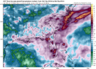
That quasi heat release pattern starting Sunday and lasting through Wednesday looks legit. I wouldn't be surprised to see RDU set a new all time record and likely more widespread 100s than we have seen so far. The bugaboo will be if we get a higher end rain event over the next few days and the increased soil moisture might hold us back a handful of degrees
BHS1975
Member
That quasi heat release pattern starting Sunday and lasting through Wednesday looks legit. I wouldn't be surprised to see RDU set a new all time record and likely more widespread 100s than we have seen so far. The bugaboo will be if we get a higher end rain event over the next few days and the increased soil moisture might hold us back a handful of degrees
So basically any rain we get will be baked away.
Sent from my iPhone using Tapatalk
I don't think we are done with patterns that favor AN chances of rain. As long as the ridge is in the west and the bermuda ridge is still pumping 2+ pwats in any drier periods will be short. Late next week looks solidSo basically any rain we get will be baked away.
Sent from my iPhone using Tapatalk
There is nothing going on. Maybe a cap or something in place? I'm surprised to see such a dearth of activity.Sb cape approaching 4000 ml cape approaching 3000 it'll be a let down if we aren't able to over perform on storm coverage this afternoon
Downeastnc
Member
This is gonna be one of those "back in the day" post....
Back in the day it seemed like we had a few days every single week in the summer where there was a line of storms would fire along the foothills from upstate SC to SW VA around 2-3 pm, then they would race east usually in time to get to us here in the east by 7-9pm....I mean I really remember this happening all the time "back in the day"....but maybe it didn't and I just remember it wrong cause it almost never happens anymore...or does it?
Back in the day it seemed like we had a few days every single week in the summer where there was a line of storms would fire along the foothills from upstate SC to SW VA around 2-3 pm, then they would race east usually in time to get to us here in the east by 7-9pm....I mean I really remember this happening all the time "back in the day"....but maybe it didn't and I just remember it wrong cause it almost never happens anymore...or does it?
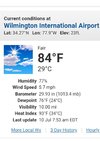
Currently reporting in from the hottest location this side of the Rockies, KRDU. It is truly oppressive outside with temperatures no doubt somehow in the triple digits. Even inside the old Southwest terminal, the A/C is having a hard time keeping up as I wait for my flight. Soon, I escape for a higher altitude location out west where the forecast low is 50 tomorrow morning. 


BHS1975
Member
This is gonna be one of those "back in the day" post....
Back in the day it seemed like we had a few days every single week in the summer where there was a line of storms would fire along the foothills from upstate SC to SW VA around 2-3 pm, then they would race east usually in time to get to us here in the east by 7-9pm....I mean I really remember this happening all the time "back in the day"....but maybe it didn't and I just remember it wrong cause it almost never happens anymore...or does it?
Seems like a lot more ridging these days.
Sent from my iPhone using Tapatalk
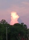
Just heard a large clap of thunder.
Front is racing east faster than the storms either it hits this axis and we get a big boom or it undercuts it and poof
It's going boom here. Lots of lightning and thunder.Front is racing east faster than the storms either it hits this axis and we get a big boom or it undercuts it and poof
That was a nice thunderstorm. Lots of wind, lightning, and heavy rain. Got right at .42"

