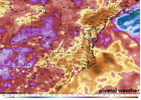
If it's any consolation tomorrow is probably better for youLocally speaking lol
Let's see what this outflow boundary from downeast headed this way does
-
Hello, please take a minute to check out our awesome content, contributed by the wonderful members of our community. We hope you'll add your own thoughts and opinions by making a free account!
You are using an out of date browser. It may not display this or other websites correctly.
You should upgrade or use an alternative browser.
You should upgrade or use an alternative browser.
Pattern Dry July 2024
- Thread starter SD
- Start date
I have received about .47 inches of rain and things are about to wrap up here near Lake Wheeler. This is the most rain from one event I've seen in over a month. I have a rain gauge at the vegetable garden I grow near Auburn in southeastern Wake County and I am looking forward to seeing how much badly needed rain fell there tomorrow. Last Sunday it rained around .25 inches which was the first rain that area had seen in three weeks.
Last edited:
2.79 in the last 7 days. This 7 day period beats my monthly total for 5 of the last 9 months
0.3" today.
Right at a half inch for the last 7 days. I hate summertime thunderstorms. I have not had the luck getting under a good storm. I thought I would do good with the current storm(s), but no. Everything missed me to the south and east. Grounds not even wet. I guess there's always tomorrow...2.79 in the last 7 days. This 7 day period beats my monthly total for 5 of the last 9 months
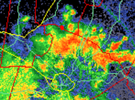
Getting a great storm here. Best thunder I have had in a while. And rain two days in a row.
Incoming colliding outflow boundaries, let's see what happens
JHS
Member
Those usually have explosive development. And with the slow movement today if you get under a good storm 1-2 inches of rain is a sure bet.Incoming colliding outflow boundaries, let's see what happens
GeorgiaGirl
Member
Currently probably under the best storm for me in some time, even though we did snap the streak of dry weather a couple weeks ago.
Impossible. You were under a 60% chance of storms today.Getting a great storm here. Best thunder I have had in a while. And rain two days in a row.
0.00. One reason I dont gamble
Rains finally made it 
.75 not too shabbyRains finally made it
Shaggy
Member
I've been blanked the last week with rain falling very close to me but never over MBY. My speculation is that with the higher temps this year the seabreeze is advancing inland faster and it seems to literally be firing just north of me as it sets up inland and pushes north away from me.
BHS1975
Member
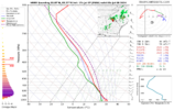
HRRR struggling with the convection in VA.
Sent from my iPhone using Tapatalk
Sent from my iPhone using Tapatalk
That's exactly what I run into living near CharlestonI've been blanked the last week with rain falling very close to me but never over MBY. My speculation is that with the higher temps this year the seabreeze is advancing inland faster and it seems to literally be firing just north of me as it sets up inland and pushes north away from me.
It looks like the Triad and areas west of Durham are the big winners in the rainfall lottery so far today according to radar. Storms are lining up along the front that is draped across the Triad. They will be slow moving today so areas lucky enough to get under a storm will get plenty of rain. Hopefully as the day progresses points east will receive the rain they have been looking for.
Pissing rain driving through Greensboro about an hour ago
Shaggy
Member
We've been here a year and last summer the seabreeze was getting us alot. I swear this year I can't buy a Seabreeze stormThat's exactly what I run into living near Charleston
JHS
Member
The storms are supposed to come out over more of NC and into SC, but I am having doubts about that due to the slightly north of east movement. I think they are already about as far south as they are going today. Tomorrow will probably be mostly dry too since GSP looks for cloud cover to last past noon, delaying storms. Most of us south of I-85 will have to wait until Tuesday or Wednesday for another legit chance for rain.
Finally! Got a storm to roll through and drop .66" so far. Still some lighter returns coming towards me on the radar so maybe I can end with ~3/4". That was a long stretch without a good storm.
BHS1975
Member
Grass still brown at my place. Not getting much.
Sent from my iPhone using Tapatalk
Sent from my iPhone using Tapatalk
Triplephase93
Member
Hixson Tn , and my mby in particular have missed out on all the rain in our area. Haven’t needed to mow in 3 weeks. My parents have a place in Englewood Florida. It’s currently 93 degrees there with a heat index of 119. Brutal
iGRXY
Member
This is aging poorlyThe storms are supposed to come out over more of NC and into SC, but I am having doubts about that due to the slightly north of east movement. I think they are already about as far south as they are going today. Tomorrow will probably be mostly dry too since GSP looks for cloud cover to last past noon, delaying storms. Most of us south of I-85 will have to wait until Tuesday or Wednesday for another legit chance for rain.
Heelyes
Member
Downeastnc
Member
Places all around me cashing in but no luck here so far this week...
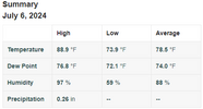
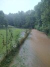
After 5 weeks of no rain. Today we received 5 inches and its still raining lightly,thundering. Had to dump my 5 inch rain gauge and start over. What a Blessing
iGRXY
Member
Getting zeroed out here. Outflow heading south has popped storms to the south but nothing of note here. Maybe some outflow boundaries will work some magic. Hearing thunder I'm the distance, but it's still questionable at best.
We drove through this crap all day. You go from dry to rain you can’t see to drive in to clear back to rain you can’t drive in. Tricky drive home. Tons of wrecks
I got a whopping .02 inches of rain at the house to add to .47 inches yesterday and a disappointing .16 inches of rain on my vegetable garden in southeastern Wake County. Hopefully I'll be one of the lucky ones who gets a decent shower or storm this coming week. We have a shot every day for the next seven days at least. The trip to my garden wasn't a total waste, I brought home some cucumbers, jalapeno peppers, zucchini squash, yellow squash and okra. If I can get some rain I am going to have a record cantaloupe and watermelon harvest for me at least. My vines are loaded with flowers and baby melons.
Downeastnc
Member
Actually got one to fire over the house now just need it to last 5 hrs
More rain here today. Third day in a row with rain. Didn't get a good storm like yesterday, though.
Yeah, I don’t think they are going to make it! Death Valley incoming in 2.1,……..The storms are supposed to come out over more of NC and into SC, but I am having doubts about that due to the slightly north of east movement. I think they are already about as far south as they are going today. Tomorrow will probably be mostly dry too since GSP looks for cloud cover to last past noon, delaying storms. Most of us south of I-85 will have to wait until Tuesday or Wednesday for another legit chance for rain.
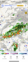
iGRXY
Member
I’m crying that post aged like an insect man.This is aging poorly

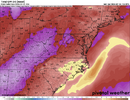
![Screenshot 2024-07-07 a[...].png Screenshot 2024-07-07 a[...].png](https://southernwx.nyc3.digitaloceanspaces.com/data/attachments/148/148399-f2339a7abc298ebc5483a17c88cd5af0.jpg)

![Screenshot 2024-07-07 a[...ss].png Screenshot 2024-07-07 a[...ss].png](https://southernwx.nyc3.digitaloceanspaces.com/data/attachments/148/148402-a0f58b9895c4e51a35fa3c1c46ba9dd5.jpg)
