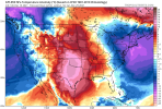
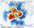
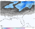
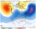
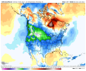
Can't wait for the fire and golf emojis when the 0z gfs flips then it flips back cold then goes warm then goes coldMight torch might be cold View attachment 98199
-
Hello, please take a minute to check out our awesome content, contributed by the wonderful members of our community. We hope you'll add your own thoughts and opinions by making a free account!
You are using an out of date browser. It may not display this or other websites correctly.
You should upgrade or use an alternative browser.
You should upgrade or use an alternative browser.
Pattern December to Remember
- Thread starter SD
- Start date
Cary_Snow95
Member
It’s hard to remember a time with this much volatility. Like we’ve had flips with rain snow lines but not complete flip flops on whether it’ll be 70 or 40. And only at 8-10 daysCan't wait for the fire and golf emojis when the 0z gfs flips then it flips back cold then goes warm then goes cold
Cary_Snow95
Member
NBAcentel
Member
Patterns the last 2 years have been chaotic with blocking, models typically suck with blockingIt’s hard to remember a time with this much volatility. Like we’ve had flips with rain snow lines but not complete flip flops on whether it’ll be 70 or 40. And only at 8-10 days
Cary_Snow95
Member
Yeah you’re right. Euro has botched so far but I think the gfs is over amping a bit. Cmc is a good middle ground. The initial cool down on Christmas looks legit but I question anything other than normal to slightly above the week afterPatterns the last 2 years have been chaotic with blocking, models typically suck with blocking
Yeah we are living the life of the pacific ridge driving the pattern and not being in an ideal position now we are layering in a developing -nao to further the headachesIt’s hard to remember a time with this much volatility. Like we’ve had flips with rain snow lines but not complete flip flops on whether it’ll be 70 or 40. And only at 8-10 days
Cary_Snow95
Member
NBAcentel
Member
pcbjr
Member
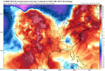
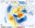
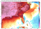
New screen saver ...Meanwhile GEFS is warmer for Christmas View attachment 98207
NBAcentel
Member
18z GFS is absolute trash for winter weather for the bulk of the SE through the entire run. Some nice cool shots and no sustained torching. But it's not a good look for snow or ice.
Downeastnc
Member
After hr 66 the 18Z GFS has no temp over 60 the rest of the run for MBY in eastern NC.....sad that that is even worthy of mention but that's where we are this winter.
Last edited:
pcbjr
Member
Cary_Snow95
Member
That’s been my take all month. Unless it’s a pattern conducive to snow I’d rather 70 degrees so I can golf. I know we are transitioning but we are riding right on the edge of a trash pattern18z GFS is absolute trash for winter weather for the bulk of the SE through the entire run. Some nice cool shots and no sustained torching. But it's not a good look for snow or ice.
NBAcentel
Member
I respectfully disagree. It’s not a great pattern at all and I’m not saying it is, but it’s not that terrible, you literally have one of the key pieces to a Carolina winter storm on the 18z GFS run, a strong 50/50 low. It’s a big change vs last years WAR, as I’ve said many times, all you need is a handoff of energy time right with the confluence and you have something interesting. A terrible pattern is a pattern with no options to score. This pattern has a option that might be a stretch, but it’s still a small possibility. Again this is just the OP GFS, and the GEFs wasn’t as good as the 12z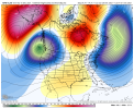
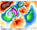


18z GFS is absolute trash for winter weather for the bulk of the SE through the entire run. Some nice cool shots and no sustained torching. But it's not a good look for snow or ice.
Yep. Its just like last year except 10-15 degrees warmer in our area. Status quo, KATL is looking at a top 5 warm December with no sub freezing lows.
No changes from me through first few weeks of January. Still waiting until Christmas Eve before I further delay our start at Winter weather chances. I haven’t canceled that last week of January just yet for those reading. Still some hope.
NBAcentel
Member
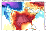
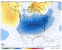
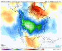
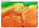
It's just not going to be cold enough. I would consider a non-terrible pattern to be one that isn't 85%+ chance against us. The upper level confluence is not bad, I don't disagree. But you literally have no genuine cold air nearby and no snow pack to our northwest. With the little bubble ridge in the middle of the country, you have an unfavorable storm track, with the exception of potentially a quasi-cool Miller B that might produce some front end mix for some lucky areas. We just need more than a -NAO and 50/50, particularly in today's climate, particularly when the bulk of the cold is well to our northwest, and particularly in early winter. This is just going off the 18z GFS, though.I respectfully disagree. It’s not a great pattern at all and I’m not saying it is, but it’s not that terrible, you literally have one of the key pieces to a Carolina winter storm on the 18z GFS run, a strong 50/50 low. It’s a big change vs last years WAR, as I’ve said many times, all you need is a handoff of energy time right with the confluence and you have something interesting. A terrible pattern is a pattern with no options to score. This pattern has a option that might be a stretch, but it’s still a small possibility. Again this is just the OP GFS, and the GEFs wasn’t as good as the 12zView attachment 98211View attachment 98212
Stephenb888
Member
Man it’s really negative in here today considering all of the cold artic air coming in January.
I dont know how Many times I’ve defended this possible reversal from the extreme SER solutions .. could easily see the faults In it with blocking becoming prominent again this winter like last
This pattern is not a pattern we are going to get snow in. The ridge creates a flow that really is not conducive for snow to develop. The 50/50 low means nothing with the ridge as any s/w will likely remain north of us. With that being said, the pattern is not bad for cold weather which is something to be excited about. I'm however encouraged about chances in the long term to move to a +PNA which will end up boosting our chances of snow.I respectfully disagree. It’s not a great pattern at all and I’m not saying it is, but it’s not that terrible, you literally have one of the key pieces to a Carolina winter storm on the 18z GFS run, a strong 50/50 low. It’s a big change vs last years WAR, as I’ve said many times, all you need is a handoff of energy time right with the confluence and you have something interesting. A terrible pattern is a pattern with no options to score. This pattern has a option that might be a stretch, but it’s still a small possibility. Again this is just the OP GFS, and the GEFs wasn’t as good as the 12zView attachment 98211View attachment 98212
NBAcentel
Member
That been the big debate in the past for the importance of a +PNA to score winter storms. I know with a perfect setup (-AO, -NAO, etc.) we can pull something out of the hat, but from all the years of tracking storms the PNA has been the biggest player for us SE folks. Bigger the ridge out west the more the storms dig in the SE.This pattern is not a pattern we are going to get snow in. The ridge creates a flow that really is not conducive for snow to develop. The 50/50 low means nothing with the ridge as any s/w will likely remain north of us. With that being said, the pattern is not bad for cold weather which is something to be excited about. I'm however encouraged about chances in the long term to move to a +PNA which will end up boosting our chances of snow.
And, the PNA looks to stay negative in the LR: https://www.cpc.ncep.noaa.gov/products/precip/CWlink/daily_ao_index/teleconnections.shtml
Well, it's not necessarily that we need a +PNA, but we need to have room for a s/w to dig or slide east. Here is a run composite of the most favorable 500mbar looks across NC.That been the big debate in the past for the importance of a +PNA to score winter storms. I know with a perfect setup (-AO, -NAO, etc.) we can pull something out of the hat, but from all the years of tracking storms the PNA has been the biggest player for us SE folks. Bigger the ridge out west the more the storms dig in the SE.
And, the PNA looks to stay negative in the LR: https://www.cpc.ncep.noaa.gov/products/precip/CWlink/daily_ao_index/teleconnections.shtml
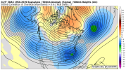
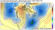
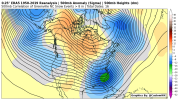
Webberweather53
Meteorologist
Ok, here's the updated version of the daily teleconnection spreadsheet. It now includes the my ENS ONI (I have a paper that's been accepted and should be published soon), daily standardized indices of the NAO, PNA, EPO, WPO, TNH, SCAND, AO, AAM, & RMM MJO coupled w/ dates for winter storms in NC since 1948.
Have at it @Ollie Williams
Nov-Apr Daily Teleconnections and NC Winter Storms List (1948-2021)
Have at it @Ollie Williams
Nov-Apr Daily Teleconnections and NC Winter Storms List (1948-2021)
Thank you! I've been working on creating a snowfall anomaly algorithm this evening. It will be nice to have some more data to work with.Ok, here's the updated version of the daily teleconnection spreadsheet. It now includes the my ENS ONI (I have a paper that's been accepted and should be published soon), daily standardized indices of the NAO, PNA, EPO, WPO, TNH, SCAND, AO, AAM, & RMM MJO coupled w/ dates for winter storms in NC since 1948.
Have at it @Ollie Williams
Nov-Apr Daily Teleconnections and NC Winter Storms List (1948-2021)
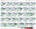
The main thing all of those images have in common is the ridging in NW Canada. The response is lower heights in the SE. It also creates the proper trajectory in the Northern stream for both cold air transport and for the opportunity of a SW in the northern stream to dig a bit and phase with a southern stream wave...or at the very least, move through in advance of a southern stream system, laying the cold foundation and keeping the southern system suppressed.Well, it's not necessarily that we need a +PNA, but we need to have room for a s/w to dig or slide east. Here is a run composite of the most favorable 500mbar looks across NC.
View attachment 98217View attachment 98218View attachment 98219
And you see heights along the west coast aren't all that amped. Get any blocking up north and you have a chance for a big dog.
Our current pattern (and the predicted pattern for at least a while) features the NW Canadian ridge way out west toward the Aleutians. Not ideal.
Mr. Golf
Member
The main thing all of those images have in common is the ridging in NW Canada. The response is lower heights in the SE. It also creates the proper trajectory in the Northern stream for both cold air transport and for the opportunity of a SW in the northern stream to dig a bit and phase with a southern stream wave...or at the very least, move through in advance of a southern stream system, laying the cold foundation and keeping the southern system suppressed.
And you see heights along the west coast aren't all that amped. Get any blocking up north and you have a chance for a big dog.
Our current pattern (and the predicted pattern for at least a while) features the NW Canadian ridge way out west toward the Aleutians. Not ideal.
Rain, do you think we will get to the more favorable pattern in January, providing the mjo moves along? No fun chasing unicorns lol
It'll be fun if you catch one though!Rain, do you think we will get to the more favorable pattern in January, providing the mjo moves along? No fun chasing unicorns lol
I think we'll move into a better pattern in January, at least for a while. Whether or not we do something with it is a different story. It's likely that when it's all said and done, it will have been a relatively mild winter with below normal precipitation in the SE. If that is the case, then the odds favor below normal snowfall. But if everything comes together just once, you can go above average in the snowfall department, just like that.
Quiz: what do these 5 periods have in common weatherwise?
- 12/29/1967-1/13/1968
- 12/1/1968-1/16/1969
- 12/27/1978-1/9/1979
- 1/24/1979- 2/21/1979
- 11/27/2010-12/25/2010
I’ll have more to say about this when I get some time, hopefully by this evening. Hint: it may be relevant to upcoming SE weather forecasting discussions for very late this month into January.
Here’s the answer: These 5 periods are the only two week plus long cold periods at ATL since 1950 that were during a -PNA:
- 12/29/1967-1/13/1968: 0.2” + 2 Ts of SN
- 12/1/1968-1/16/1969: 3 Ts of SN
- 12/27/1978-1/9/1979: 2 Ts of SN
- 1/24/1979- 2/21/1979: major ZR & 4.4” of sleet from different storms
- 11/27/2010-12/25/2010: 1.3” Christmas snow (only measurable one on record?) plus 3 other trace to 0.1” wintry events.
So, what did these rare five periods have in common to be able to get that longlasting cold during a -PNA? A -AO and a -NAO were both present every time with them being quite strong during most of these 5 periods. A -EPO was present only during 3 of the 5 periods….so, not crucial. ENSO wasn’t crucial. The key is the strong -AO and -NAO. Furthermore, note the multiple wintry precip events during all 5 periods.
This is relevant in case we never get out of the -PNA to see if there’d still be much hope for sustained cold in the SE. Whereas a +PNA would certainly be most preferred, these five periods show that given both a strong enough -AO and -NAO it is still a reasonable possibility.
Last edited:
Cary_Snow95
Member
Cary_Snow95
Member
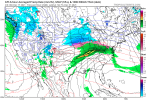
That’s great! Christmas Day should be warm so everyone can get out and play with their new presents ?! ?Gfs doesn’t amp the 50/50 and in result it becomes torch city View attachment 98231
The 0Z GEFS sucks around days 9-10 as it is the warmest run of at least the last 4 then. It may be because of a weaker -NAO as Europe is also not as cold. Let’s see how much it cools later.
Edit: the warmest coldest of any December on record at KATL is the 31 of 1931. Tied for second warmest at 30 are five years including 2014, 2012, and 1994. So far, the coldest this month is 36.
Edit: the warmest coldest of any December on record at KATL is the 31 of 1931. Tied for second warmest at 30 are five years including 2014, 2012, and 1994. So far, the coldest this month is 36.
Last edited:
dsaur
Member
Goofy keeps throwing up gom lows, and if they actually start occurring in Jan, we might find some cold air to go with it. I never expect much until near New Years. Except for that weird Xmas annomoly a few years back...and that might have been mass hypnotism, lol.It's just not going to be cold enough. I would consider a non-terrible pattern to be one that isn't 85%+ chance against us. The upper level confluence is not bad, I don't disagree. But you literally have no genuine cold air nearby and no snow pack to our northwest. With the little bubble ridge in the middle of the country, you have an unfavorable storm track, with the exception of potentially a quasi-cool Miller B that might produce some front end mix for some lucky areas. We just need more than a -NAO and 50/50, particularly in today's climate, particularly when the bulk of the cold is well to our northwest, and particularly in early winter. This is just going off the 18z GFS, though.

