Got a few DFW sites reporting gusts over 50 MPH right now.
Pretty widespread 35 - 45 MPH gusts though.
Pretty widespread 35 - 45 MPH gusts though.
Gonna need the fluorescent balls to find in the snow!Pretty chilly morning to test out the new callaways View attachment 98058
One thing models showing consistently. DRY. Cant wait to get into some -0's DPs and hear Brick go on a tangent about how bad Cold/Dry is lol.Got to love how touchy the pattern is around Christmas op gfs comes in chilly gefs mean is warm vs the 6z
Got to love how touchy the pattern is around Christmas op gfs comes in chilly gefs mean is warm vs the 6z
Just a 1052, we tossWell the gfs is unloading this View attachment 98068
Looks like the energy diving through west Canada the week of Christmas is the bugaboo. The gfs kind of splits that/keeps it separated instead of bodily digging it down the west coast which many of the gefs must be doingYeah, 12Z GEFS is warmest of last 3 runs.
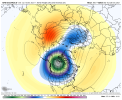
Oh the gfs ended up dumping the entire strat pv into Canada View attachment 98075
View attachment 98076
View attachment 98077
Oh the gfs ended up dumping the entire strat pv into Canada View attachment 98075
View attachment 98076
View attachment 98077

You aren’t kidding. Wow.Geez that would be ridiculously cold in early jan
This might make Christmas colder on the euro fwiw given more seperation between PNW trough and can trough, lfgggOh yeahhhhh View attachment 98080
Now if it can just park there for 2 months, we might have a slightly higher than slim chance of seeing some snow down in Atlanta.Oh the gfs ended up dumping the entire strat pv into Canada View attachment 98075
View attachment 98076
View attachment 98077
Idk if I like where it's goingThis might make Christmas colder on the euro fwiw given more seperation between PNW trough and can trough, lfggg
Unlike the gfs the euro digs the energy into the westIdk if I like where it's going
#patternloadedOh the gfs ended up dumping the entire strat pv into Canada View attachment 98075
View attachment 98076
View attachment 98077
Yup either phase it or bomb out the northern wave like the gfs. Long way to go with it but overall the trend stunk for right around Christmas minus the op gfs. Watch the eps have a super cold look nowWe need a phase between these 2 so we can have a powerful 50/50 low dragging cold down View attachment 98082
Uggh, and Canada is warming aaaand the coldest air on earth is opposite us again! Nothing good today! Fook weather, I’m outEps wasting no time failing along the WC
View attachment 98084
I don’t understand how it’s a week out and these models are so bad that we don’t even know if it’s gonna be hot or cold on Christmas.Now it is back to near 70 in ATL on XMAS...LOL
I will believe it when I see it. It's obvious to me that it's not worth checking out the specifics that far out considering what we have seen lately.Now it is back to near 70 in ATL on XMAS...LOL
I don’t understand how it’s a week out and these models are so bad that we don’t even know if it’s gonna be hot or cold on Christmas.
