• Hello, please take a minute to check out our awesome content, contributed by the wonderful members of our community. We hope you'll add your own thoughts and opinions by making a free account!

Pattern December to Remember

Yes. First half December 89 was torch

No, there were only 2 MA days in the first half: 12/5 and 12/6. Otherwise, the first half of Dec of 1989 was very cold!
This was at the Jackson, TN, airport:


1989-12-01 57 30 43.5 -1.1 21 0 0.00 0.0 0
1989-12-02 56 34 45.0 0.6 20 0 0.00 0.0 0
1989-12-03 34 19 26.5 -17.6 38 0 0.00 0.0 0
1989-12-04 54 21 37.5 -6.4 27 0 0.00 0.0 0
1989-12-05 68 38 53.0 9.3 12 0 0.00 0.0 0
1989-12-06 66 41 53.5 10.0 11 0 0.00 0.0 0
1989-12-07 43 32 37.5 -5.8 27 0 0.03 0.0 0
1989-12-08 32 29 30.5 -12.6 34 0 0.42 T T
1989-12-09 43 24 33.5 -9.4 31 0 0.00 0.0 0
1989-12-10 49 28 38.5 -4.2 26 0 0.00 0.0 0
1989-12-11 44 30 37.0 -5.5 28 0 T T 0
1989-12-12 31 17 24.0 -18.3 41 0 T T 0
1989-12-13 43 11 27.0 -15.1 38 0 0.00 0.0 0
1989-12-14 39 21 30.0 -12.0 35 0 0.00 0.0 0
1989-12-15 45 9 27.0 -14.8 38 0 T T 0
1989-12-16 22 4 13.0 -28.6 52 0 0.00 0.0 0
1989-12-17 27 15 21.0 -20.5 44 0 T T 0
1989-12-18 34 14 24.0 -17.3 41 0 0.09 0.0 0
1989-12-19 31 17 24.0 -17.2 41 0 0.09 0.0 T
1989-12-20 30 11 20.5 -20.5 44 0 0.00 0.0 0
1989-12-21 21 1 11.0 -29.9 54 0 0.00 0.0 0
1989-12-22 5 -7 -1.0 -41.7 66 0 0.00 0.0 0
0
1989-12-23 15 -6 4.5 -36.1 60 0 0.00 0.0 0
1989-12-24 20 0 10.0 -30.5 55 0 T T 0
1989-12-25 39 18 28.5 -11.8 36 0 T T T
1989-12-26 42 31 36.5 -3.7 28 0 0.00 0.0 0
1989-12-27 55 29 42.0 1.9 23 0 0.00 0.0 0
1989-12-28 60 28 44.0 4.1 21 0 0.00 0.0 0
1989-12-29 56 48 52.0 12.2 13 0 0.30 0.0 0
1989-12-30 59 52 55.5 15.8 9 0 1.13 0.0 0
1989-12-31 53 31 42.0 2.4 23 0 0.30 0.0 0
 
all i can remember first 10 days or so was above average here then the artic blast came mid december and after that winter pretty much done

At least you changed it from first half being s torch to first 10 days being AN. But you’re not correct about the first ten days being AN either as only 2 of the 10 were. 6 of the 10 were BN and 2 NN. Dec 1-10 averaged BN at Jackson, TN.

Also, there were several big Arctic blasts that month.
 
Ok hear me out...even when the pattern is somewhat favorable for us we still find a way to suck. What if things have changed so much that now in order for us to get snow it HAS to be warm. Obviously the cold doesn’t work around here either so let’s see what happens.
 
Ok hear me out...even when the pattern is somewhat favorable for us we still find a way to suck. What if things have changed so much that now in order for us to get snow it HAS to be warm. Obviously the cold doesn’t work around here either so let’s see what happens.
To your point that makes some sense. I think periods of big changes in pattern are always favorable for us. I still hold hope for late month and a flip
 
I was a HS junior in 89 on the OBX. I have crystal clear memory of the Christmas blizzard and the torch the rest of winter after the New Year. Everything before Christmas is not so clear. Maybe it was Dec. ‘88 that was warm.
 
I was a HS junior in 89 on the OBX. I have crystal clear memory of the Christmas blizzard and the torch the rest of winter after the New Year. Everything before Christmas is not so clear. Maybe it was Dec. ‘88 that was warm.
Anyone who got experience that coastal blizzard will always remember it vividly. My father was in construction and his company was working at Myrtle Beach that winter doing repairs from Hurricane Hugo. The hotel that they were working on allowed the construction workers to bring their families down for a few days for Christmas for free. We all stayed in the upper floors and it was amazing watching that storm. The drifts were amazing.
 
What the heck are you talking about??? For Heaven's sake, it's only Dec 2nd. You folks are acting like winter is over already. Give it a chance....
It’s every single winter and usually right around this time. It’s actually fun to watch at this point. Better to torch now then 30 days from now. I know we could of course torch all winter but even in the worst winters we get cold shots. I mean my area did just come out of basically a month long cold shot called November. I haven’t done the math yet but I know it was way below normal last month.
 
Last edited:
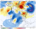
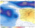
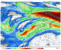
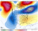
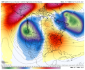
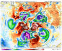
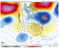
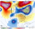
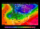
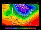
Some thoughts about the large scale pattern that could lead to a colder pattern across the eastern US. I have done some observations and I'd say a colder pattern may return in about 2 - 2 and a half weeks. Weather systems will be cutting, tracking into eastern Canada and eventually out over the very far northern portion of the Atlantic - these storm systems would eventually lead to Greenland blocking because the systems would enhance sinking air (blocking) north of the storm systems. A -NAO maybe seen in the foreseeable future. A stationary high could get locked into place north of Europe over the Arctic Ocean due to blocking over Greenland and storm systems tracking across central/northern Russia keeping the high locked into place. This stationary high would be good, because it would help elongating the PV on a northwest to southeast axis. I think the stubborn blocking over the EPO region is what's going to be the biggest issue. However, the storm systems that track from Russia to the Bearing Sea towards AK is what could help force the North Pacific blocking to go poleward, being replaced with a trough. We'll see what plays out upstream over the Pacific within the next week or so. If everything comes together from what I have observed, we may very well see better setups at 500mb in the LR, concerning colder air. Any questions, feel free to ask!
 
Last edited:
I don't get the infatuation with the MJO. I mean, it's not unimportant, but it isn't operating in a vacuum, and there are certainly other factors influencing the atmosphere. If it was as easy as some Twitter jabronis would lead you to believe, we could ignore everything else and focus on nothing ever but the MJO.

It's funny because when the MJO is in the warm phases and it's actually warm, it gets all the credit. But when it's in the cool phases and it's warm, oh well it's because it's overwhelmed by something else.

The popular modern day approach is to distill a complex and chaotic system down to an index. Twitter people learn a new 3 letter acronym and go to town. At least the SAI has been largely put to bed.
 
From RNK?
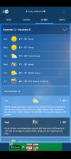
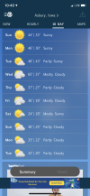
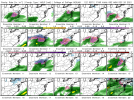
- All I'm reading is how warm it's going to get, and how long it's going to last. So I check the forecast to see if any RAIN is showing up, and this---- ?‍♂️
TUESDAY NIGHT
Partly cloudy in the evening, then mostly cloudy with a chance of rain and snow after midnight. Lows in the lower 30s. Chance of precipitation 30 percent.

WEDNESDAY
Snow likely in the morning. Rain likely. Highs in the upper 40s. Chance of precipitation 60 percent.

EDIT: For the record, I'm certainly not expecting snow...........
 
Back
Top