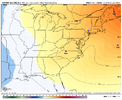
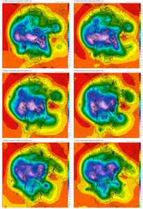
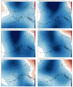
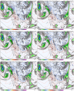
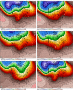
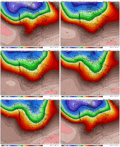
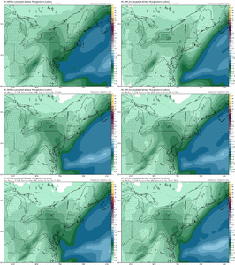
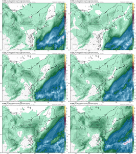
Beautiful -NAO.This is one of the warmest patterns for the conus that I can remember....trop pv consolidated and just off the pole in the worst spot. Good news is the pattern literally can't get worse..so maybe things turn up from here.
View attachment 156126
-
Hello, please take a minute to check out our awesome content, contributed by the wonderful members of our community. We hope you'll add your own thoughts and opinions by making a free account!
You are using an out of date browser. It may not display this or other websites correctly.
You should upgrade or use an alternative browser.
You should upgrade or use an alternative browser.
Pattern December Dud 👀
- Thread starter SD
- Start date
Good pattern to trap something under thisBeautiful -NAO.
Euro tried to freezing rain Christmas morning
The only thing getting trapped under that -NAO are the suckers that think it’s going to snow at their houseGood pattern to trap something under this
- Joined
- Jan 5, 2017
- Messages
- 3,769
- Reaction score
- 5,966
70.2 degrees! It's starting to cloud up, though, so maybe not much more rise today.
Pretty much, we likely don't snow if we trap something under that but all of this winter is over lawn mower go vroom golf shots go splash talk turns into low to mid 50s and lolThe only thing getting trapped under that -NAO are the suckers that think it’s going to snow at their house
Drizzle Snizzle
Member
I’m at 77 !70.2 degrees! It's starting to cloud up, though, so maybe not much more rise today.
75F under Sunny Skies & very light winds.. (We had Heavy Fog this Morning)..
Perfect Golf Weather here on the Coast
I wouldn't be Surprised if @Shaggy , (wasn't playing Hooky & is out on the Greens today)
Or Fishing..
I Went down to the Surf & Sand Early this Morning..
Once the Fog started clearing,,, the bite stopped..
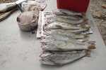
Perfect Golf Weather here on the Coast
I wouldn't be Surprised if @Shaggy , (wasn't playing Hooky & is out on the Greens today)
Or Fishing..
I Went down to the Surf & Sand Early this Morning..
Once the Fog started clearing,,, the bite stopped..

Last edited:
The more you trap, the more everything else behind it gets backed up lolPretty much, we likely don't snow if we trap something under that but all of this winter is over lawn mower go vroom golf shots go splash talk turns into low to mid 50s and lol
Sheesh. Bloodbath
Webberweather53
Meteorologist
Pretty much, we likely don't snow if we trap something under that but all of this winter is over lawn mower go vroom golf shots go splash talk turns into low to mid 50s and lol
There’s always a risk of undercutting like that happening and keeping temps moderated in the southeastern us when your block is centered that far north into Canada. We really need a cut off upper low to dig and meander around the SW US or south-central plains to get this blocking ridge rooted into the subtropics.
NBAcentel
Member
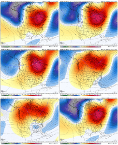
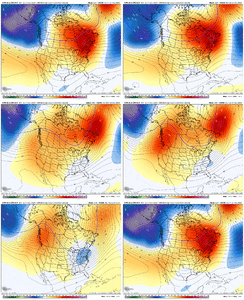
Don’t get the moaning and groaning, most ens (the GEFS is rather unimpressive given it looks like it drops something in the SW which makes the STR stronger in the east) already show the western ridge returning by new years already. The warm up was kinda seen a while back pretty easily, we actually kinda delayed it a bit with this the pre Christmas cold  womp oof pattern is suppose to stay cold entirety of winter womp oof unrealistic expectations


Webberweather53
Meteorologist
I'm off work today and even though it doesn't feel like the Christmas season, it does feel good today. The temperature at my house is 68.3 degrees and this warm spell is giving the HVAC unit a rest before we go back below normal this coming weekend.
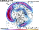
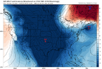
lts on an island by itself. Save maybe the CFS. Everything looks improved to me today LR, except GFS.The way the GFS OP dislodges all of that bottled up cold at the pole to the opposite side of the northern hemisphere to start January is incredible. The anti Christmas miracle. Best of luck undoing that if it happens. Which it won’t. But it might.View attachment 156144
We are getting ready to spend Fri-Wed at or below normal. We caught an above normal day today finally here ( with a shower mixed in) and should have one tomorrow.
Greensboro sitting at -4.4 BN, Fayeteville, RockyMount -2.4 BN. Then there's RDU only like -1.4 LOL with its inferno located sensors.
Just a reminder, this is the pattern thread. Banter is better in the Complaining thread. Appreciate it!
Webberweather53
Meteorologist
Don’t be surprised even as the pattern changes favorably to an eastern trough with perhaps a in-situ -NAO & possibly -EPO, that the first few systems are cutters with rain and severe weather over the southern us.
Just trying to keep expectations in check. We usually need to let patterns like this cook for a bit before we get hit
Just trying to keep expectations in check. We usually need to let patterns like this cook for a bit before we get hit
Wow! That’s a SE Ridge I’ll tell my grandkids about! Nina winter rock!The way the GFS OP dislodges all of that bottled up cold at the pole to the opposite side of the northern hemisphere to start January is incredible. The anti Christmas miracle. Best of luck undoing that if it happens. Which it won’t. But it might.View attachment 156144
NBAcentel
Member
LickWx
Member
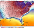
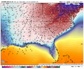
Rare to see these types of cold blasts that target only the ne. Been a whileThis hasn’t been the snowiest Dec in a while, but it’s definitely been the coldest in a long long time. EC AI early next week has wind chills in the lower teens and lows in the upper teens. Pretty cold. These are generally great snowmaking conditions as well just sayingView attachment 156154View attachment 156155
NBAcentel
Member
Yeah last few years it’s been west of the apps. But thing is when trough axis is further west it’s easier to get overrunning. Further east it is the colder here and NE yeah but drierRare to see these types of cold blasts that target only the ne. Been a while
LickWx
Member
Those usually not as extreme though as the ones west.Yeah last few years it’s been west of the apps. But thing is when trough axis is further west it’s easier to get overrunning. Further east it is the colder here and NE yeah but drier
Webberweather53
Meteorologist
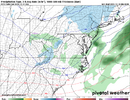
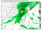
This event in the mid Atlantic is going to overperform compared to global model forecasts. The setup screams that with a localized low-level convergence zone setting up along a norlun trough
Mahomeless
Member
Need to push that moisture further north into mid Ohio.#Trendy.
View attachment 156152
Hopefully we can get a few more rain sprinkles before we go into a dry pattern again.
NBAcentel
Member
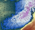
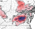
It wouldn't take too much to move the totals on that map a bit further south into the Foothills of N.C. While those totals do not scream devastating ice storm, that would be an inconvenience to those who live there.0z Canadian total freezing rain for December 26:
View attachment 156196
If the setup panned out, I could see this spreading at least into our foothills locations.
Last edited:
The last time I remember there being thunderstorms on Christmas Day was 1987. Two weeks later we all know what happenedThunderstorms on Christmas is diabolical View attachment 156188

